gee-community / Ee Runner
Licence: apache-2.0
Command-line runner for Google Earth Engine Playground scripts
Stars: ✭ 59
Programming Languages
javascript
184084 projects - #8 most used programming language
Projects that are alternatives of or similar to Ee Runner
land-cover-to-land-use-classification
Satellite image processing pipeline to classify land-cover and land-use
Stars: ✭ 64 (+8.47%)
Mutual labels: gis, remote-sensing
Datacube Core
Open Data Cube analyses continental scale Earth Observation data through time
Stars: ✭ 285 (+383.05%)
Mutual labels: remote-sensing, gis
open-impact
To help quickstart impact work with Satellogic [hyperspectral] data
Stars: ✭ 21 (-64.41%)
Mutual labels: gis, remote-sensing
pylandsat
Search, download, and preprocess Landsat imagery 🛰️
Stars: ✭ 49 (-16.95%)
Mutual labels: gis, remote-sensing
Qgis Earthengine Examples
A collection of 300+ Python examples for using Google Earth Engine in QGIS
Stars: ✭ 482 (+716.95%)
Mutual labels: remote-sensing, gis
earthengine-py-examples
A collection of 300+ examples for using Earth Engine and the geemap Python package
Stars: ✭ 76 (+28.81%)
Mutual labels: gis, remote-sensing
geoblaze
Blazing Fast JavaScript Raster Processing Engine
Stars: ✭ 80 (+35.59%)
Mutual labels: gis, remote-sensing
eodag
Earth Observation Data Access Gateway
Stars: ✭ 183 (+210.17%)
Mutual labels: gis, remote-sensing
Whitebox Tools
An advanced geospatial data analysis platform
Stars: ✭ 362 (+513.56%)
Mutual labels: remote-sensing, gis
Awesome Gee
A curated list of Google Earth Engine resources
Stars: ✭ 292 (+394.92%)
Mutual labels: remote-sensing, gis
ee extra
A ninja python package that unifies the Google Earth Engine ecosystem.
Stars: ✭ 42 (-28.81%)
Mutual labels: gis, remote-sensing
Wetland Hydro Gee
Mapping wetland hydrological dynamics using Google Earth Engine (GEE)
Stars: ✭ 20 (-66.1%)
Mutual labels: remote-sensing, gis
awesome-spectral-indices
A ready-to-use curated list of Spectral Indices for Remote Sensing applications.
Stars: ✭ 357 (+505.08%)
Mutual labels: gis, remote-sensing
spectral
Awesome Spectral Indices for the Google Earth Engine JavaScript API (Code Editor).
Stars: ✭ 68 (+15.25%)
Mutual labels: gis, remote-sensing
whiteboxgui
An interactive GUI for WhiteboxTools in a Jupyter-based environment
Stars: ✭ 94 (+59.32%)
Mutual labels: gis, remote-sensing
NodeMICMAC
A Lightweight REST API to Access MICMAC Photogrammetry and SFM Engine.
Stars: ✭ 54 (-8.47%)
Mutual labels: gis, remote-sensing
programming-for-gis-and-rs
Materials for the Intro to Programming for GIS and Remote Sensing Course that I teach at Saint Louis University. They include the updates I made for the spring 2020 and fall 2020 semesters.
Stars: ✭ 61 (+3.39%)
Mutual labels: gis, remote-sensing
wildfire-forecasting
Forecasting wildfire danger using deep learning.
Stars: ✭ 39 (-33.9%)
Mutual labels: gis, remote-sensing
Geospatial Machine Learning
A curated list of resources focused on Machine Learning in Geospatial Data Science.
Stars: ✭ 289 (+389.83%)
Mutual labels: remote-sensing, gis
Earthengine Py Notebooks
A collection of 360+ Jupyter Python notebook examples for using Google Earth Engine with interactive mapping
Stars: ✭ 807 (+1267.8%)
Mutual labels: remote-sensing, gis
ee-runner
Command line runner of Google Earth Engine Playground scripts using Node.js.
Install or update globally and use as a script
-
npm install -g [email protected] -
Run Code Editor scripts as:
> ee-runner <script-file>
or
> ee <script-file>
Install as a package
-
npm install ee-runner -
in your scripts, use:
require("ee-runner")

gee.initialize(function() {
  // ... your Google Earth Engine code comes here ...
})
Install as a command-line tool from GitHub
- Clone this repository.
- Inside Repository
Run: npm run init
You may have to remove any previous and no longer valid tokens, for example having played with ee-python.
rm ~/.config/earthengine/credentials.
Usage
node ee-runner.js \<playground script file\>
Example
node ee-runner.js examples/hello.js
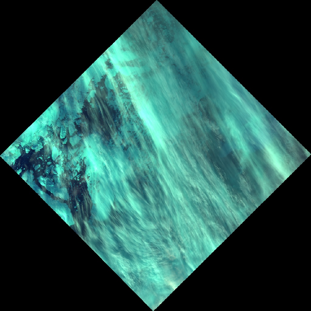
First image in LANDSAT 8 TOA collection was aquired on 2013-09-26
Downloading thumbnail ...
- cat examples/hello.js
var image = new ee.Image(new ee.ImageCollection('LANDSAT/LC8_L1T_TOA').first());
var info = image.getInfo();

var date = info.properties['DATE_ACQUIRED'];
print('First image in LANDSAT 8 TOA collection was aquired on ' + date);

print('Downloading thumbnail ...');

var url = image
  .visualize({bands:['B6','B5','B3'], gamma: 1.5})
  .getThumbURL({dimensions:'1024x1024', format: 'jpg'});

download(url, 'hello.jpg');
- hello.jpg
Roadmap
- [ ] Fetch user scripts from https://earthengine.googlesource.com/
- [ ] Implement ui.Chart printing to PNG / SVG
Note that the project description data, including the texts, logos, images, and/or trademarks,
for each open source project belongs to its rightful owner.
If you wish to add or remove any projects, please contact us at [email protected].

