RandomFractals / Geo Data Viewer
Projects that are alternatives of or similar to Geo Data Viewer
geo-data-viewer
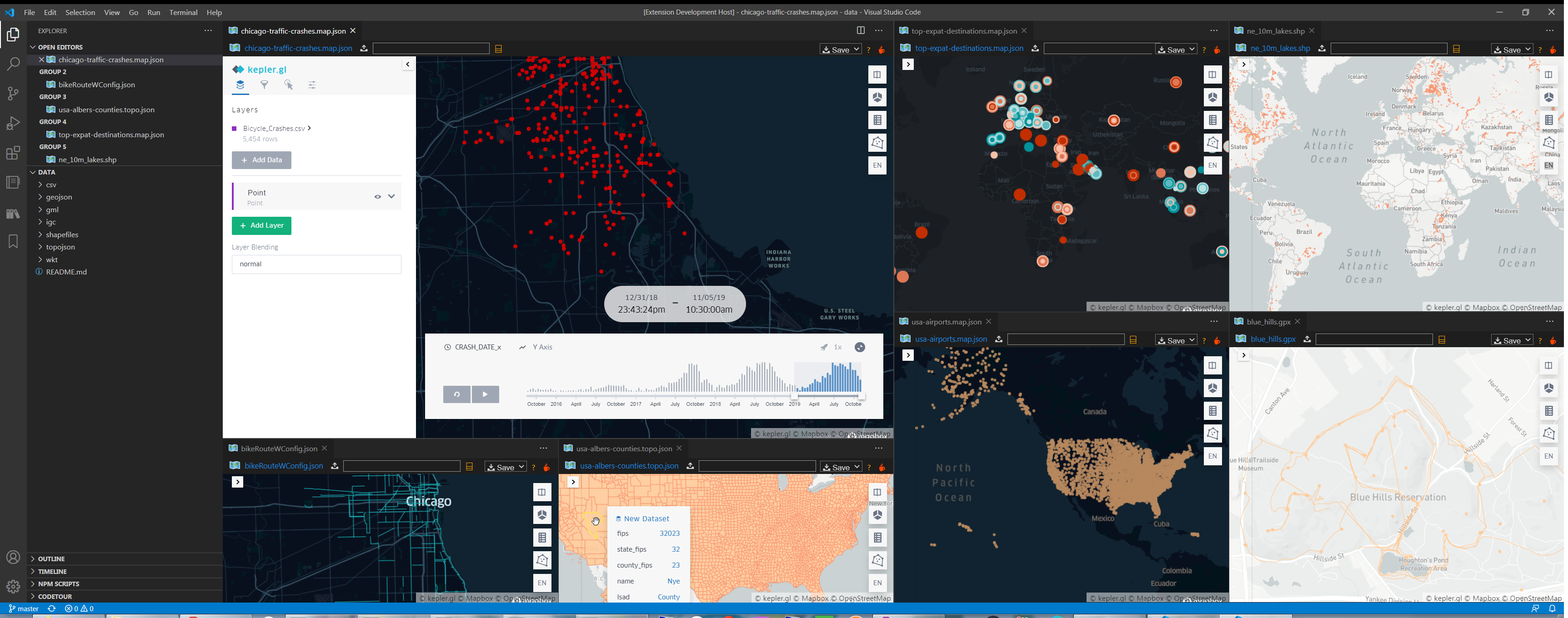
🗺️ Geo Data Analytics tool for VSCode with kepler.gl to gen. some snazzy 🗺️s w/0 Py 🐍 || pyWidgets ⚙️ || pandas 🐼 || @reactjs ⚛️ required ...
Features
- Map View 🗺️ for GeoJSON, TopoJSON, keplerg.gl JSON, KML, GPX, shapefiles, FlatGeobuf, IGC, WKT and CSV geo data files
- Create
.geojsonfile for.topojson,.kml,.gpx,.fgb,.shp.prjand.dbfshapefiles - Dark & Light Map View 🗺️ Controls UI Themes
- Dark, Light, Satellite & Outdoors Map Styles
- Map Gallery with public kepler.gl map configs to try
- Save map 🗺️ in standalone html format to share with others via Slack or email :)
- Save kepler.gl JSON data and map config for loading online via kepler.gl demo app or in this geo data tool
- Load map config or geo data from kepler.gl demo app url, github or gists
- View map from ⭐️ Starred Gists in GistPad 📘
- View CSV and JSON data with Data Preview 🈸 grid and charts 📊
Usage
- Run
Geo: View Map(ctrl/cmd + alt + m) command on an open geo data document to view 🗺️ - Use
Geo: View Map from Url(ctrl/cmd + alt + u) command to load a map from kepler.gl demo app, github or gist - Run
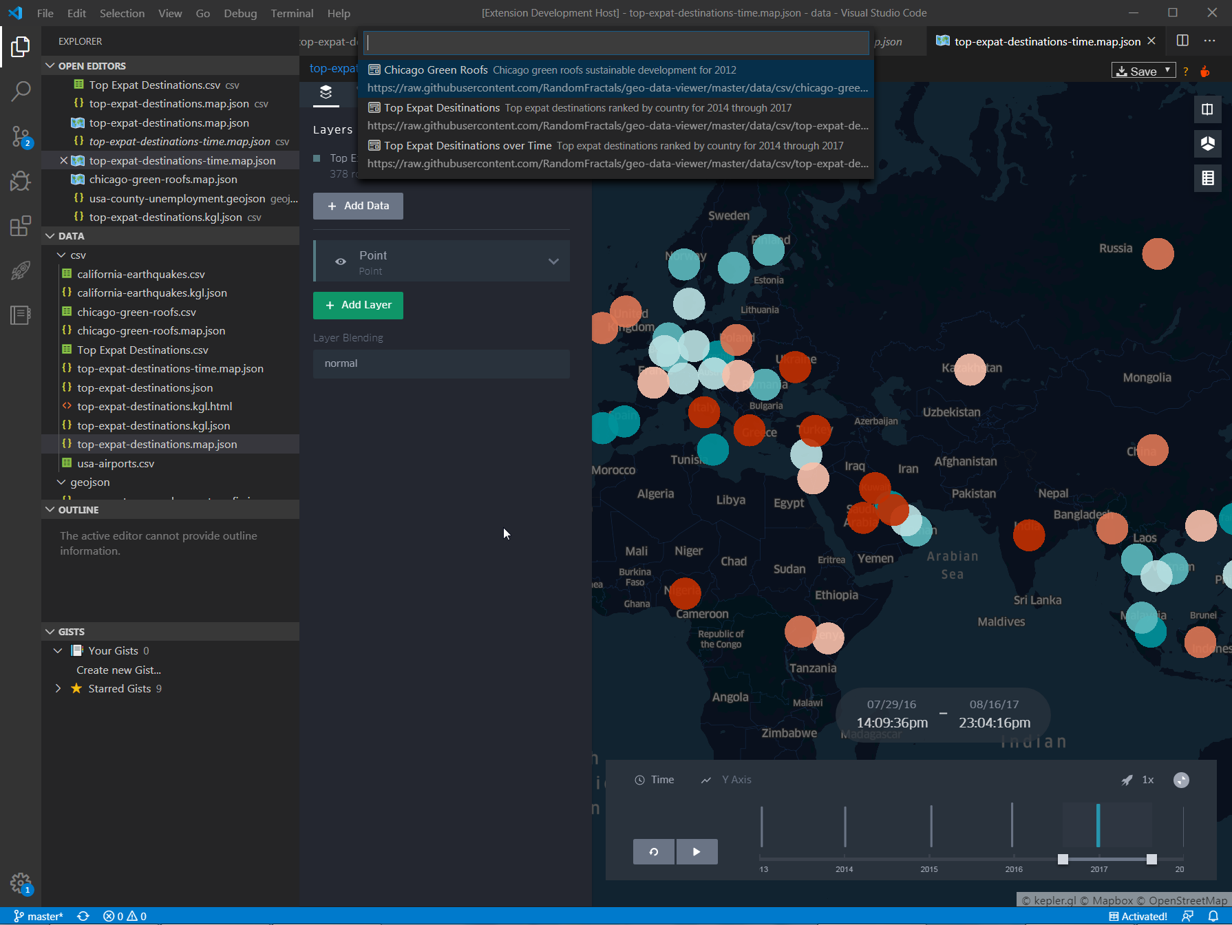
Geo: Map Gallery(ctrl/cmd + alt + g) command to view a list of built-in public keplergl map configs 🗺️
Supported File Formats
See kepler.gl file formats documentation for the supported geo data files in addition to the geo data formats this extension provides for kepler.gl map 🗺️ views: TopoJSON, keplerg.gl JSON, KML, GPX, FlatGeobuf, shapefiles, IGC, WKT
Map Gallery
Geo Data Viewer 🗺️ comes with a built-in map gallery for devs to try kepler.gl maps 🗺️ found in the wild 🌐:
Note: if you'd like to see your public keplerg.gl map config featured in our maps gallery, please send us a PR with links to your kepler.gl maps 🗺️ data & config github repo || gist in the /data/README.md map list.
Installation
Install Geo Data Viewer 🗺️ via vscode Extensions tab (Ctrl+Shift+X) by searching for keplerGL|| via VSCode marketplace search results. It's the only 1 out there! ;)
List of the Geo Data Viewer 🗺️ commands, keyboard shortcuts, augmented vscode UI context menus, added geo data Language mappings and supported geo data files:
Configuration
Create User or Workspace Settings in vscode to change default Geo Data Viewer 🗺️ extension Settings:
| Setting | Type | Default Value | Description |
|---|---|---|---|
geo.data.viewer.theme |
string | dark |
Map View 🗺️ Controls UI Theme: dark or light
|
geo.data.viewer.map.style |
string | dark |
Default Map Style: dark, light, muted (light), muted_night, satellite, dark_streets, light_streets, outdoors
|
geo.data.viewer.create.geojson |
boolean | true |
Creates .geojson data file on disk for topojson, kml, gpx, fgb and shp map views |
Recommended Extensions
Other extensions Geo Data Viewer 🗺️ replaces, enhances or supplements for working with geo data formats in VSCode:
| Extension | Description |
|---|---|
| Data Preivew 🈸 | Data Preview 🈸 extension for importing 📤 viewing 🔎 slicing 🔪 dicing 🎲 charting 📊 & exporting 📥 large JSON array/config, YAML, Apache Arrow, Avro & Excel data files |
| GistPad 📘 | VS Code extension for managing and sharing code snippets, notes and interactive samples using GitHub Gists |
| VSCode Map Preview | VSCode extension for visually previewing geospatial file content (GeoJSON, KML, etc) on a map |
| Geo Tools | Geo Tools VSCode extension allows you to easily interact with geographical data |
| Hex Editor | Allows Hex Editing inside VS Code |
Dev Log
See #GeoDataViewer 🗺️ tag on Twitter for the latest & greatest updates on this vscode extension & what's in store next.
Dev Build
$ git clone https://github.com/RandomFractals/geo-data-viewer
$ cd geo-data-viewer
$ npm install
$ code .
F5 to launch Geo Data Viewer 🗺️ extension VSCode debug session.
Contributions
Any & all test, code || feedback contributions are welcome.
Open an issue || create a pull request to make this Geo Data Viewer 🗺️ vscode extension work better for all. 🤗


