All Projects → jwasilgeo → esri-experiments

jwasilgeo / esri-experiments

Licence: other
Fly in space and look across the sea: demos and experiments with the ArcGIS API for JavaScript

Programming Languages

HTML
75241 projects
javascript
184084 projects - #8 most used programming language

Projects that are alternatives of or similar to esri-experiments

geog4572
Geovisual Analytics @ Oregon State University
Stars: ✭ 67 (+131.03%)
Mutual labels:  webmaps, geovisualization
c-through
A prototype for interactive 3D urban planning analysis on the web based on the ArcGIS Javascript API 4.3.
Stars: ✭ 30 (+3.45%)
Mutual labels:  arcgis-js-api, esri
participatory-planning
3D web app for participatory planning in Dumbo, Brooklyn NY
Stars: ✭ 36 (+24.14%)
Mutual labels:  arcgis-js-api, esri
workflowmanager-viewer-js
Source code for ArcGIS Workflow Manager JavaScript viewer - Manage your workflows on the web.
Stars: ✭ 23 (-20.69%)
Mutual labels:  arcgis-js-api, esri
Microsoft.SqlServer.Types
a .NET Standard implementation of the spatial types in `Microsoft.SqlServer.Types`
Stars: ✭ 64 (+120.69%)
Mutual labels:  mapping, geography
Contextily
Context geo-tiles in Python
Stars: ✭ 254 (+775.86%)
Mutual labels:  mapping, geography
jsapi4x
ArcGIS Javascript API 4.x YouTube Series
Stars: ✭ 21 (-27.59%)
Mutual labels:  arcgis-js-api, esri
cmv-contrib-widgets
User contributed widgets for CMV
Stars: ✭ 36 (+24.14%)
Mutual labels:  arcgis-js-api, esri-js
cmv-widgets
Widgets for CMV, the Configurable Map Viewer.
Stars: ✭ 37 (+27.59%)
Mutual labels:  arcgis-js-api, esri-js
Geoserver
geoserver is a Go library for manipulating a GeoServer instance via the GeoServer REST API.
Stars: ✭ 48 (+65.52%)
Mutual labels:  mapping, geography
d3-geomap
A library for creating geographical maps based on D3.js
Stars: ✭ 124 (+327.59%)
Mutual labels:  mapping, geography
CodableWrapper
@codec("encoder", "decoder") var cool: Bool = true
Stars: ✭ 143 (+393.1%)
Mutual labels:  mapping
geemap-apps
Interactive web apps created using geemap and streamlit
Stars: ✭ 24 (-17.24%)
Mutual labels:  mapping
EsriRESTScraper
A Python class that scrapes ESRI Rest Endpoints and exports data to a geodatabase
Stars: ✭ 43 (+48.28%)
Mutual labels:  esri
morphmorph
😱 Isomorphic transformations. Map, transform, filter, and morph your objects
Stars: ✭ 26 (-10.34%)
Mutual labels:  mapping
Mappable
flexible JSON to Model converter, specially optimized for immutable properties
Stars: ✭ 27 (-6.9%)
Mutual labels:  mapping
android
Where you can find everything Android from Mapzen
Stars: ✭ 106 (+265.52%)
Mutual labels:  mapping
bactmap
A mapping-based pipeline for creating a phylogeny from bacterial whole genome sequences
Stars: ✭ 36 (+24.14%)
Mutual labels:  mapping
geocoder
Web app interface for geocoding addresses in CSV files.
Stars: ✭ 17 (-41.38%)
Mutual labels:  mapping
gracidea
🌺 A Pokémon 2D live map gathering all regions, including wandering pokémons and characters and animated tiles!
Stars: ✭ 163 (+462.07%)
Mutual labels:  mapping

esri-experiments

Web mapping experiments using the ArcGIS API for JavaScript.

Also check out my LeafletJS experiments and other data visualizations on CodePen.

Table of Contents

earth-at-night

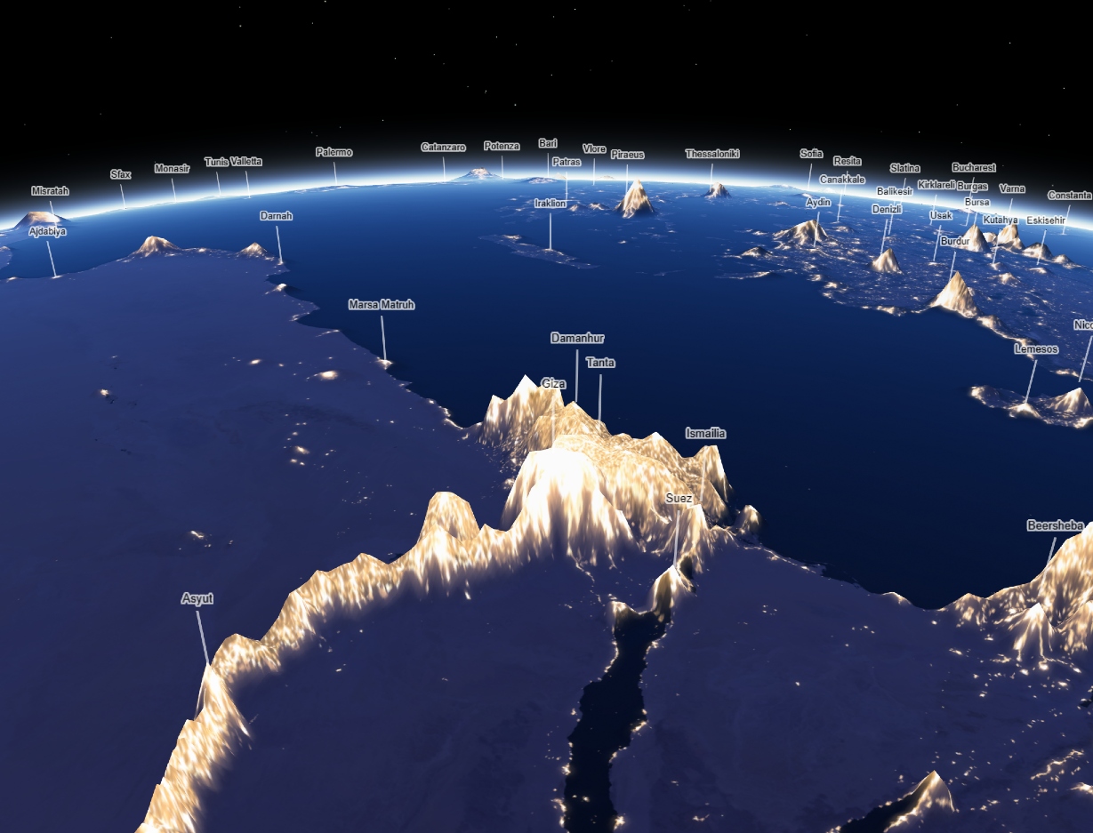
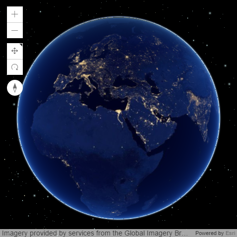
"Earth at Night, Mountains of Light"

🏆 KANTAR Information is Beautiful Awards 2019: GOLD winner in "Maps, Places & Spaces" category

Explore the Earth at night as seen by Suomi NPP VIIRS. Light emissions are used as the world's thematic elevation layer by using chroma.js to calculate pixel color luminance.

screenshot

screenshot

antipodes

Get to know the opposite side of the Earth in 3D.
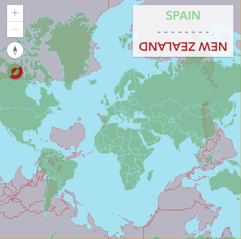
antipodes

antipodes-2d

Get to know the opposite side of the Earth in 2D. Includes several color scheme choices for colorblind support.
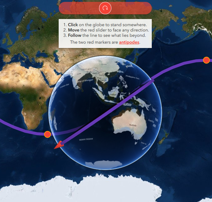
antipodes-2d

around-the-world

Find out what lies across the ocean and beyond by traveling around the Earth, and along the way learn how geodesic lines appear on globes vs. 2D web mercator maps.

screenshot

custom-point-layer

Find out how to build your own 2D layer with the Canvas API and animate it the help of Anime.js, or alternatively with Tween.js.

You can also use canvas helpers from D3.js to make donuts charts, draw sketchy looking graphics with Rough.js, and anything else you can dream of.

Radius animation example with Anime.js

Radius animation example with Tween.js

Pie/donuts charts example with D3js
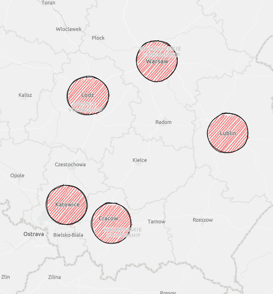
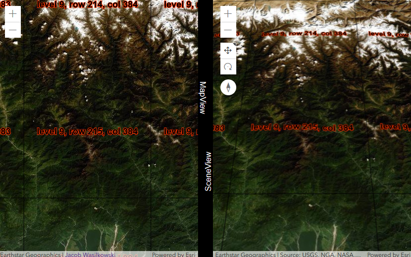
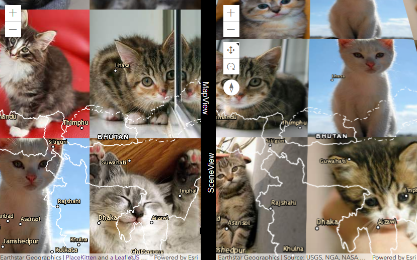
Sketchy example with Rough.js

screenshot

screenshot-pies

screenshot-rough

custom-tile-layer

Find out how to build your own tiled layer in either 2D or 3D with the Canvas API.

Example showing level, row, and column info
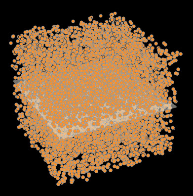
Example with kittens! 😻 🐈

screenshot

screenshot

scene-view-as-chart

You've always wanted to turn a SceneView into your own 3D scatterplot charting library. Here you go.

screenshot

iss-view

Take a ride on the International Space Station and explore NASA astronaut photography.

solar-terminator

Note that the project description data, including the texts, logos, images, and/or trademarks, for each open source project belongs to its rightful owner. If you wish to add or remove any projects, please contact us at [email protected].