All Projects → osin-vladimir → kaggle-satellite-imagery-feature-detection

osin-vladimir / kaggle-satellite-imagery-feature-detection

Licence: other
Satellite Imagery Feature Detection (68 out of 419)

Programming Languages

Jupyter Notebook
11667 projects
python
139335 projects - #7 most used programming language

Projects that are alternatives of or similar to kaggle-satellite-imagery-feature-detection

Kaggle dstl submission
Code for a winning model (3 out of 419) in a Dstl Satellite Imagery Feature Detection challenge
Stars: ✭ 159 (+448.28%)
Mutual labels:  segmentation, satellite-imagery
Open Solution Mapping Challenge
Open solution to the Mapping Challenge 🌎
Stars: ✭ 291 (+903.45%)
Mutual labels:  kaggle, satellite-imagery
Robosat
Semantic segmentation on aerial and satellite imagery. Extracts features such as: buildings, parking lots, roads, water, clouds
Stars: ✭ 1,789 (+6068.97%)
Mutual labels:  segmentation, satellite-imagery
U-Net-Satellite
Road Detection from satellite images using U-Net.
Stars: ✭ 38 (+31.03%)
Mutual labels:  segmentation, satellite-imagery
Open Solution Data Science Bowl 2018
Open solution to the Data Science Bowl 2018
Stars: ✭ 159 (+448.28%)
Mutual labels:  kaggle, segmentation
Pytorch Toolbelt
PyTorch extensions for fast R&D prototyping and Kaggle farming
Stars: ✭ 942 (+3148.28%)
Mutual labels:  kaggle, segmentation
Keras Unet
Helper package with multiple U-Net implementations in Keras as well as useful utility tools helpful when working with image semantic segmentation tasks. This library and underlying tools come from multiple projects I performed working on semantic segmentation tasks
Stars: ✭ 196 (+575.86%)
Mutual labels:  segmentation, satellite-imagery
argus-tgs-salt
Kaggle | 14th place solution for TGS Salt Identification Challenge
Stars: ✭ 73 (+151.72%)
Mutual labels:  kaggle, segmentation
Segmentation
Tensorflow implementation : U-net and FCN with global convolution
Stars: ✭ 101 (+248.28%)
Mutual labels:  kaggle, segmentation
Data Science Bowl 2018
End-to-end one-class instance segmentation based on U-Net architecture for Data Science Bowl 2018 in Kaggle
Stars: ✭ 56 (+93.1%)
Mutual labels:  kaggle, segmentation
Kaggle airbus ship detection
Kaggle airbus ship detection challenge 21st solution
Stars: ✭ 238 (+720.69%)
Mutual labels:  kaggle, segmentation
pixel-decoder
A tool for running deep learning algorithms for semantic segmentation with satellite imagery
Stars: ✭ 68 (+134.48%)
Mutual labels:  segmentation, satellite-imagery
dcsp segmentation
No description or website provided.
Stars: ✭ 34 (+17.24%)
Mutual labels:  segmentation
CAPE
Cylinder and Plane Extraction from Depth Cameras
Stars: ✭ 107 (+268.97%)
Mutual labels:  segmentation
pcan
Prototypical Cross-Attention Networks for Multiple Object Tracking and Segmentation, NeurIPS 2021 Spotlight
Stars: ✭ 294 (+913.79%)
Mutual labels:  segmentation
ML IDCard Segmentation-TF-Keras
Machine Learning Project to identify an ID Card on an image
Stars: ✭ 38 (+31.03%)
Mutual labels:  segmentation
medical image segmentation
Medical image segmentation ( Eye vessel segmentation)
Stars: ✭ 90 (+210.34%)
Mutual labels:  segmentation
Lyrics-to-Audio-Alignment
Aligns text (lyrics) with monophonic singing voice (audio). The algorithm uses structural segmentation to segment the audio into structures and then uses hidden markov models to obtain alignment within segments. The final alignment is concatenation of time stamps of lyrics within the segments for each song.
Stars: ✭ 57 (+96.55%)
Mutual labels:  segmentation
fabric
Urban change model designed to identify changes across 2 timestamps
Stars: ✭ 53 (+82.76%)
Mutual labels:  satellite-imagery
color-pop
🌈 Automatic Color Pop effect on any image inspired by Google Photos
Stars: ✭ 21 (-27.59%)
Mutual labels:  segmentation

Description

In this competition, DSTL provides 1km x 1km satellite images in both 3-band and 16-band formats. Main goal is to detect and classify the types of objects found in these regions.

Object types

In a satellite image, you will find lots of different objects like roads, buildings, vehicles, farms, trees, water ways, etc:

  1. Buildings - large building, residential, non-residential, fuel storage facility, fortified building
  2. Misc. Manmade structures
  3. Road
  4. Track - poor/dirt/cart track, footpath/trail
  5. Trees - woodland, hedgerows, groups of trees, standalone trees
  6. Crops - contour ploughing/cropland, grain (wheat) crops, row (potatoes, turnips) crops
  7. Waterway
  8. Standing water
  9. Vehicle Large - large vehicle (e.g. lorry, truck,bus), logistics vehicle
  10. Vehicle Small - small vehicle (car, van), motorbike

Main ideas

  • Panchromatic sharpennig
  • Reflectance indices
  • Generative Adversarial Networks
  • State-of-the-art CNN for Image Segmentation

Panchromatic Sharpening

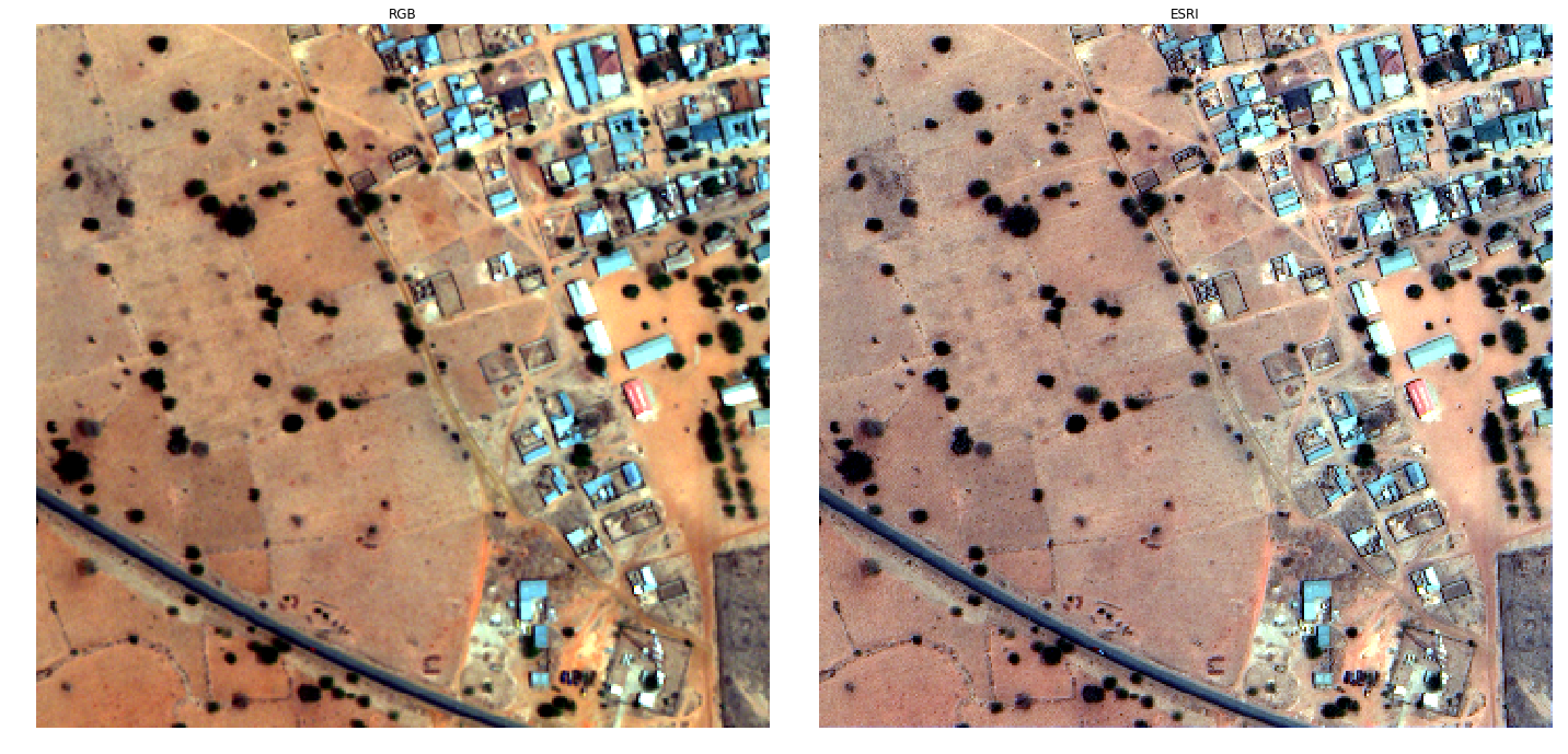
Pansharpening is a process of merging high-resolution panchromatic and lower resolution multispectral imagery to create a single high-resolution color image. Google Maps and nearly every map creating company use this technique to increase image quality. Pansharpening produces a high-resolution color image from three, four or more low-resolution multispectral satellite bands plus a corresponding high-resolution panchromatic band.

Reflectance Index

The reflectance is used to calculate different reflectance indices, which sum up the large amount of information contained in a reflectance spectrum. Some of them are related to plant biomass, photosynthetic size and radiation use efficiency. Other parameters are related to the physiological status, e.g. water content.

Neural networks

My solution is based on modified fully convolutional neural network architecture called U-Net, that was previously used for the tasks of biomedical image segmentation. The U-Net architecture allows combining low-level feature maps with higher-level ones, which enables precise localization. In addition, I tried to improve segmentation accuracy using generative adversarial network as described in credits section.

Technical Report

Credits and Inspiration

  1. Towards Adversarial Retinal Image Synthesis (code)
  2. Image-to-Image Translation with Conditional Adversarial Networks
  3. Vegetation indices

Slack for new Kagglers

Note that the project description data, including the texts, logos, images, and/or trademarks, for each open source project belongs to its rightful owner. If you wish to add or remove any projects, please contact us at [email protected].