mapbox / Montilecarlo
Stars: ✭ 16
Programming Languages
python
139335 projects - #7 most used programming language
Labels
Projects that are alternatives of or similar to Montilecarlo
KS-1Q
Opensat first generation cubesat bus, launch into orbit at 2016/11/11
Stars: ✭ 22 (+37.5%)
Mutual labels: satellite
Libcsp
Cubesat Space Protocol - A small network-layer delivery protocol designed for Cubesats
Stars: ✭ 258 (+1512.5%)
Mutual labels: satellite
Gr Satellites
GNU Radio decoders for several Amateur satellites
Stars: ✭ 472 (+2850%)
Mutual labels: satellite
sentinel-tiler
A serverless Sentinel-2 tiles server using AWS Lambda
Stars: ✭ 59 (+268.75%)
Mutual labels: satellite
Opensatelliteproject
Open Satellite Project Information
Stars: ✭ 265 (+1556.25%)
Mutual labels: satellite
ORBITM
🌏 📡 🌏 📡 ORBITM - Orbit maintenance, propulsion sizing, and life-time estimation of space objects!
Stars: ✭ 28 (+75%)
Mutual labels: satellite
Satellite Eyes
Mac OS X app to automatically set your desktop wallpaper to the satellite view overhead.
Stars: ✭ 578 (+3512.5%)
Mutual labels: satellite
Noaa Apt
NOAA APT weather satellite image decoder, for Linux, Windows, RPi 2+ and OSX
Stars: ✭ 257 (+1506.25%)
Mutual labels: satellite
himawari-rx
📡 Receive images from weather satellite Himawari-8 via HimawariCast.
Stars: ✭ 21 (+31.25%)
Mutual labels: satellite
landslide
Research project on building and evaluating deep learning models for landslides detection on satellite images
Stars: ✭ 36 (+125%)
Mutual labels: satellite
Mapbox Sdk Py
Python SDK for Mapbox APIs **DEVELOPMENT IS TEMPORARILY PAUSED, SEE CONTRIBUTING.md**
Stars: ✭ 300 (+1775%)
Mutual labels: satellite
geoblaze
Blazing Fast JavaScript Raster Processing Engine
Stars: ✭ 80 (+400%)
Mutual labels: satellite
HAMRadio
How-To and Wiki pages for PW-Sat2 Ground Segment equipment and software dedicated for radio amateurs.
Stars: ✭ 21 (+31.25%)
Mutual labels: satellite
Torchsat
🔥TorchSat 🌏 is an open-source deep learning framework for satellite imagery analysis based on PyTorch.
Stars: ✭ 261 (+1531.25%)
Mutual labels: satellite
Satpy
Python package for earth-observing satellite data processing
Stars: ✭ 679 (+4143.75%)
Mutual labels: satellite
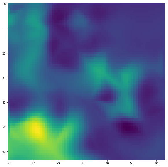
montilecarlo
Uses monte-carlo-ish sampling of tile data to interpolate across larger areas.
Installation
Installation from GitHub
$ git clone [email protected]:mapbox/montilecarlo.git
$ cd montilecarlo
$ pip install -e .
Example API Usage
import os

from montilecarlo.tiles import MonteCarloTiles
from montilecarlo.tasks import process_tiles, load_tile, make_urls

from matplotlib.pyplot import figure, show


tile = [655, 1582, 12]
zoom = 18
MCT = MonteCarloTiles(tile, zoom, tilebuffer=2)

sampling = 0.025
sampletiles = MCT.generate_tiles(sampling, method='boxed')

total_possible_tiles = 4 ** (zoom - tile[-1])
# sampling * total_possible_tiles should ~= len(sampletiles)


def get_weird(img):
    '''Rather than something useful,
    let look at the variance of a greyscale image
    flipped in 4 directions'''
    grey = np.mean(img, axis=2)
    return np.mean(np.var(np.dstack([
        grey[::a, ::b] for a, b in product([-1, 1], [-1, 1])
    ]), axis=2))

# provide a list of functions to run;
# each function should take a (depth, rows, cols)
# ndarray and return a single numeric value
runfunctions = [
    get_weird
]

_, results = zip(*list(process_tiles(sampletiles,
                        os.environ['MAPBOX_ACCESS_TOKEN'],
                        runfunctions,
                        mapid='mapbox.satellite',
                        fmt='jpg')))


results = np.array(results)

fig = figure(figsize=(10, 10))
ax = fig.add_subplot(111)
ax.imshow(MCT.reinterpolate_tiles(sampletiles, results[:, 0], method='cubic'))
Note that the project description data, including the texts, logos, images, and/or trademarks,
for each open source project belongs to its rightful owner.
If you wish to add or remove any projects, please contact us at [email protected].

