HTenkanen / Pyrosm
Programming Languages
Labels
Projects that are alternatives of or similar to Pyrosm
Pyrosm
Pyrosm is a Python library for reading OpenStreetMap data from Protocolbuffer Binary Format -files (*.osm.pbf) into Geopandas GeoDataFrames.
Pyrosm makes it easy to extract various datasets from OpenStreetMap pbf-dumps including e.g. road networks, buildings,
Points of Interest (POI), landuse and natural elements. Also fully customized queries are supported which makes it possible
to parse the data from OSM with more specific filters.
Pyrosm is easy to use and it provides a somewhat similar user interface as OSMnx. The main difference between pyrosm and OSMnx is that OSMnx reads the data over internet using OverPass API, whereas pyrosm reads the data from local OSM data dumps that can be downloaded e.g. from GeoFabrik's website. This makes it possible to read data faster thus allowing e.g. parsing street networks for the whole country fairly efficiently (however, see caveats).
The library has been developed by keeping performance in mind, hence, it is mainly written in Cython (Python with C-like performance) which makes it probably faster than any other Python alternatives for parsing OpenStreetMap data. Pyrosm is built on top of another Cython library called Pyrobuf which is a faster Cython alternative to Google's Protobuf library: It provides 2-4x boost in performance for deserializing the protocol buffer messages compared to Google's version with C++ backend. Google's Protocol Buffers is a commonly used and efficient method to serialize and compress structured data which is also used by OpenStreetMap contributors to distribute the OSM data in PBF format (Protocolbuffer Binary Format).
Documentation is available at https://pyrosm.readthedocs.io.
Current features
- download PBF data easily from hundreds of locations across the world
- read street networks (separately for driving, cycling, walking and all-combined)
- read buildings from PBF
- read Points of Interest (POI) from PBF
- read landuse from PBF
- read "natural" from PBF
- read boundaries from PBF (+ allow searching by name)
- read any other data from PBF by using a custom user-defined filter
- filter data based on bounding box
- export networks as a directed graph to
igraph,networkxandpandana
Roadmap
- add possibility to optimize memory usage (see #87)
- add possibility to simplify graph (see #89)
- add possibility to crop PBF and save a subset into new PBF.
- add Cython specific tests
Install
Pyrosm is distributed via PyPi and conda-forge.
The recommended way to install pyrosm is using conda package manager:
$ conda install -c conda-forge pyrosm
You can also install the package with pip:
$ pip install pyrosm
Troubleshooting
Notice that pyrosm requires geopandas to work.
On Linux and Mac installing geopandas with pip should work without a problem, which is handled automatically when installing pyrosm.
However, on Windows installing geopandas with pip is likely to cause issues, hence, it is recommended to install Geopandas before installing
pyrosm. See instructions from Geopandas website.
When should I use Pyrosm?
Pyrosm can of course be used whenever you need to parse data from OSM into geopandas GeoDataFrames.
However, pyrosm is better suited for situations where you want to fetch data for whole city or larger regions (even whole country).
If you are interested to fetch OSM data for smaller areas such as neighborhoods, or search data around a specific location/address, we recommend using OSMnx which is more flexible in terms of specifying the area of interest. That being said, it is also possible to extract neighborhood level information with pyrosm and filter data based on a bounding box (see docs).
How to use?
Using pyrosm is straightforward. See docs
for instructions how to use the library.
Performance
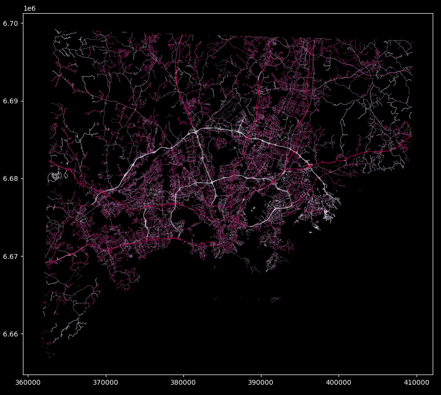
See docs for more comprehensive benchmarking tests. Reading all drivable roads in Helsinki Region (approx. 85,000 roads) takes approximately 12 seconds (laptop with 16GB memory, SSD drive, and Intel Core i5-8250U CPU 1.6 GHZ). And the result looks something like:
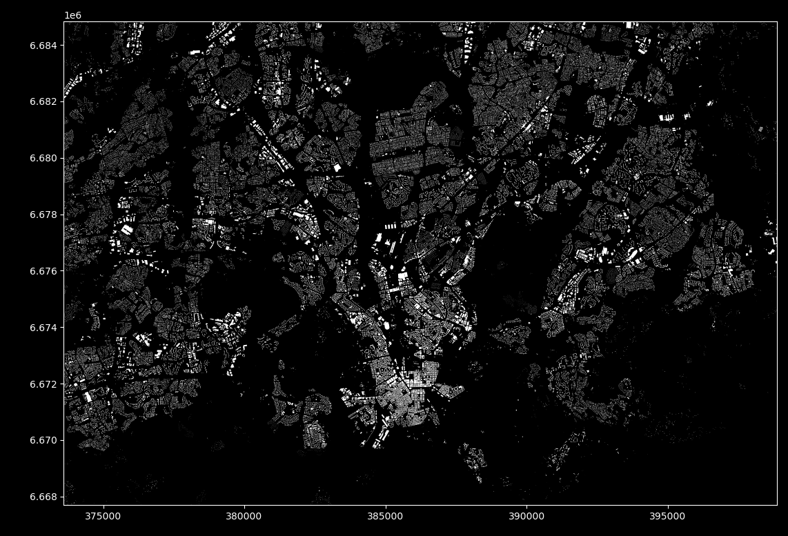
Parsing all buildings from the same area (approx. 180,000) takes approximately 17 seconds. And the result looks something like:
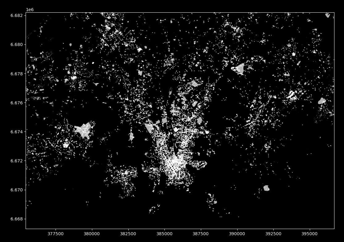
Parsing all Points of Interest (POIs) with defaults elements (amenities, shops and tourism) takes approximately 14 seconds (approx. 32,000 features). And the result looks something like:
Get in touch + contributions
If you find a bug from the tool, have question, or would like to suggest a new feature to it, you can make a new issue here.
We warmly welcome contributions to pyrosm to make it better. If you are interested in contributing to the library,
please check the contribution guidelines of geopandas
until pyrosm gets it's own guidelines (guide of geopandas will be used as the basis for this library as well).
Development
You can install a local development version of the tool by 1) installing necessary packages with conda and 2) building pyrosm from source:
-
install conda-environment for Python 3.7 or 3.8 by:
- Python 3.7 (you might want to modify the env-name which is
testby default):$ conda env create -f ci/37-conda.yaml - Python 3.8:
$ conda env create -f ci/38-conda.yaml
- Python 3.7 (you might want to modify the env-name which is
-
build pyrosm development version from master (activate the environment first):
pip install -e .
You can run tests with pytest by executing:
$ pytest -v
License and copyright
Pyrosm is licensed under MIT (see license).
The OSM data is downloaded from two sources:
Data © Geofabrik GmbH, BBBike and OpenStreetMap Contributors
All data from the OpenStreetMap is licensed under the OpenStreetMap License.
Caveats
Filtering large files by bounding box
Although pyrosm provides possibility to filter even larger data files based on bounding box,
this process can slow down the reading process significantly (1.5-3x longer) due to necessary lookups when parsing the data.
This might not be an issue with smaller files (up to ~100MB) but with larger data dumps this can take longer than necessary.
Hence, a recommended approach with large data files is to first filter the protobuf file based on bounding box into a smaller subset by using a dedicated open source Java tool called Osmosis which is available for all operating systems. Detailed installation instructions are here, and instructions how to filter data based on bounding box are here.


