


Checkout the new Jupyterlab extension: eodag-labextension!
This will bring a fiendly UI to your notebook and help you search and browse for EO products using eodag.
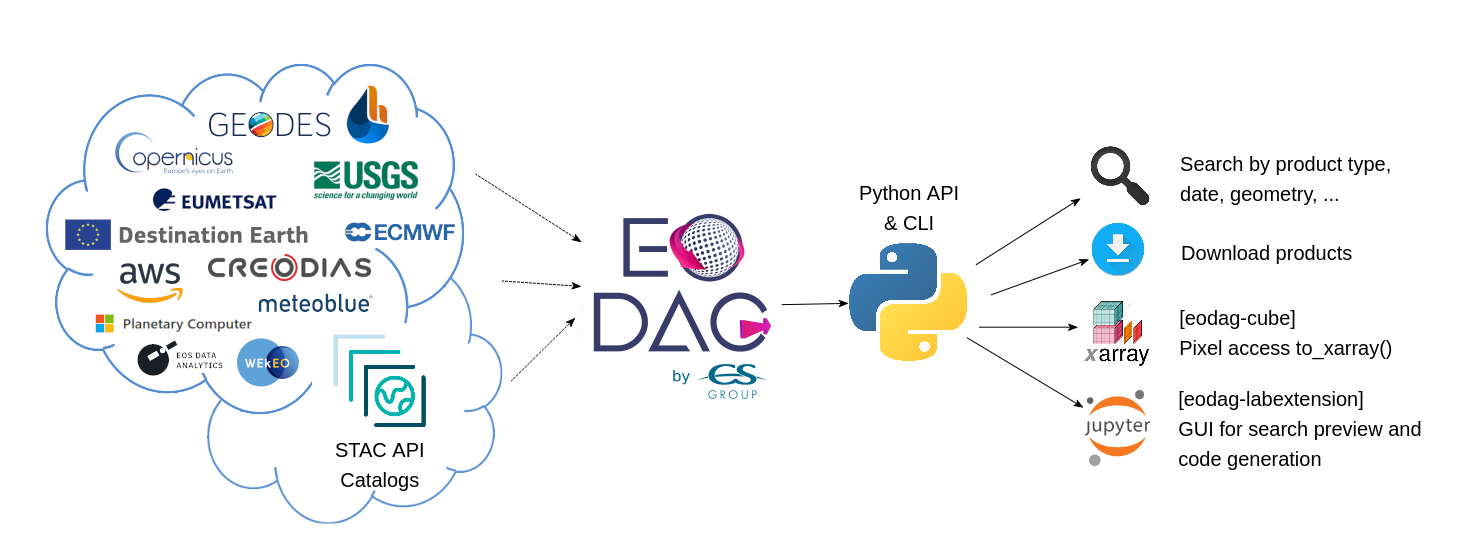
EODAG (Earth Observation Data Access Gateway) is a command line tool and a plugin-oriented Python framework for searching, aggregating results and downloading remote sensed images while offering a unified API for data access regardless of the data provider. The EODAG SDK is structured around three functions:
- List product types: list of supported products and their description
- Search products (by product type or uid) : searches products according to the search criteria provided
- Download products : download product “as is"
EODAG is developed in Python. It is structured according to a modular plugin architecture, easily extensible and able to integrate new data providers. Three types of plugins compose the tool:
- Catalog search plugins, responsible for searching data (OpenSearch, CSW, ...), building paths, retrieving quicklook, combining results
- Download plugins, allowing to download and retrieve data locally (via FTP, HTTP, ..), always with the same directory organization
- Authentication plugins, which are used to authenticate the user on the external services used (JSON Token, Basic Auth, OAUTH, ...).
Since v2.0 EODAG can be run as STAC client or server.
Read the documentation for more insights.
Installation
EODAG is available on PyPI:
python -m pip install eodagAnd with conda from the conda-forge channel:
conda install -c conda-forge eodagUsage
For downloading you will need to fill your credentials for the desired providers in your eodag user configuration file. The file will automatically be created with empty values on the first run.
Python API
Example usage for interacting with the api in your Python code:
from eodag import EODataAccessGateway

dag = EODataAccessGateway()

search_results, total_count = dag.search(
    productType='S2_MSI_L1C',
    geom={'lonmin': 1, 'latmin': 43.5, 'lonmax': 2, 'latmax': 44}, # accepts WKT polygons, shapely.geometry, ...
    start='2021-01-01',
    end='2021-01-15'
)

product_paths = dag.download_all(search_results)
This will search for Sentinel 2 level-1C products on the default provider and return the found products first page and an estimated total number of products matching the search criteria. And then it will download these products. Please check the Python API User Guide for more details.
STAC REST API
An eodag installation can be exposed through a STAC compliant REST api from the command line:
$ eodag serve-rest --help
Usage: eodag serve-rest [OPTIONS]

  Start eodag HTTP server

Options:
  -f, --config PATH   File path to the user configuration file with its
                      credentials
  -d, --daemon TEXT   run in daemon mode
  -w, --world         run flask using IPv4 0.0.0.0 (all network interfaces),
                      otherwise bind to 127.0.0.1 (localhost). This maybe
                      necessary in systems that only run Flask  [default:
                      False]
  -p, --port INTEGER  The port on which to listen  [default: 5000]
  --debug             Run in debug mode (for development purpose)  [default:
                      False]
  --help              Show this message and exit.

# run server
$ eodag serve-rest

# list available product types for ``peps`` provider:
$ curl "http://127.0.0.1:5000/collections?provider=peps" | jq ".collections[].id"
"S1_SAR_GRD"
"S1_SAR_OCN"
"S1_SAR_SLC"
"S2_MSI_L1C"
"S2_MSI_L2A"
"S3_EFR"
"S3_ERR"
"S3_LAN"
"S3_OLCI_L2LFR"
"S3_OLCI_L2LRR"
"S3_SLSTR_L1RBT"
"S3_SLSTR_L2LST"

# search for items
$ curl "http://127.0.0.1:5000/search?collections=S2_MSI_L1C&bbox=0,43,1,44&datetime=2018-01-20/2018-01-25" \
| jq ".context.matched"
6

# browse for items
$ curl "http://127.0.0.1:5000/S2_MSI_L1C/country/FRA/year/2021/month/01/day/25/cloud_cover/10/items" \
| jq ".context.matched"
9

# get download link
$ curl "http://127.0.0.1:5000/S2_MSI_L1C/country/FRA/year/2021/month/01/day/25/cloud_cover/10/items" \
| jq ".features[0].assets.downloadLink.href"
"http://127.0.0.1:5000/S2_MSI_L1C/country/FRA/year/2021/month/01/day/25/cloud_cover/10/items/S2A_MSIL1C_20210125T105331_N0209_R051_T31UCR_20210125T130733/download"

# download
$ wget "http://127.0.0.1:5000/S2_MSI_L1C/country/FRA/year/2021/month/01/day/25/cloud_cover/10/items/S2A_MSIL1C_20210125T105331_N0209_R051_T31UCR_20210125T130733/download"
You can also browse over your STAC API server using STAC Browser. Simply run:
git clone https://github.com/CS-SI/eodag.git
cd eodag
docker-compose up
# or for a more verbose logging:
EODAG_LOGGING=3 docker-compose up
And browse http://127.0.0.1:5001:
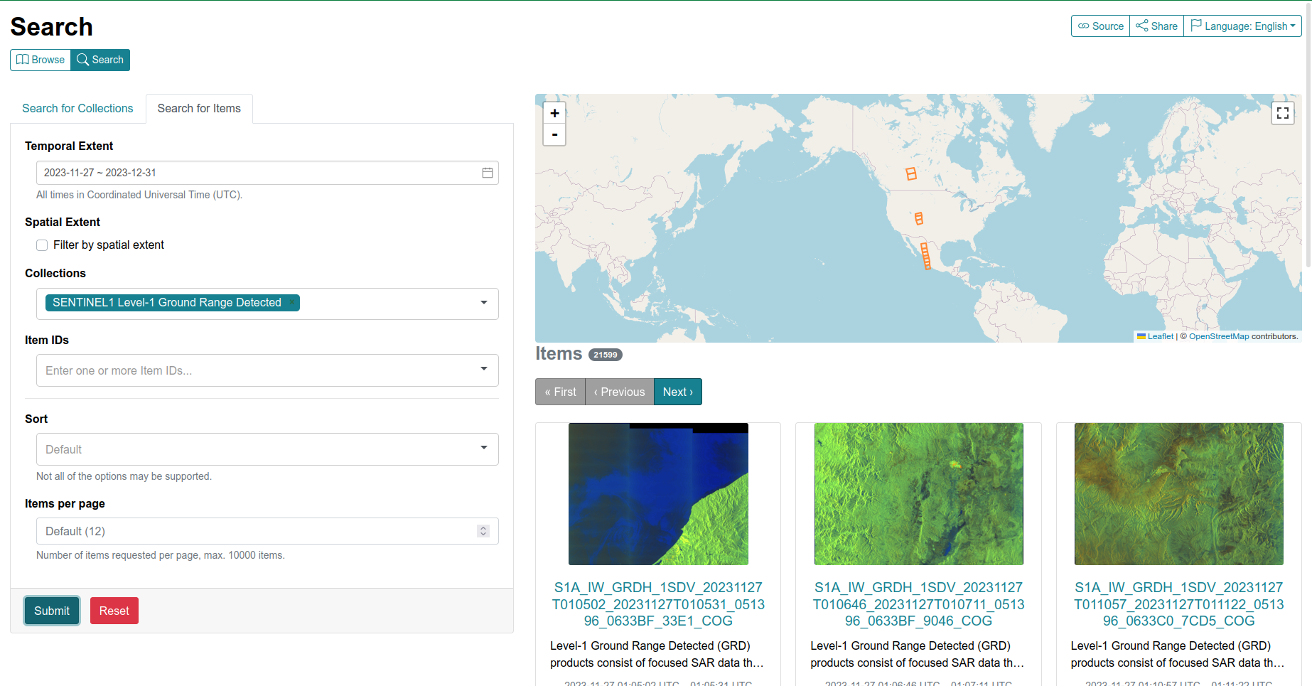
For more information, see STAC REST API usage.
Command line interface
Start playing with the CLI:
To search for some products:
eodag search --productType S2_MSI_L1C --box 1 43 2 44 --start 2021-03-01 --end 2021-03-31
The request above searches for
S2_MSI_L1Cproduct types in a given bounding box, in March 2021. It saves the results in a GeoJSON file (search_results.geojsonby default).Results are paginated, you may want to get all pages at once with
--all, or search products having 20% of maximum coud cover with--cloudCover 20. For more information on available options:eodag search --help
To download the result of the previous call to search:
eodag download --search-results search_results.geojson
To download only the result quicklooks of the previous call to search:
eodag download --quicklooks --search-results search_results.geojson
To list all available product types and supported providers:
eodag list
To list available product types on a specified supported provider:
eodag list -p sobloo
To see all the available options and commands:
eodag --help
To print log messages, add
-vto eodag master command. e.g.eodag -v list. The morevgiven (up to 3), the more verbose the tool is. For a full verbose output, do for example:eodag -vvv list
Contribute
Have you spotted a typo in our documentation? Have you observed a bug while running EODAG? Do you have a suggestion for a new feature?
Don't hesitate and open an issue or submit a pull request, contributions are most welcome!
For guidance on setting up a development environment and how to make a contribution to eodag, see the contributing guidelines.
License
EODAG is licensed under Apache License v2.0. See LICENSE file for details.
Authors
EODAG has been created by CS GROUP - France.
Credits
EODAG is built on top of amazingly useful open source projects. See NOTICE file for details about those projects and their licenses. Thank you to all the authors of these projects !