All Projects → r-spatial → Mapview

r-spatial / Mapview

Licence: gpl-3.0
Interactive viewing of spatial data in R

Programming Languages

r
7636 projects

Projects that are alternatives of or similar to Mapview

Iclient Javascript
Modern GIS Web Client for JavaScript, based on Leaflet\OpenLayers\MapboxGL-JS\Classic(iClient8C), enhanced with ECharts\D3\MapV etc. Contributed by SuperMap & community.
Stars: ✭ 593 (+73.9%)
Mutual labels:  gis, leaflet
Mapboard
A framework for data-rich web mapping 🌎📊✨
Stars: ✭ 29 (-91.5%)
Mutual labels:  gis, leaflet
Leaflet Search
Search stuff in a Leaflet map
Stars: ✭ 536 (+57.18%)
Mutual labels:  gis, leaflet
Ui Leaflet
AngularJS directive to embed an interact with maps managed by Leaflet library
Stars: ✭ 315 (-7.62%)
Mutual labels:  gis, leaflet
Mapstore2
Modern webmapping with OpenLayers, Leaflet and React
Stars: ✭ 251 (-26.39%)
Mutual labels:  gis, leaflet
Inloco
A Geographic Information System (GIS) used by Ministério Público do Estado do Rio de Janeiro to show social, institutional and administrative data , based on React and Leaflet, interacting with a GeoServer back-end.
Stars: ✭ 51 (-85.04%)
Mutual labels:  gis, leaflet
Agentmaps
Make social simulations on interactive maps with Javascript! Agent-based modeling for the web.
Stars: ✭ 822 (+141.06%)
Mutual labels:  gis, leaflet
swap
A Solver for the Wavelength Assignment Problem (RWA) in WDM networks
Stars: ✭ 27 (-92.08%)
Mutual labels:  leaflet, gis
Leaflet Wfst
OGC WFS-T client layer for Leaflet.
Stars: ✭ 111 (-67.45%)
Mutual labels:  gis, leaflet
Leaflet Geoman
🍂🗺️ The most powerful leaflet plugin for drawing and editing geometry layers
Stars: ✭ 1,088 (+219.06%)
Mutual labels:  gis, leaflet
georaster-layer-for-leaflet
Display GeoTIFFs and soon other types of raster on your Leaflet Map
Stars: ✭ 168 (-50.73%)
Mutual labels:  leaflet, gis
mars2d
【Mars2D平台 】主仓库,包含所有开源仓库清单导航
Stars: ✭ 182 (-46.63%)
Mutual labels:  leaflet, gis
Solaris
CosmiQ Works Geospatial Machine Learning Analysis Toolkit
Stars: ✭ 290 (-14.96%)
Mutual labels:  gis
Geospatial Machine Learning
A curated list of resources focused on Machine Learning in Geospatial Data Science.
Stars: ✭ 289 (-15.25%)
Mutual labels:  gis
Datacube Core
Open Data Cube analyses continental scale Earth Observation data through time
Stars: ✭ 285 (-16.42%)
Mutual labels:  gis
Homebrew Osgeo4mac
Mac homebrew tap for maintaining a stable work environment for the OSGeo.org geospatial toolset
Stars: ✭ 329 (-3.52%)
Mutual labels:  gis
Cga.js
CGA 3D 计算几何算法库 | 3D Compute Geometry Algorithm Library webgl three.js babylon.js等任何库都可以使用
Stars: ✭ 313 (-8.21%)
Mutual labels:  gis
Grass
GRASS GIS - free and open source Geographic Information System (GIS)
Stars: ✭ 281 (-17.6%)
Mutual labels:  gis
Mapnik
Mapnik is an open source toolkit for developing mapping applications
Stars: ✭ 3,067 (+799.41%)
Mutual labels:  gis
Osmnx
OSMnx: Python for street networks. Retrieve, model, analyze, and visualize street networks and other spatial data from OpenStreetMap.
Stars: ✭ 3,357 (+884.46%)
Mutual labels:  gis

mapview

tic cran checks monthly total CRAN License Coverage Status status

Interactive viewing of spatial data in R

mapview provides functions to very quickly and conveniently create interactive visualisations of spatial data. It’s main goal is to fill the gap of quick (not presentation grade) interactive plotting to examine and visually investigate both aspects of spatial data, the geometries and their attributes. It can also be considered a data-driven API for the leaflet package as it will automatically render correct map types, depending on the type of the data (points, lines, polygons, raster). In addition, it makes use of some advanced rendering functionality that will enable viewing of much larger data than is possible with leaflet. Furthermore, if you’re a fan of mapdeck (which you should!), you can choose to use it as the rendering platform instead of leaflet by setting mapviewOptions(platform = "mapdeck").

The main user relevant functions are:

  • mapview - view (multiple) spatial objects on a set of background maps
  • viewExtent - view extent / bounding box of spatial objects
  • viewRGB - view RGB true- or false-color images of raster objects
  • mapshot - easily save maps (including leaflet maps) as html and/or png (or other image formats)

Functions that have been deprecated/deleted recently:

  • addHomeButton - deprecated, use package leafem instead.
  • addLogo - deprecated, use package leafem instead.
  • addFeatures - deprecated, use package leafem instead.
  • addMouseCoordinates - deprecated, use package leafem instead.
  • addExtent - deprecated, use package leafem instead.
  • addImageQuery - deprecated, use package leafem instead.
  • latticeView & sync - deprecated, use package leafsync instead.
  • slideView - deprecated, use package slideview instead.
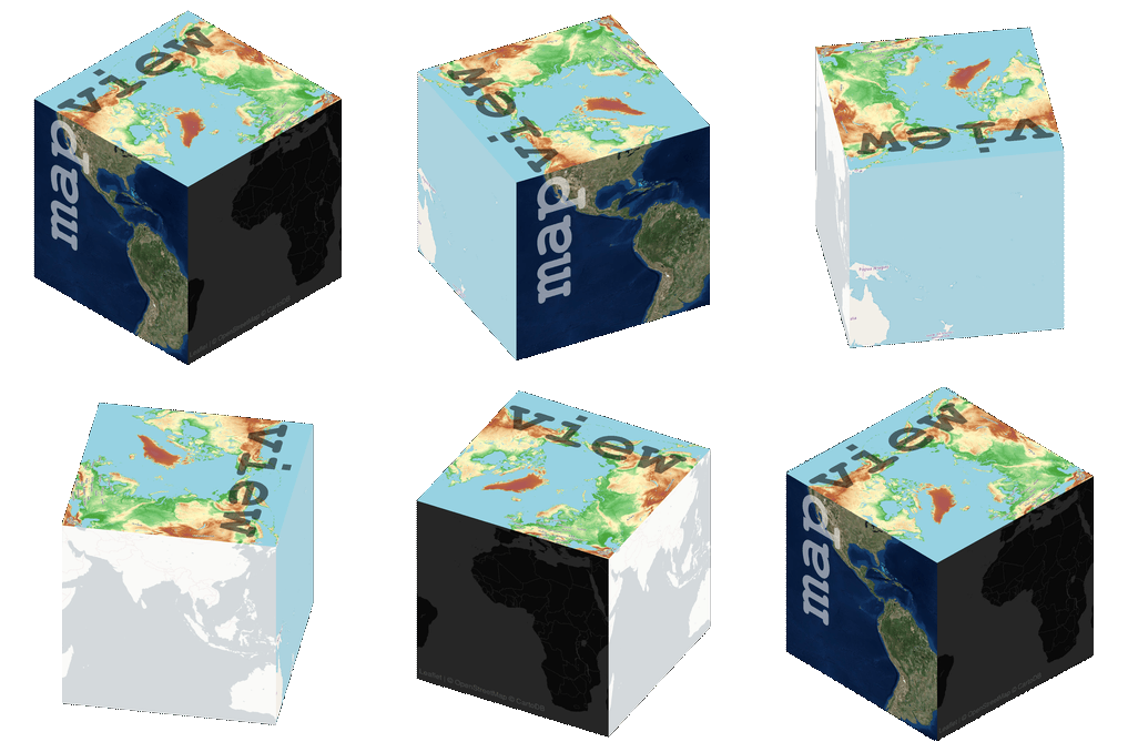
  • cubeView - deprecated, use package cubeview instead.
  • plainview - deprecated, use package plainview instead.
  • popupTable, popupGraph & popupImage - deprecated, use package leafpop instead.
  • addLargeFeatures - use leafgl::addGL* functions instead.

Objects of the following spatial classes are supported:

  • sf
  • raster (Layer, Stack, Brick and SpatialPixels* / SpatialGridDataFrame)
  • stars
  • sp (Points, Polygons, Lines and their DataFrame version)
  • satellite

Installation

For CRAN release version of mapview use

install.packages("mapview")

To install the development version you can install the remotes package.

NOTE: As of version 2.9.1 development will happen on the master branch. Please consider the develop branch obsolete.

remotes::install_github("r-spatial/mapview")

Usage

The most basic call

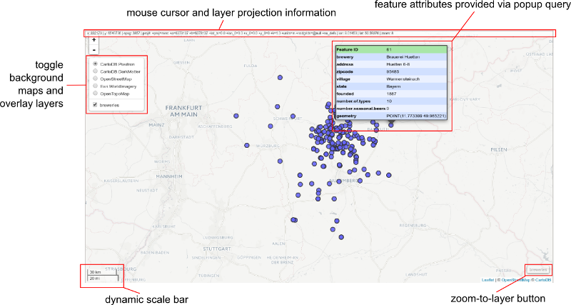
mapview(breweries)

will produce a web map visualisation of the breweries data with the following components:

Contact

Please file bug reports and feature requests at https://github.com/r-spatial/mapview/issues

Note that the project description data, including the texts, logos, images, and/or trademarks, for each open source project belongs to its rightful owner. If you wish to add or remove any projects, please contact us at [email protected].