All Projects → noncomputable → Agentmaps

noncomputable / Agentmaps

Licence: bsd-2-clause
Make social simulations on interactive maps with Javascript! Agent-based modeling for the web.

Programming Languages

javascript
184084 projects - #8 most used programming language

Projects that are alternatives of or similar to Agentmaps

Mapfish Print
A component of MapFish for printing templated cartographic maps. This module is the Java serverside module. For support post to the mailing list: https://groups.google.com/forum/#!forum/mapfish-print-users
Stars: ✭ 159 (-80.66%)
Mutual labels:  gis, geospatial, maps
Mapstore2
Modern webmapping with OpenLayers, Leaflet and React
Stars: ✭ 251 (-69.46%)
Mutual labels:  gis, maps, leaflet
Geotiff.io
Static website for viewing and analyzing GeoTIFF's in the browser
Stars: ✭ 53 (-93.55%)
Mutual labels:  gis, geospatial, maps
Mapboard
A framework for data-rich web mapping 🌎📊✨
Stars: ✭ 29 (-96.47%)
Mutual labels:  gis, maps, leaflet
rafagas
Daily geospatial links curated by Raf Roset
Stars: ✭ 17 (-97.93%)
Mutual labels:  maps, geospatial, gis
georaster-layer-for-leaflet
Display GeoTIFFs and soon other types of raster on your Leaflet Map
Stars: ✭ 168 (-79.56%)
Mutual labels:  leaflet, geospatial, gis
Openglobus
JavaScript 3d maps and geospatial data visualization engine library.
Stars: ✭ 199 (-75.79%)
Mutual labels:  gis, geospatial, maps
Osmnx
OSMnx: Python for street networks. Retrieve, model, analyze, and visualize street networks and other spatial data from OpenStreetMap.
Stars: ✭ 3,357 (+308.39%)
Mutual labels:  gis, geospatial, maps
Leaflet Dvf
Leaflet Data Visualization Framework
Stars: ✭ 678 (-17.52%)
Mutual labels:  geospatial, maps, leaflet
mapmint
Fast and easy webmapping.
Stars: ✭ 51 (-93.8%)
Mutual labels:  maps, geospatial, gis
geowarp
Super Low-Level Raster Reprojection and Resampling Library
Stars: ✭ 20 (-97.57%)
Mutual labels:  maps, geospatial, gis
Ui Leaflet
AngularJS directive to embed an interact with maps managed by Leaflet library
Stars: ✭ 315 (-61.68%)
Mutual labels:  gis, maps, leaflet
H3 Py
Python bindings for H3, a hierarchical hexagonal geospatial indexing system
Stars: ✭ 354 (-56.93%)
Mutual labels:  gis, geospatial
Mapview
Interactive viewing of spatial data in R
Stars: ✭ 341 (-58.52%)
Mutual labels:  gis, leaflet
Whitebox Tools
An advanced geospatial data analysis platform
Stars: ✭ 362 (-55.96%)
Mutual labels:  gis, geospatial
Orb
Types and utilities for working with 2d geometry in Golang
Stars: ✭ 378 (-54.01%)
Mutual labels:  gis, geospatial
Offlinemap
基于MySQL + Node.js + Leaflet的离线地图展示,支持百度、谷歌、高德、腾讯地图
Stars: ✭ 343 (-58.27%)
Mutual labels:  maps, leaflet
Blendergis
Blender addons to make the bridge between Blender and geographic data
Stars: ✭ 4,642 (+464.72%)
Mutual labels:  gis, geospatial
Greatmaps
GMap.NET - Great Maps for Windows Forms & Presentation
Stars: ✭ 739 (-10.1%)
Mutual labels:  gis, maps
Mapsui
Mapsui is a .NET Map component for WPF, Xamarin.Forms, Xamarin.Android, Xamarin.iOS and UWP
Stars: ✭ 447 (-45.62%)
Mutual labels:  gis, geospatial

AgentMaps - Social Simulations on Interactive Maps
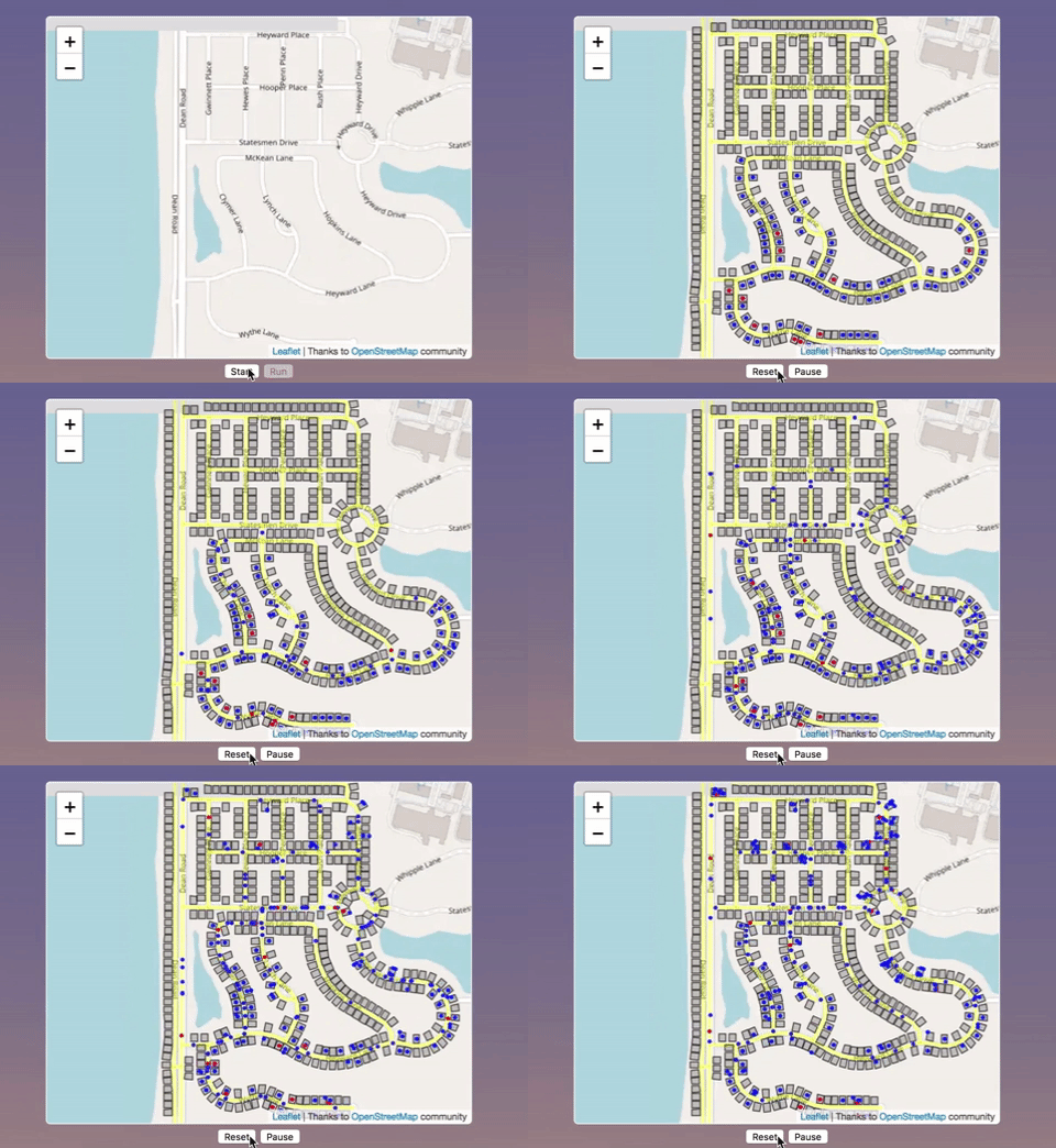
AgentMaps is a JS library for building and visualizing simulations on maps. It is based on the Leaflet interactive mapping library. Provided a neighborhood, AgentMaps lets you quickly and easily:

  • Build houses along the streets.
  • Put agents on the map.
  • Schedule them to move between places.
  • Change their appearance and internal properties.

AgentMaps lets you turn this:
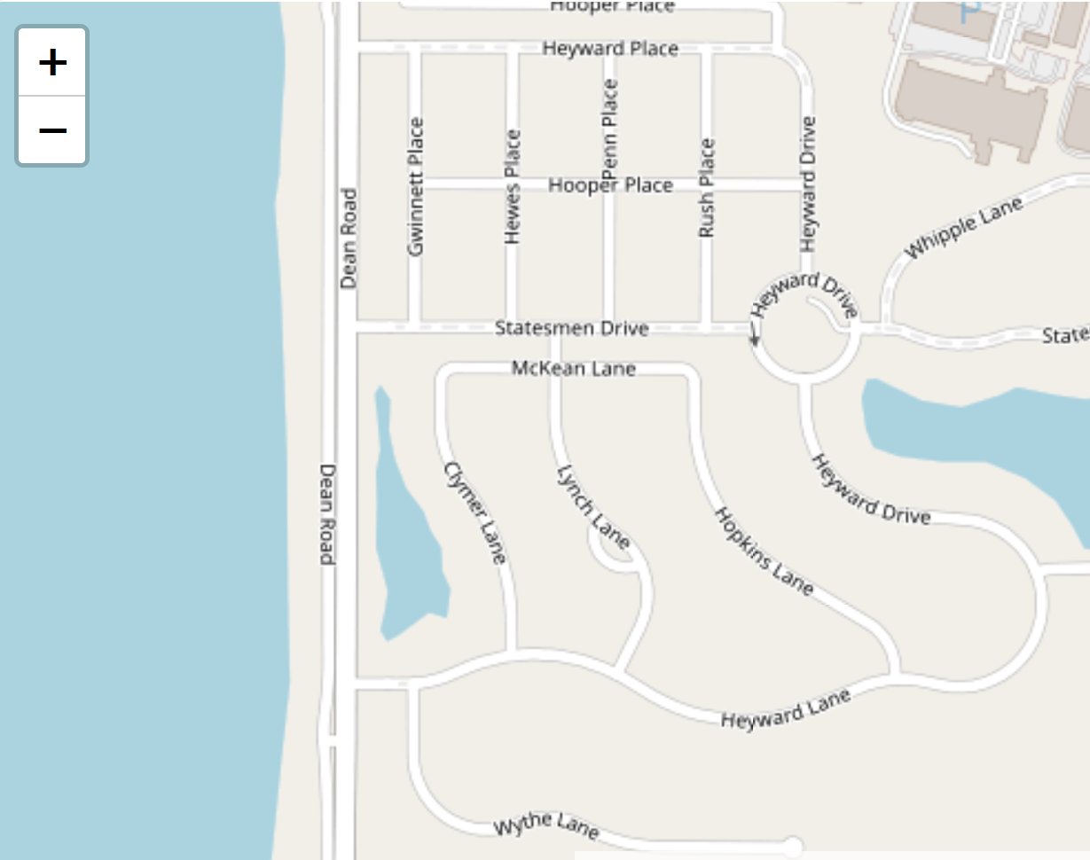
into something like this:
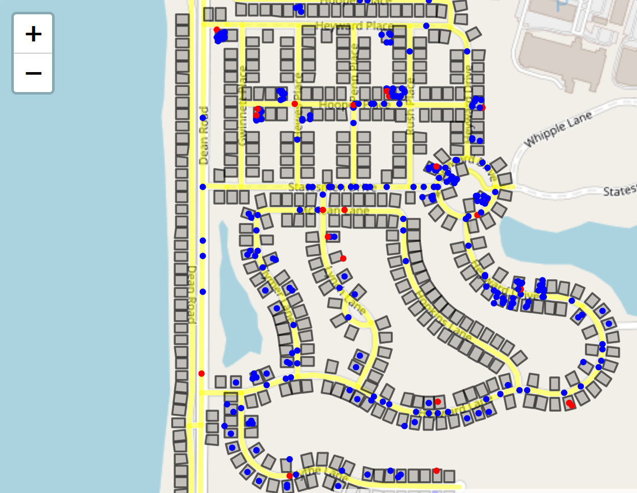
You can install it via npm (npm install agentmaps) and bundle it yourself, or you can get a premade bundle here to include directly in a webpage. You'll need to include Leaflet separately.

Documentation

Docs for people who want to use AgentMaps are available here.

Docs for people who want to understand its internals are here.

A basic walkthrough for creating an AgentMaps simulation can be found here.

Demos

Simple: Shows all the different ways agents can travel around a map.

Contagion: Agents commute between different parts of a neighborhood while an infection spreads between them.

You can find the corresponding code under /demos in the gh-pages branch here.

Plugins

IconAgents: Lets you depict agents with custom icons instead of circles.


Thank you to anyone who somehow benefits from this.

AgentMaps: Geospatial Agent-based Modeling and Simulation for JavaScript.

Note that the project description data, including the texts, logos, images, and/or trademarks, for each open source project belongs to its rightful owner. If you wish to add or remove any projects, please contact us at [email protected].