r-spatial / Sf
Programming Languages
Projects that are alternatives of or similar to Sf
![]()
![]()

![]()
Simple Features for R

A package that provides simple features access for R. Package sf:
- represents simple features as records in a
data.frameortibblewith a geometry list-column - represents natively in R all 17 simple feature types for all dimensions (XY, XYZ, XYM, XYZM)
- interfaces to GEOS to support geometrical operations including the DE9-IM
- interfaces to GDAL, supporting all driver options,
DateandPOSIXctand list-columns - interfaces to PRØJ for coordinate reference system conversions and transformations
- uses well-known-binary serialisations written in C++/Rcpp for fast I/O with GDAL and GEOS
- reads from and writes to spatial databases such as PostGIS using DBI
- is extended by pkg lwgeom for further liblwgeom/PostGIS functions, including some spherical geometry functions
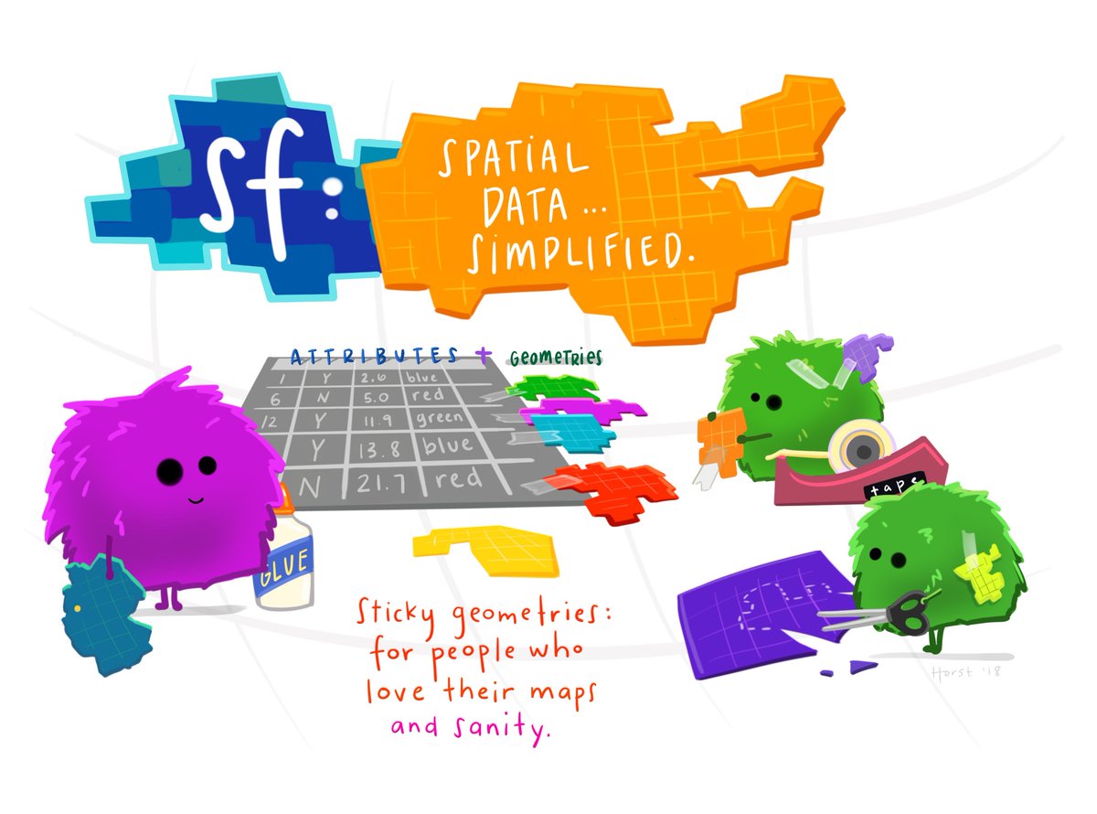
(Illustration (c) by Allison Horst)
Blogs, presentations, vignettes, sp-sf wiki
- an open access R Journal article summarizes the package
- package vignettes: first, second, third, forth, fifth, sixth
- blog posts: first, second, third, fourth
- the original R Consortium ISC proposal, the R Consortium blog post
- presentations: rstudio::conf 2018 (video), UseR! 2016
- wiki page describing sp-sf migration
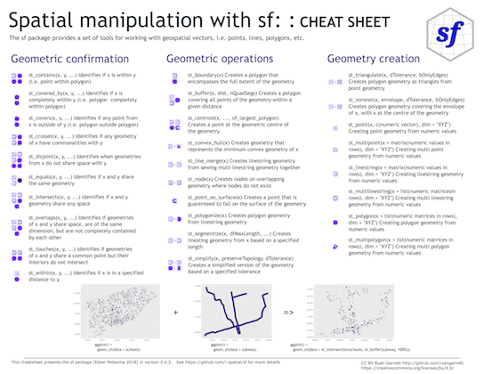
Cheatsheet
Installing
Install either from CRAN with:
install.packages("sf")
this will install binary packages on Windows and MacOS, unless you configured R such that it tries to install source packages; in that case, see below.
Install development versions from github with
library(devtools)
install_github("r-spatial/sf")
Windows
Installing sf from source works under windows when Rtools is installed. This downloads the system requirements from rwinlib.
MacOS
The easiest way to install gdal is using Homebrew. Recent versions of homebrew include a full-featured up-to-date gdal formula, which installs proj and gdal at the same time:
brew install pkg-config
brew install gdal
Once gdal is installed, you will be able to install sf package from source in R. With the current version of proj (7.0.0) on homebrew, installation requires additional configuration:
install.packages("sf", configure.args = "--with-proj-lib=/usr/local/lib/")
Or the development version:
library(devtools)
install_github("r-spatial/sf", configure.args = "--with-proj-lib=/usr/local/lib/")
If you are using sf and rgdal together it is necessary to install rgdal from source using this configuration:
install.packages("rgdal", configure.args = c("--with-proj-lib=/usr/local/lib/", "--with-proj-include=/usr/local/include/"))
Alternatively these instructions explain how to install gdal using kyngchaos frameworks.
For Mac OS 11 Big Sur source install instruction see here
Linux
For Unix-alikes, GDAL (>= 2.0.1), GEOS (>= 3.4.0) and Proj.4 (>= 4.8.0) are required.
Ubuntu
Dependencies for recent versions of Ubuntu (18.04 and later) are available in the official repositories; you can install them with:
apt-get -y update && apt-get install -y libudunits2-dev libgdal-dev libgeos-dev libproj-dev
However, to get more up-to-date versions of dependencies such as GDAL, we recommend adding the ubuntugis-unstable PPA to the package repositories and installing them as follows:
sudo add-apt-repository ppa:ubuntugis/ubuntugis-unstable
sudo apt-get update
sudo apt-get install libudunits2-dev libgdal-dev libgeos-dev libproj-dev
Adding this PPA is required for installing sf on older versions of Ubuntu (e.g. Xenial).
Another option, for advanced users, is to install dependencies from source; see e.g. an older travis config file for hints.
Fedora
The following command installs all required dependencies:
sudo dnf install gdal-devel proj-devel proj-epsg proj-nad geos-devel sqlite-devel udunits2-devel
Arch
Get gdal, proj and geos from the main repos and udunits from the AUR:
pacman -S gdal proj geos
yay/pacaur/yaourt/whatever -S udunits
Other
To install on Debian, the rocker geospatial Dockerfiles may be helpful. Ubuntu Dockerfiles are found here.
Multiple GDAL, GEOS and/or PROJ versions on your system
In case you use dynamic linking (installation from source) and have multiple versions of these libraries installed (e.g. one from ubuntugis-unstable, another installed from source in /usr/local/lib) then this will in general not work, even when setting LD_LIBRARY_PATH manually. See here for the reason why.
lwgeom
Functions and methods that require liblwgeom, including st_make_valid and all spherical or ellipsoidal metrics (area, distances), have since sf 0.5-5 been moved to their own package, lwgeom, which is also on CRAN.
Contributing
- Contributions of all sorts are most welcome, issues and pull requests are the preferred ways of sharing them.
- When contributing pull requests, please adhere to the package style (in package code use
=rather than<-; don't change indentation; tab stops of 4 spaces are preferred) - This project is released with a Contributor Code of Conduct. By participating in this project you agree to abide by its terms.
Acknowledgment
This project gratefully acknowledges financial support from the
