All Projects → z3tt → 30DayMapChallenge

z3tt / 30DayMapChallenge

Licence: other
My contributions to the #30DayMapChallenge 2019, a daily challenge focusing on spatial visualizations happening throughout November.

Programming Languages

HTML
75241 projects
QML
638 projects

Projects that are alternatives of or similar to 30DayMapChallenge

Maps Api For Javascript Examples
Self-contained examples for Maps API for JavaScript v3.
Stars: ✭ 130 (-23.53%)
Mutual labels:  maps, mapping
Google Maps
Google Maps Web Services API wrapper for .NET
Stars: ✭ 171 (+0.59%)
Mutual labels:  maps, mapping
Geojsonify
Easily add GeoJson layers to your Maps
Stars: ✭ 141 (-17.06%)
Mutual labels:  maps, mapping
Leaflet Tilefilter
Change the appearance of Leaflet map tiles on the fly using a variety of canvas or CSS3 image filters. It's like Instagram for Leaflet map tiles.
Stars: ✭ 90 (-47.06%)
Mutual labels:  maps, mapping
flagfillr
Use flags as fills for ggplot2 maps. (WIP)
Stars: ✭ 23 (-86.47%)
Mutual labels:  ggplot2, maps
Here Android Sdk Examples
Java-based projects using the HERE SDK for Android.
Stars: ✭ 127 (-25.29%)
Mutual labels:  maps, mapping
Azuremapscodesamples
A set of code samples for the Azure Maps web control.
Stars: ✭ 167 (-1.76%)
Mutual labels:  maps, mapping
Magrit
♠ Thematic cartography ♠
Stars: ✭ 60 (-64.71%)
Mutual labels:  maps, mapping
mapr
Map species occurrence data
Stars: ✭ 34 (-80%)
Mutual labels:  ggplot2, mapping
Gmapsfx
Java API for using Google Maps within a JavaFX application.
Stars: ✭ 233 (+37.06%)
Mutual labels:  maps, mapping
Obaddon
A repository of community-built prefabs and other enhancements for Oblige 7.70
Stars: ✭ 81 (-52.35%)
Mutual labels:  maps, mapping
osm-extracts
Each day, OSM Extracts by Interline mirrors the entire OpenStreetMap planet and creates city and region sized extracts
Stars: ✭ 34 (-80%)
Mutual labels:  maps, mapping
Examples
Self-contained examples for the legacy Maps API for JavaScript.
Stars: ✭ 78 (-54.12%)
Mutual labels:  maps, mapping
deck.gl-time-series-widget
A React Time Slider implementation for DECK.GL - (non)temporal data - by CPU filtering ⌛
Stars: ✭ 19 (-88.82%)
Mutual labels:  maps, mapping
Editor
An open source visual editor for the 'Mapbox Style Specification'
Stars: ✭ 1,167 (+586.47%)
Mutual labels:  maps, mapping
Openrailwaymap
An OpenStreetMap-based project for creating a map of the world's railway infrastructure.
Stars: ✭ 150 (-11.76%)
Mutual labels:  maps, mapping
Geotiff.io
Static website for viewing and analyzing GeoTIFF's in the browser
Stars: ✭ 53 (-68.82%)
Mutual labels:  maps, raster
Gwt Ol
GWT wrapper for OpenLayers 3+ using JSInterop
Stars: ✭ 57 (-66.47%)
Mutual labels:  maps, mapping
Geoserver
Official GeoServer repository
Stars: ✭ 2,573 (+1413.53%)
Mutual labels:  maps, mapping
svelte-mapbox
MapBox Map and Autocomplete components for Svelte (or Vanilla JS)
Stars: ✭ 267 (+57.06%)
Mutual labels:  maps, mapping

 #30DayMapChallenge 2019 

    Blog    Email    Twitter    Instagram    Behance    LinkedIn    BuyMeACoffee   

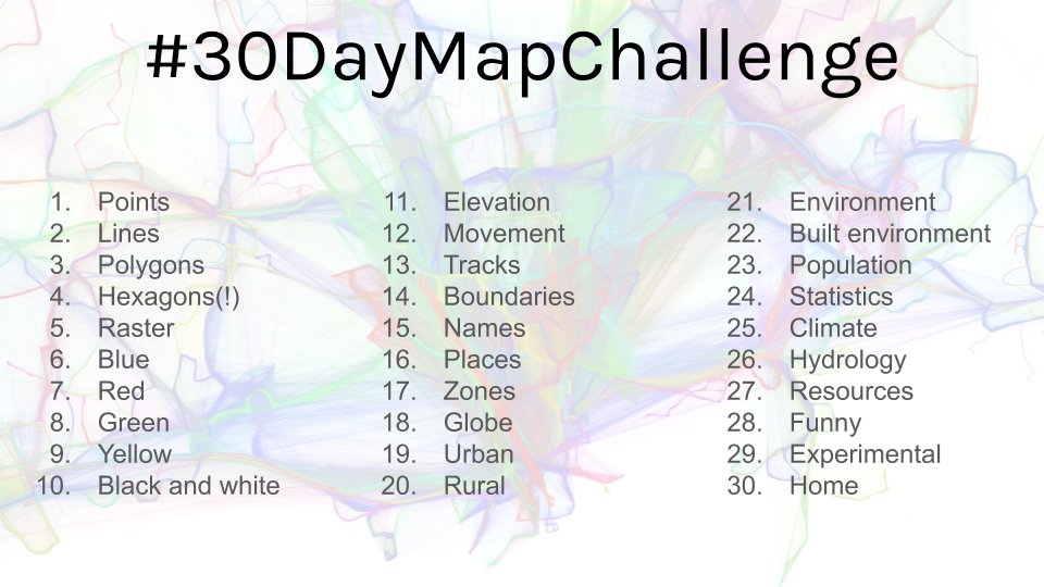
My contributions to the first #30DayMapChallenge initiated by Topi Tjukanov.

./data/30daymapchallenge.jpg

List of All Contributions (click to expand)

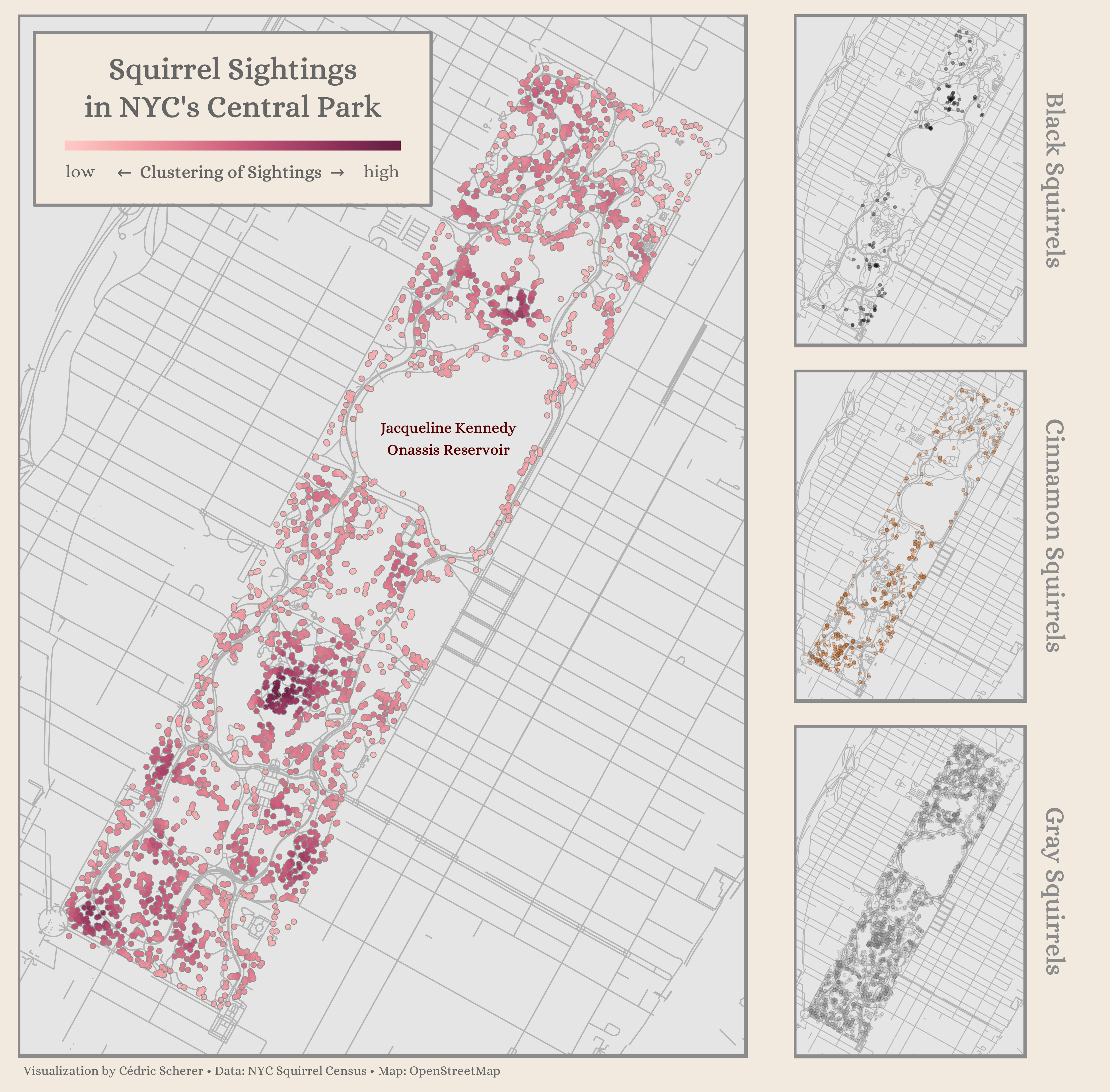
Day 1: Points

./Day01_Points/Points_Squirrels.png

Day 2: Lines

./Day02_Lines/Lines_OSMnx_Kiez.png

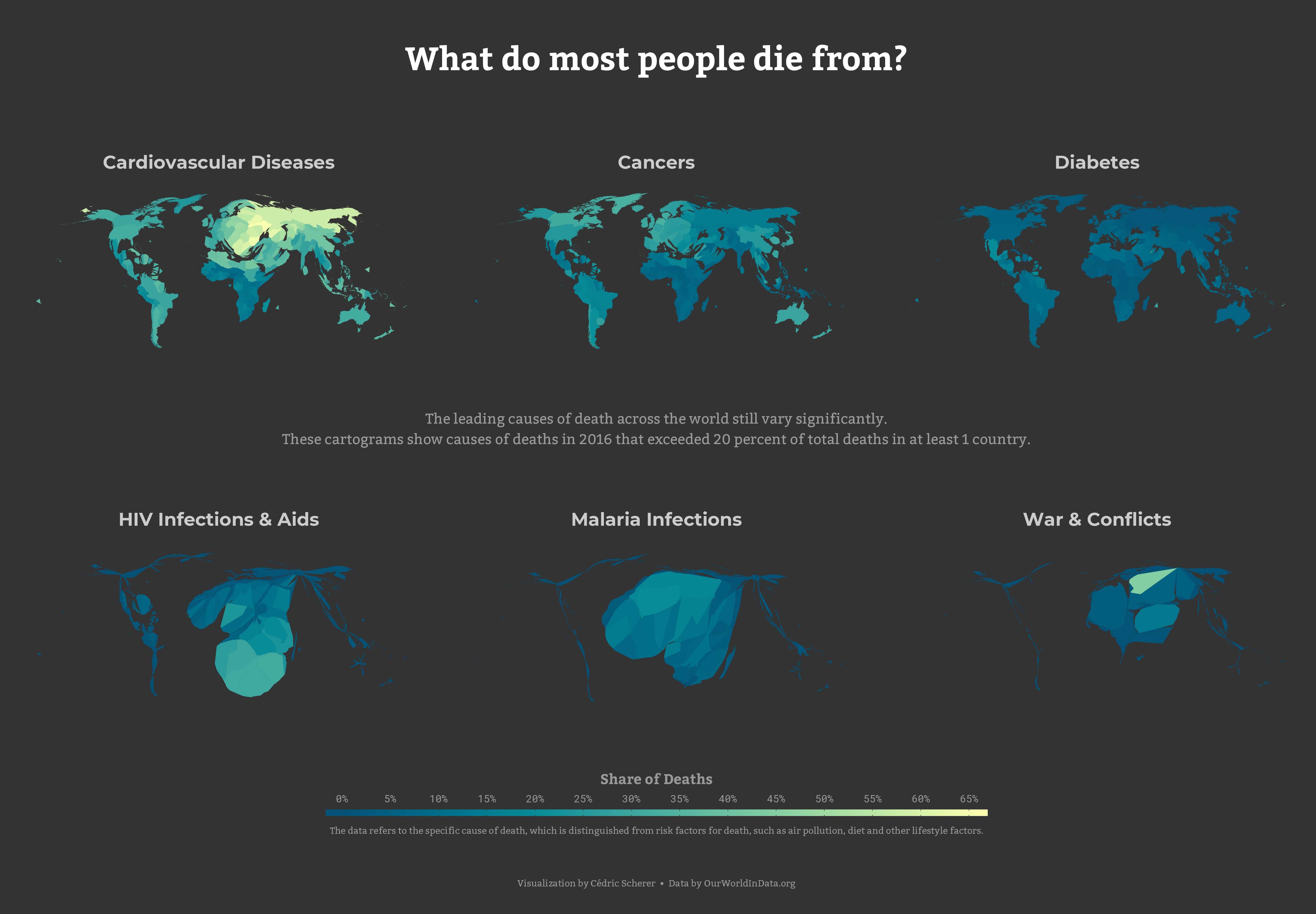
Day 3: Polygons

./Day03_Polygons/Polygons_GlobalMortality.png
... and a version showing deaths due to alcohol and drug disorder

Day 4: Hexagons
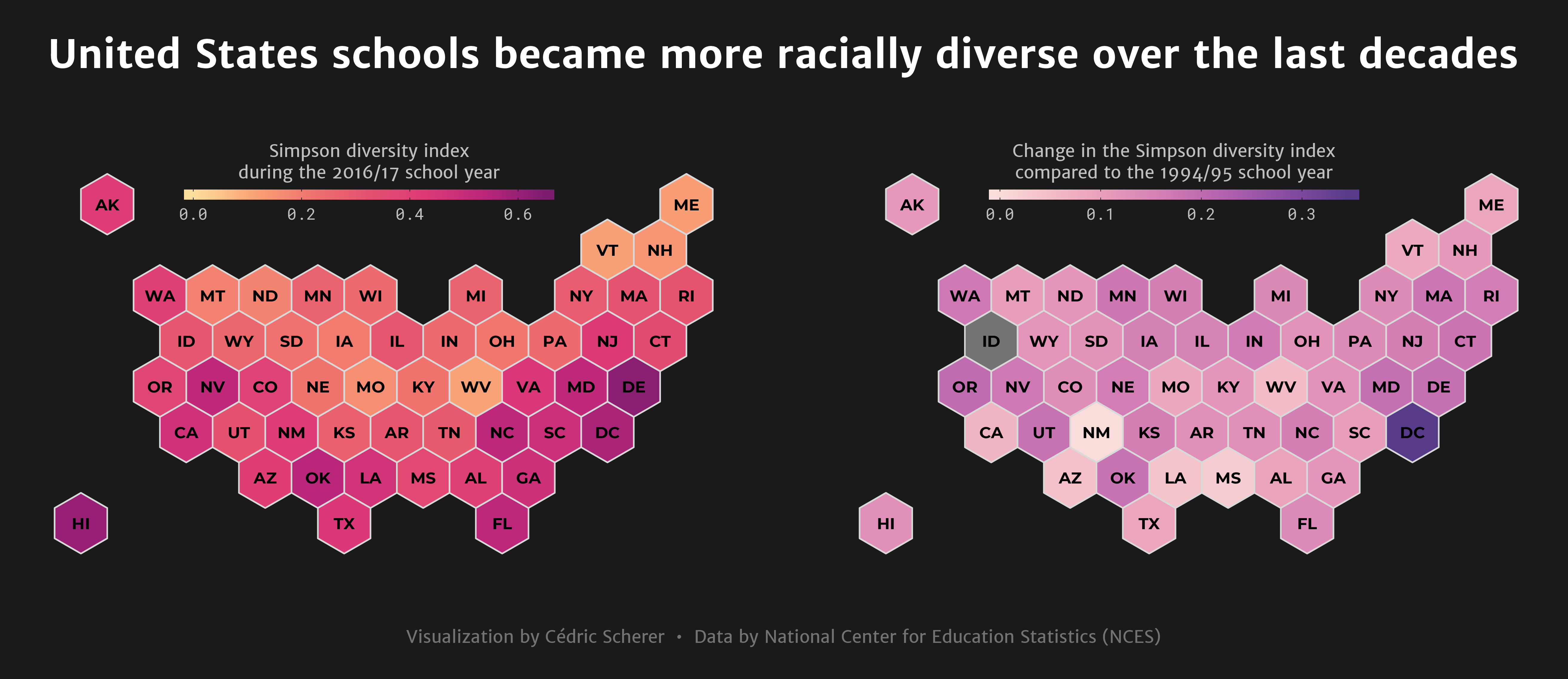
./Day04_Hexagons/Hexagons_SchoolDiversity_hex.png
... and a version showing diversity indices for the school year 1994/95 with the same color scale for comparison

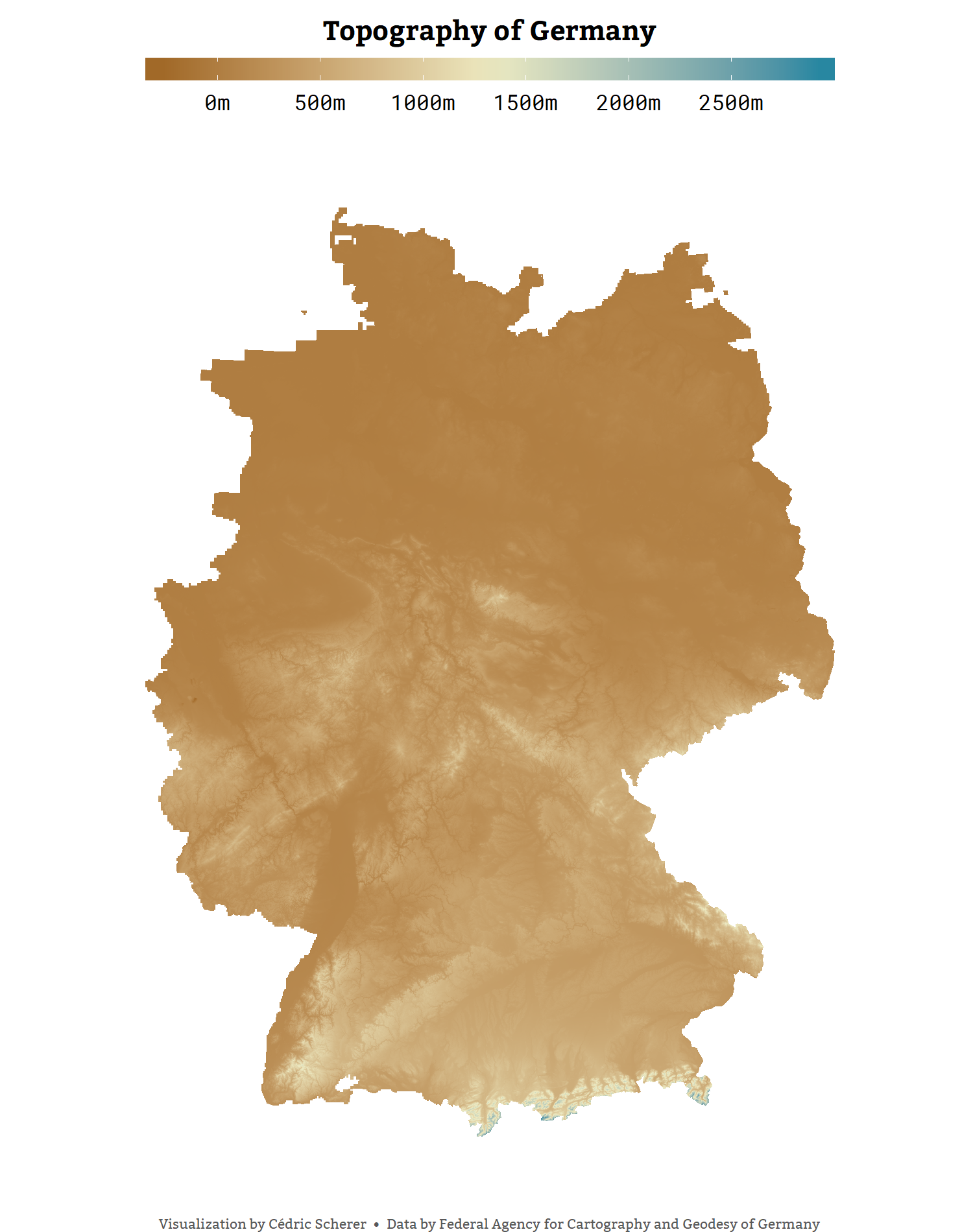
Day 5: Raster

./Day05_Raster/Raster_GermanyDGM.png

Days 6 to 9: Blue, Green, Red & Yellow

./Day09_Yellow/BlueRedGreenYellow_BerlinPublicTransport.png
Day 6: Blue | Day 7: Red | Day 8: Green | Day 9: Yellow

Day 10: Black & White
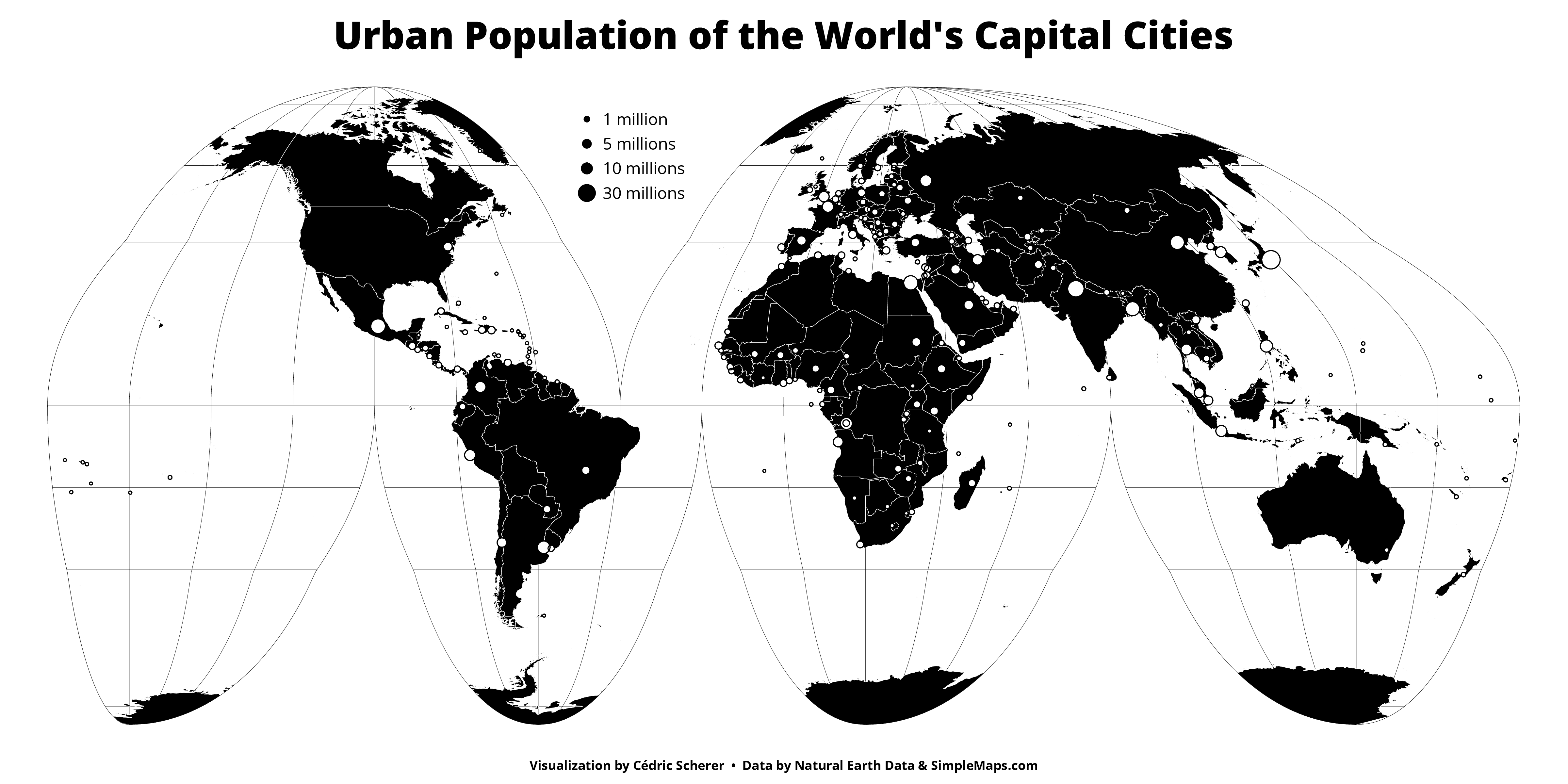
./Day10_BlackWhite/BlackWhite_CapitalPop_bw.png
... and a version with some grey

Day 11: Elevation
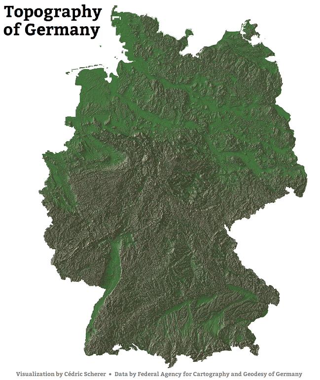
./Day11_Elevation/Elevation_Rayshader_custom.png
Here is the high resolution version and another version using a different custom texture palette

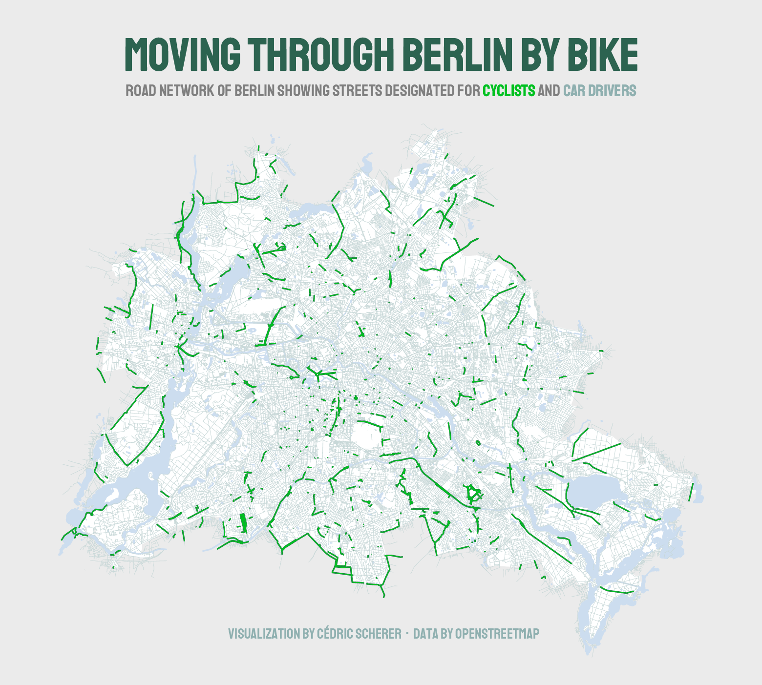
Day 12: Movement

./Day12_Movement/Movement_BerlinByBike.png

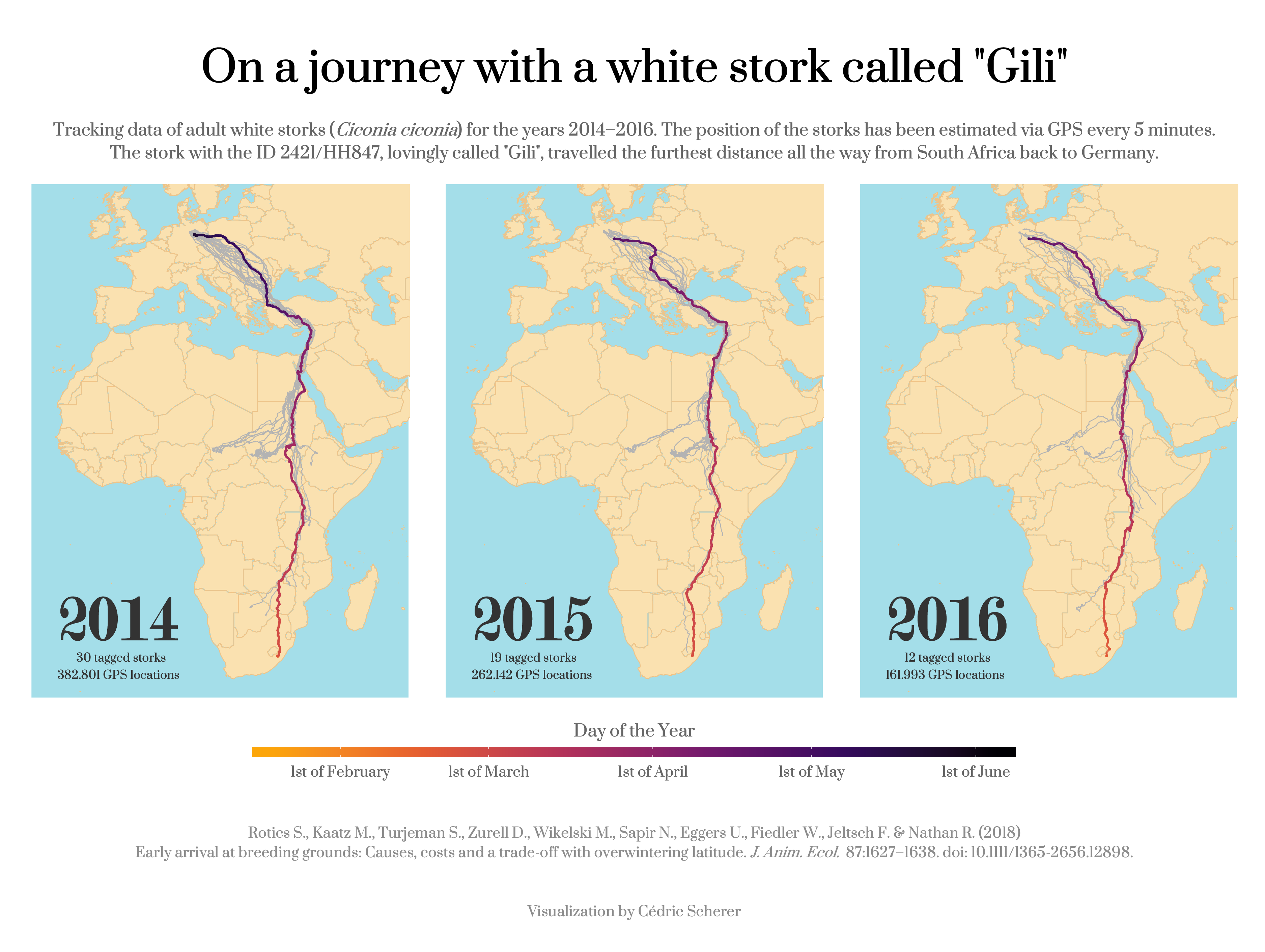
Day 13: Tracks

./Day13_Tracks/Tracks_StorksGili.png
Read the paper!

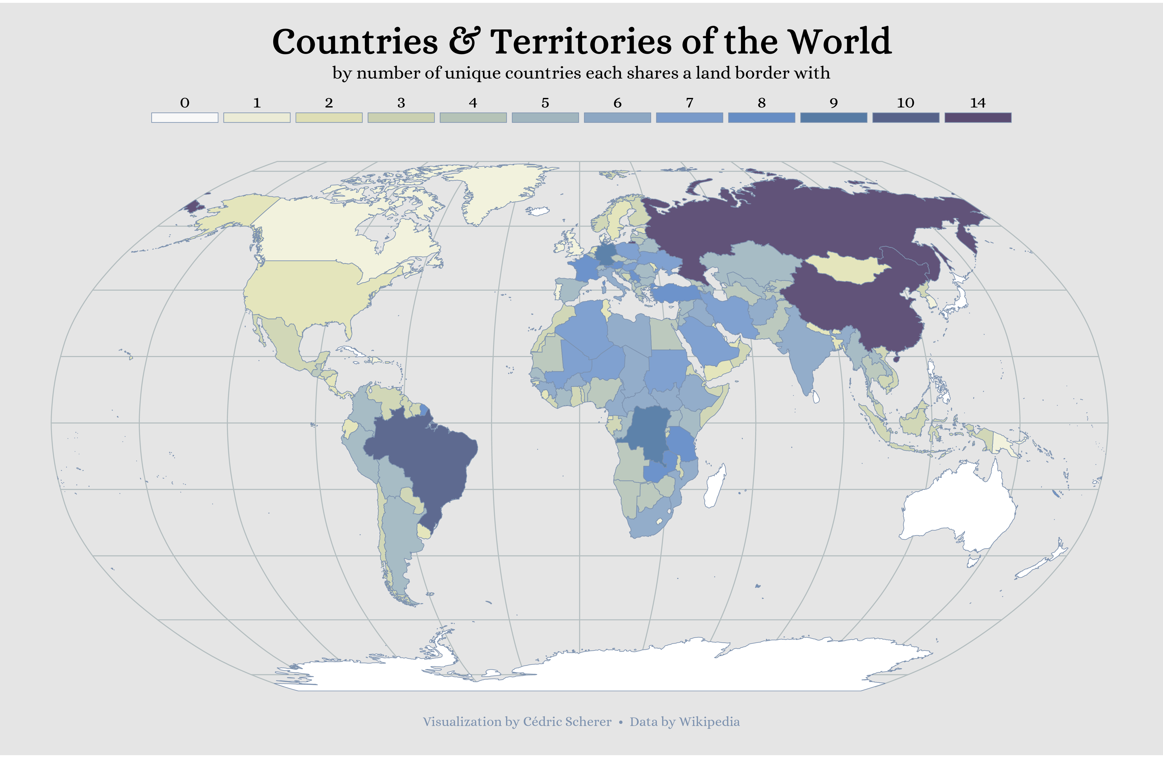
Day 14: Boundaries

./Day14_Boundaries/Boundaries_GlobalNeighbors.png

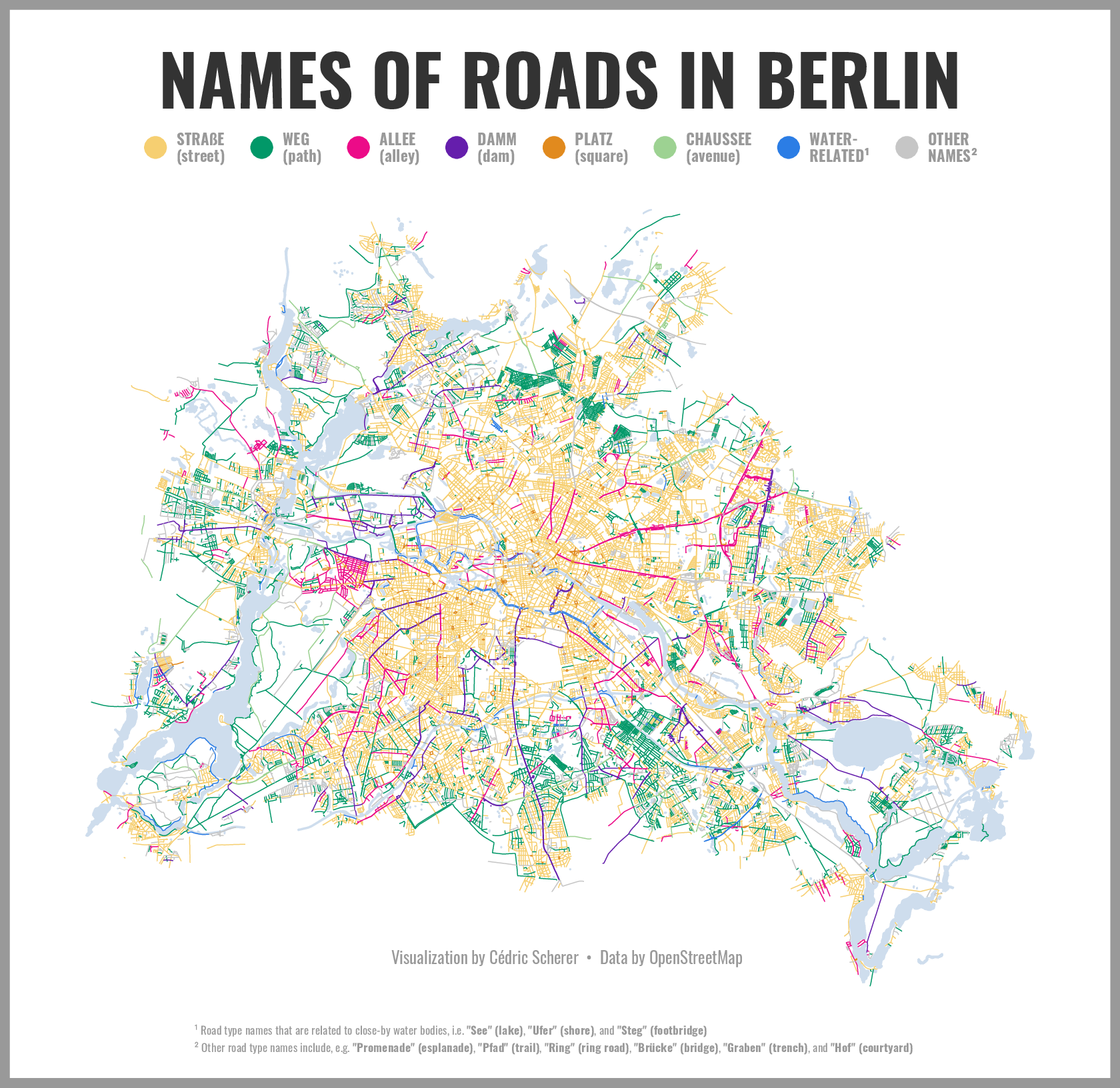
Day 15: Names

./Day15_Names/Names_BerlinRoads.png Here is the high resolution version

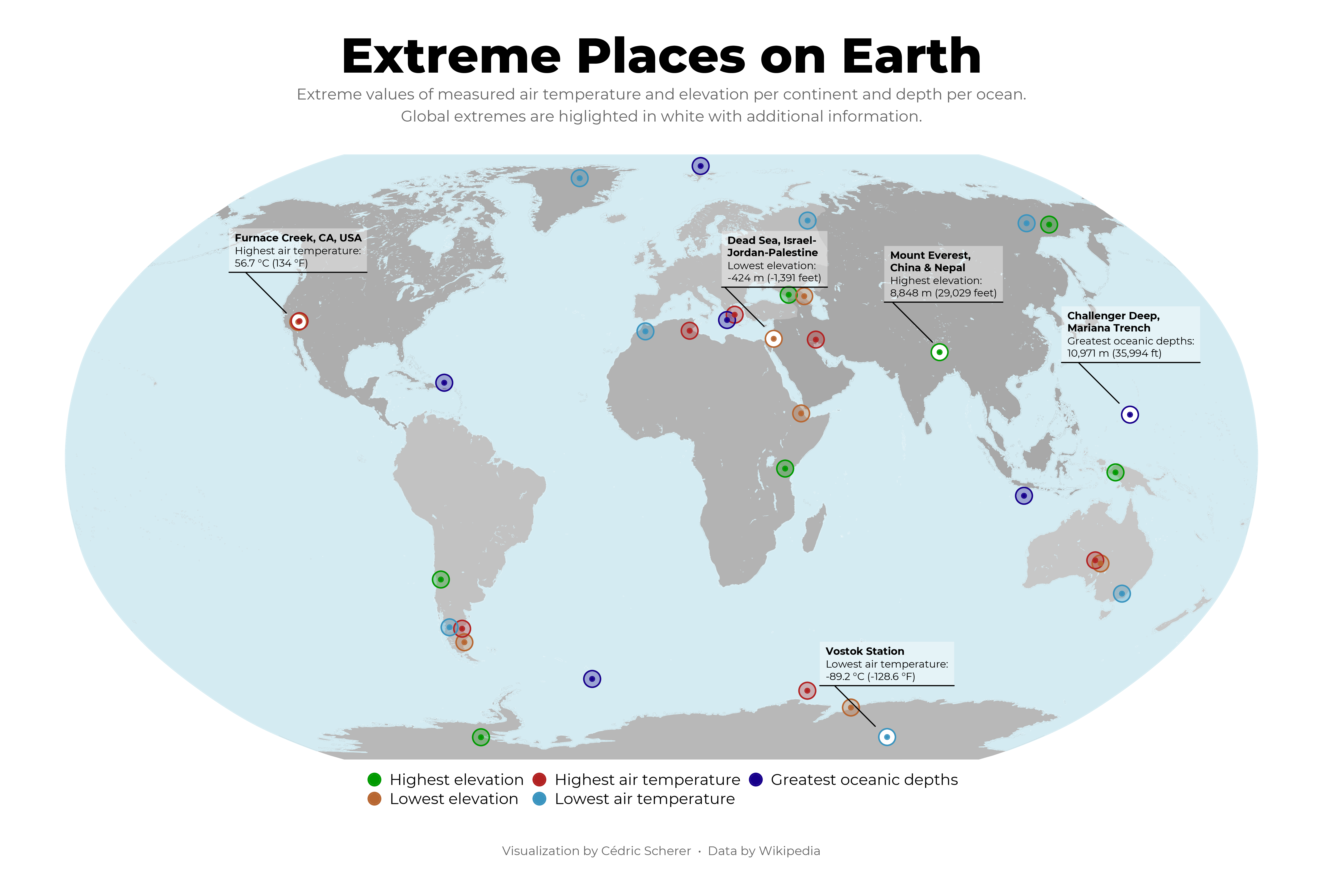
Day 16: Places

./Day16_Places/Places_ExtremesEarth.png

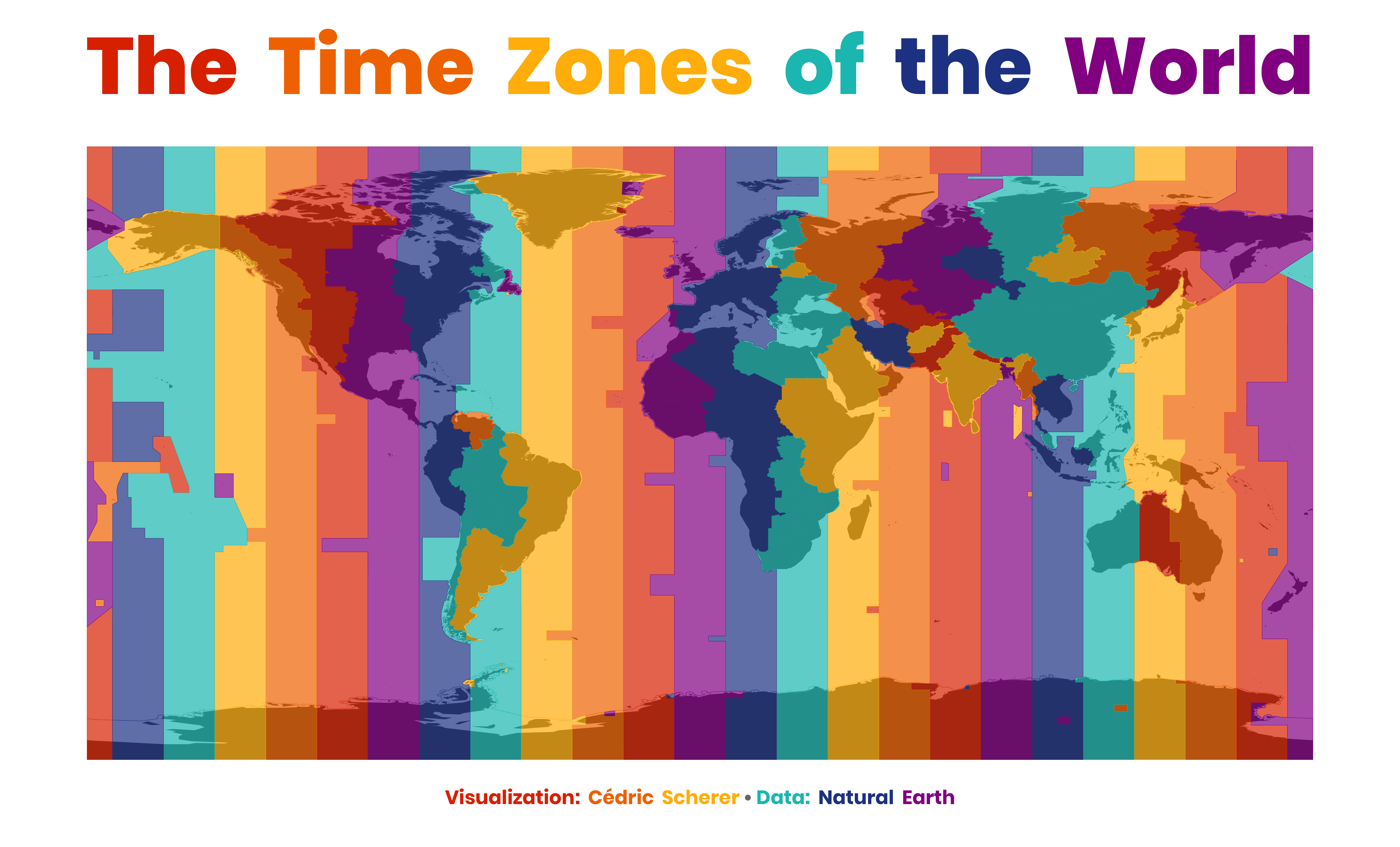
Day 17: Zones

./Day17_Zones/Zones_TimezonesEarth.png ... and another version with filled countries only

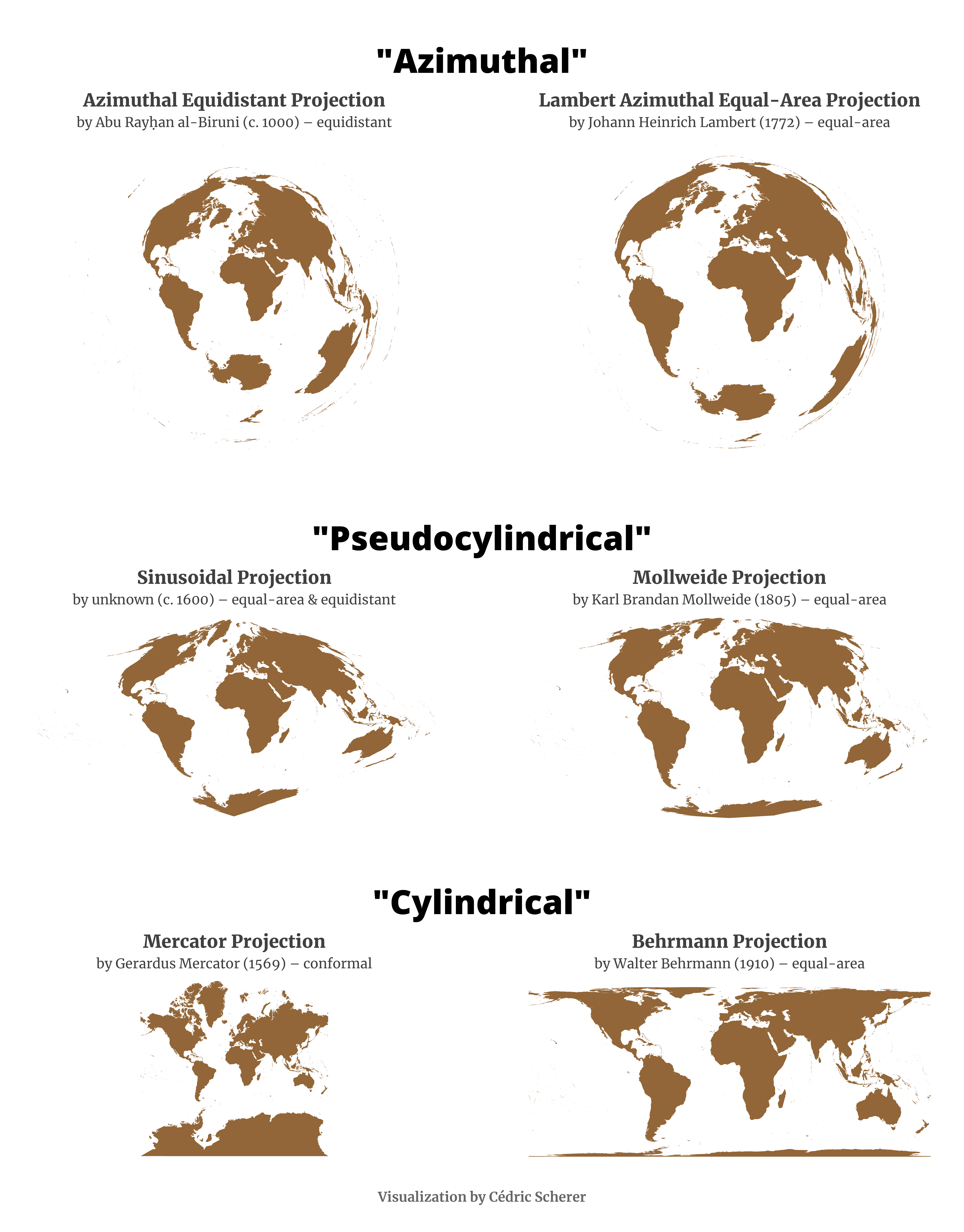
Day 18: Globe

./Day18_Globe/Globe_Projections.png

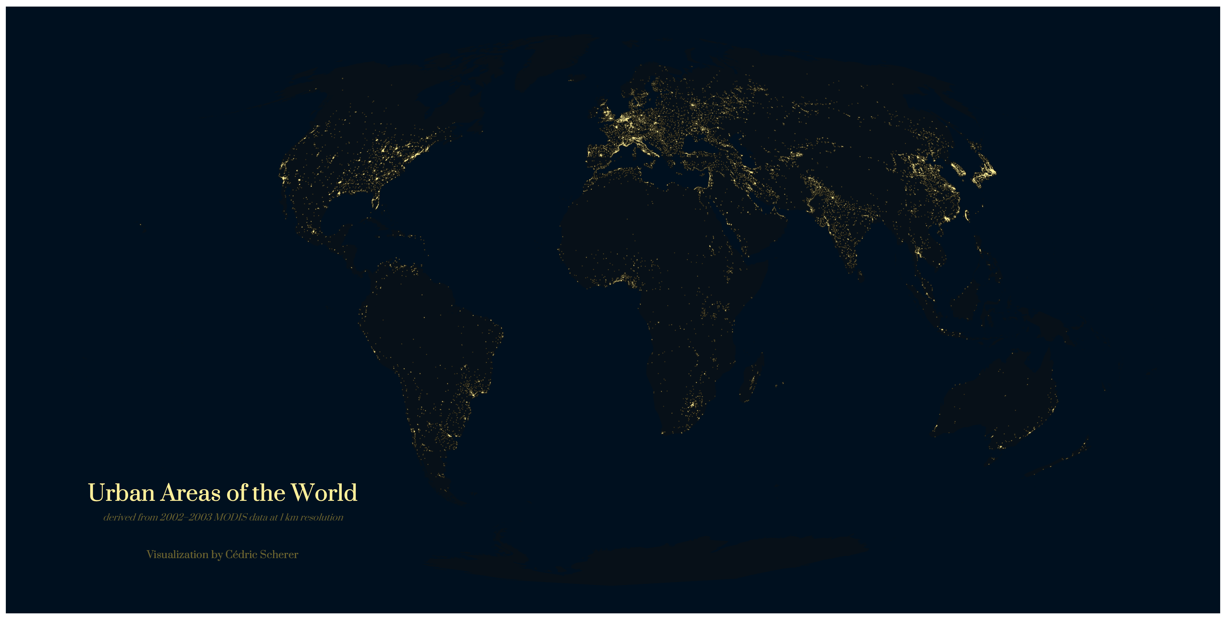
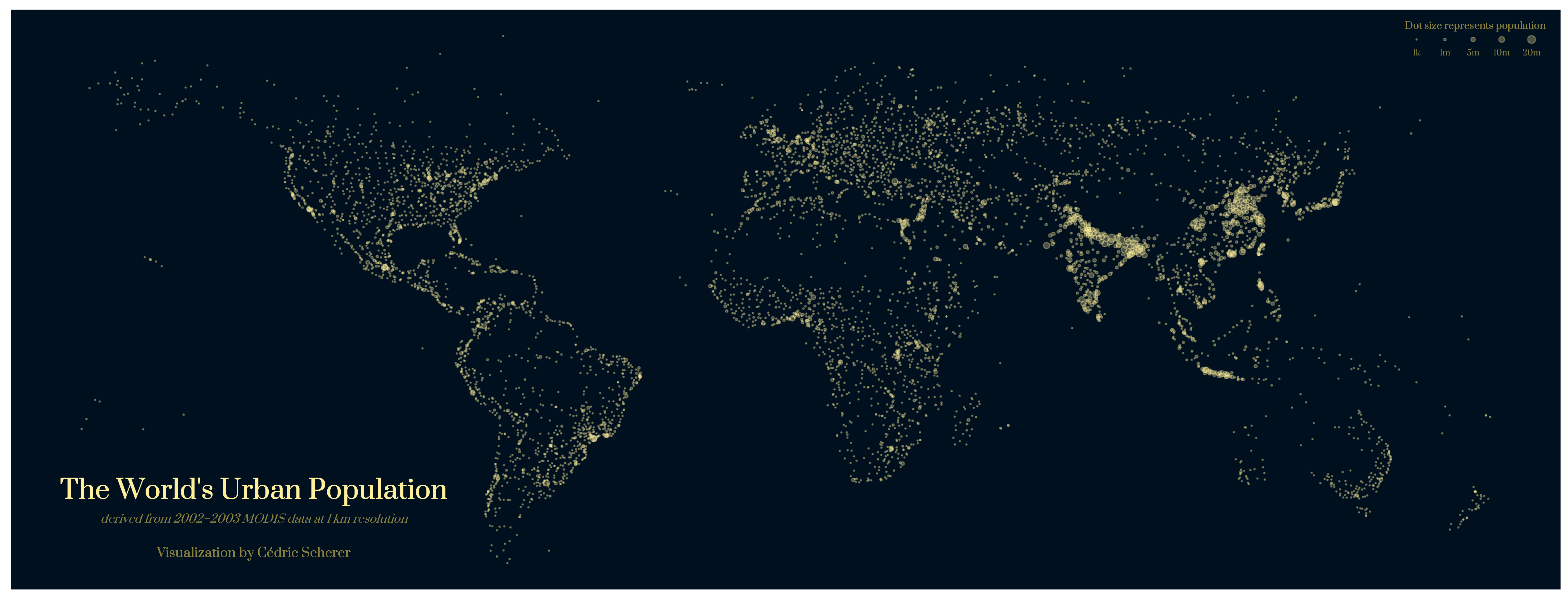
Day 19: Urban

./Day19_Urban/Urban_GlobalUrbanAreas_bg.png
./Day19_Urban/Urban_GlobalUrbanLands.png
... and another version of the "light map" without land masses

Day 20: Rural
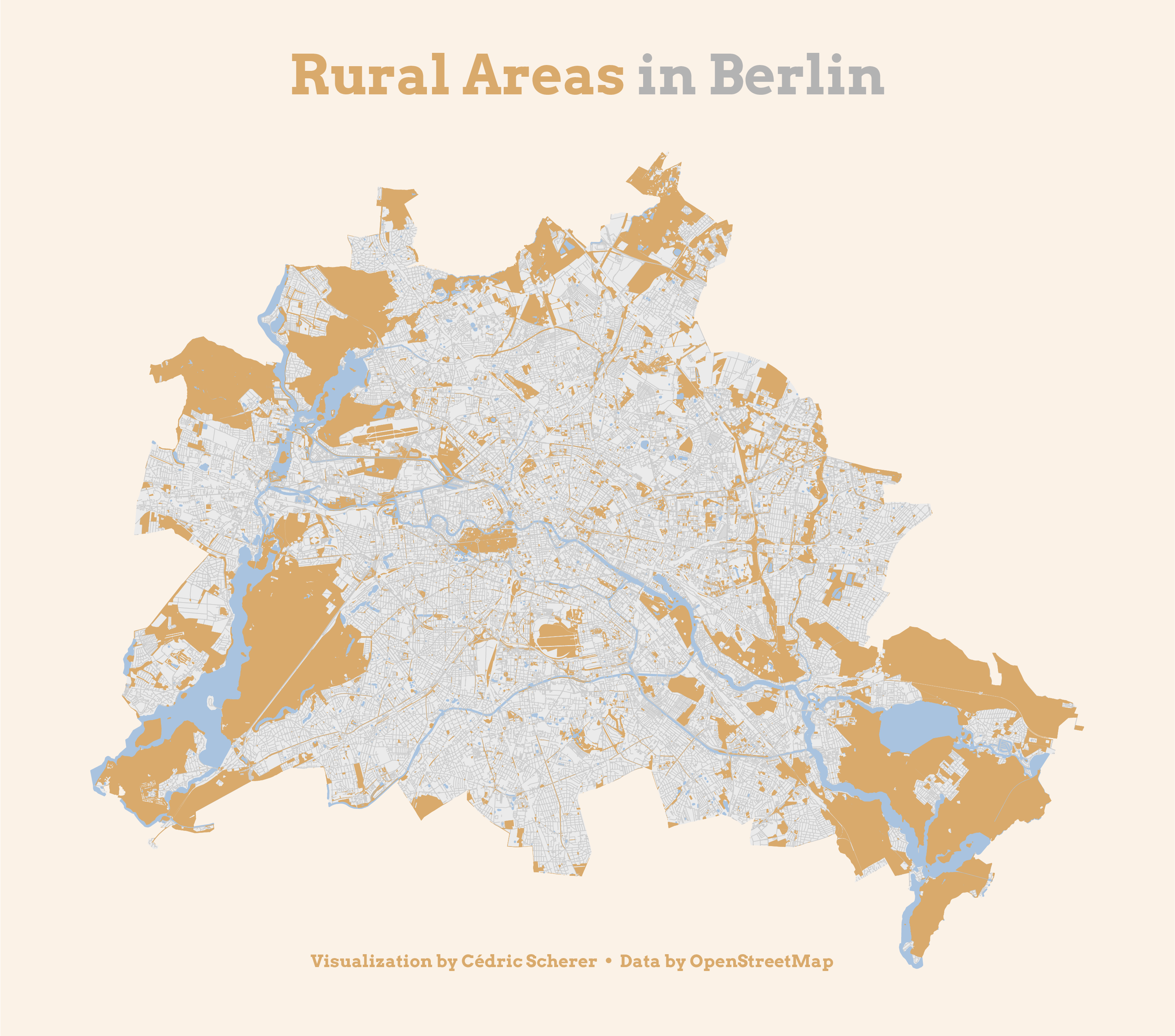
./Day20_Rural/Rural_BerlinRuralAreas.png ... and a green version without roads

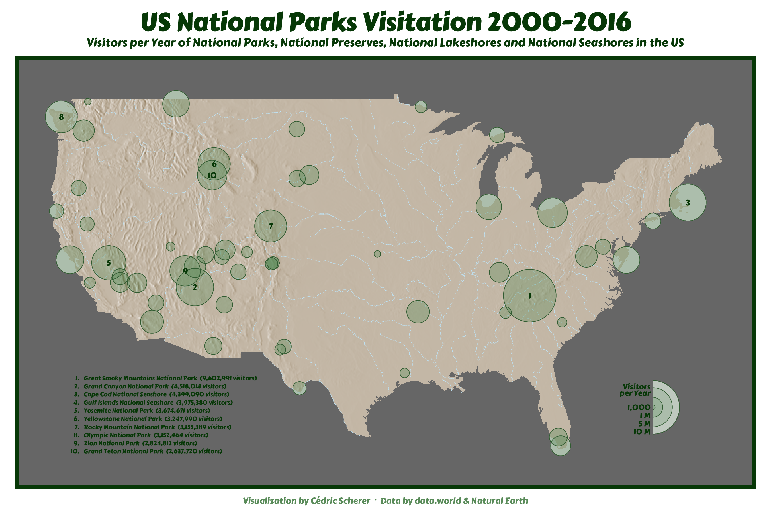
Day 21: Environment

./Day21_Environment/Environment_NationalParksUS.png

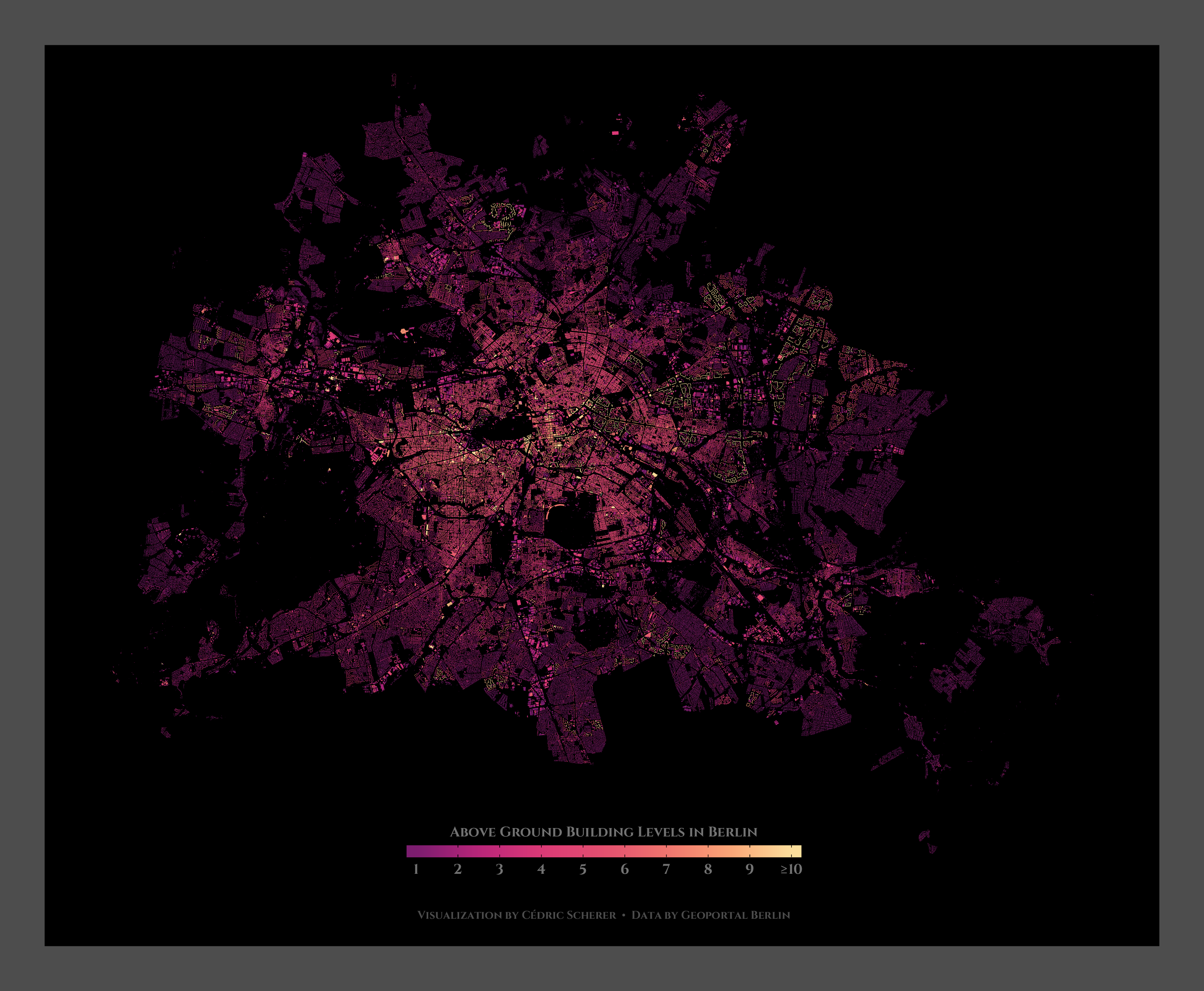
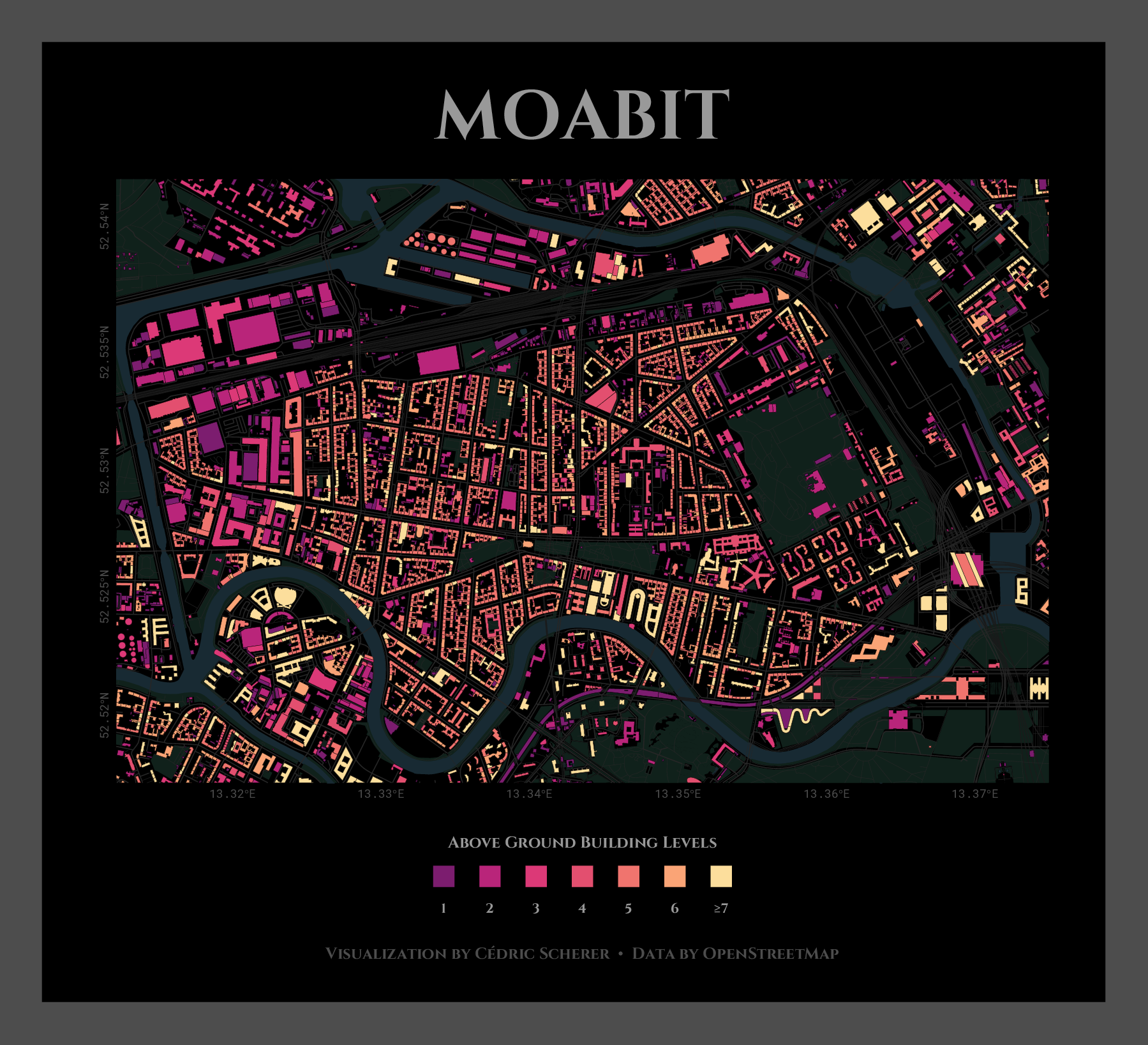
Day 22: Built Environment

./Day22_BuiltEnvironment/BuiltEnv_BerlinBuildings.png ./Day22_BuiltEnvironment/BuiltEnv_BuildingsMoabit.png ... and here is a blank version of Moabit showing the buildings only

Day 23: Population
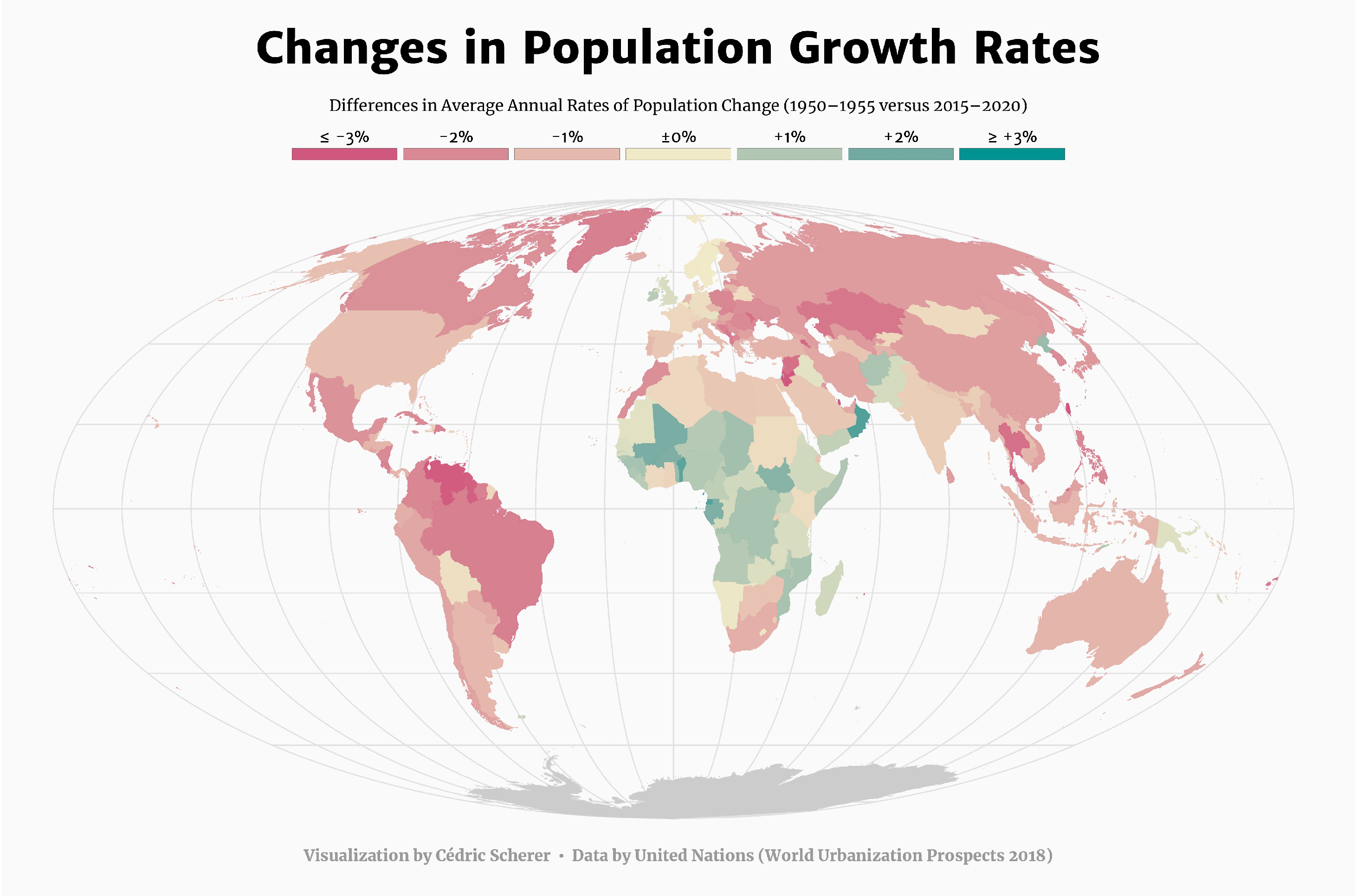
./Day23_Population/Population_ChangeGlobal_diff.png ... and a version showing the projections for the coming 5 years and for 20-year periods from 1950 to 2050

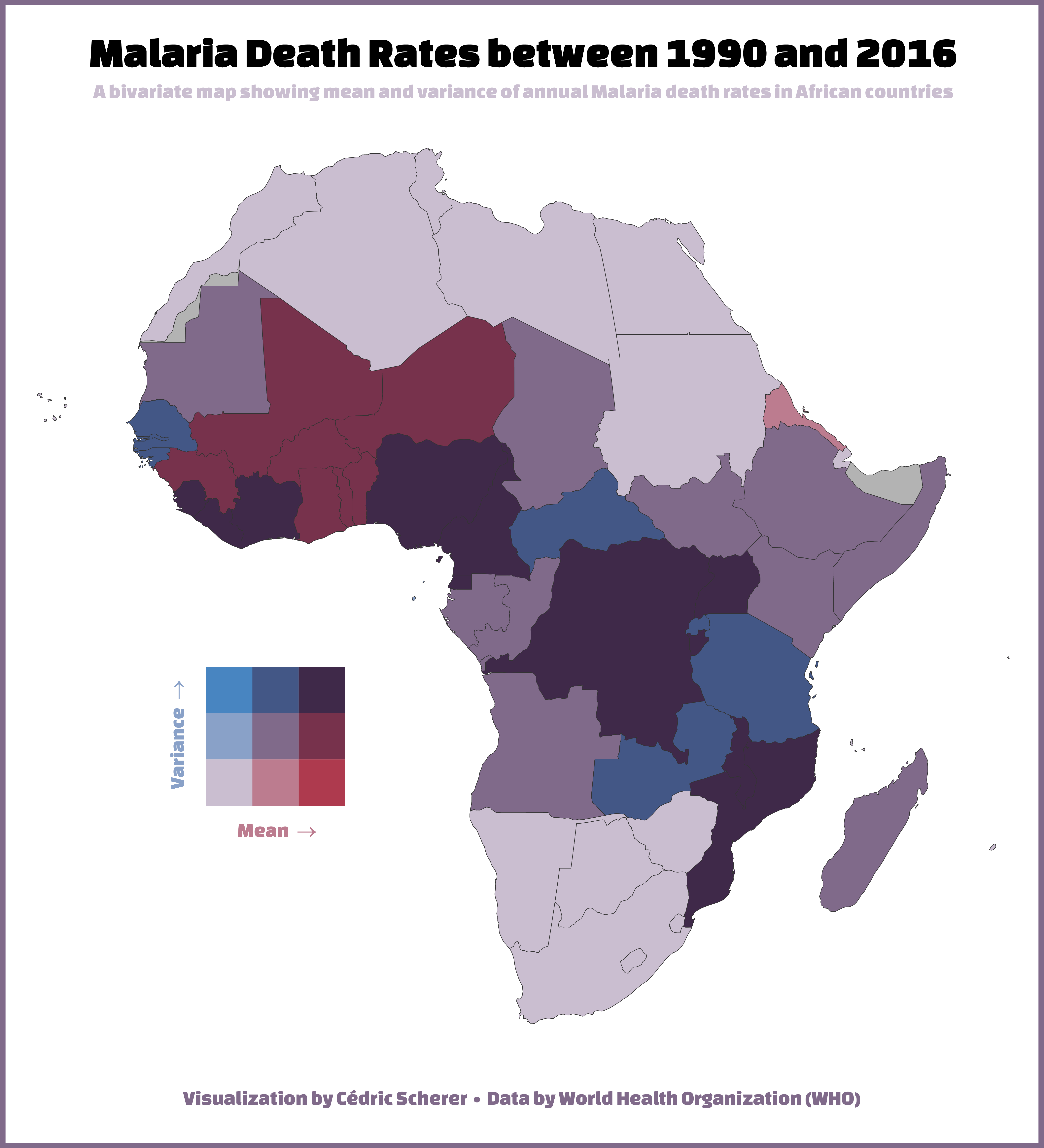
Day 24: Statistics

./Day24_Statistics/Statistics_MalariaDeaths.png

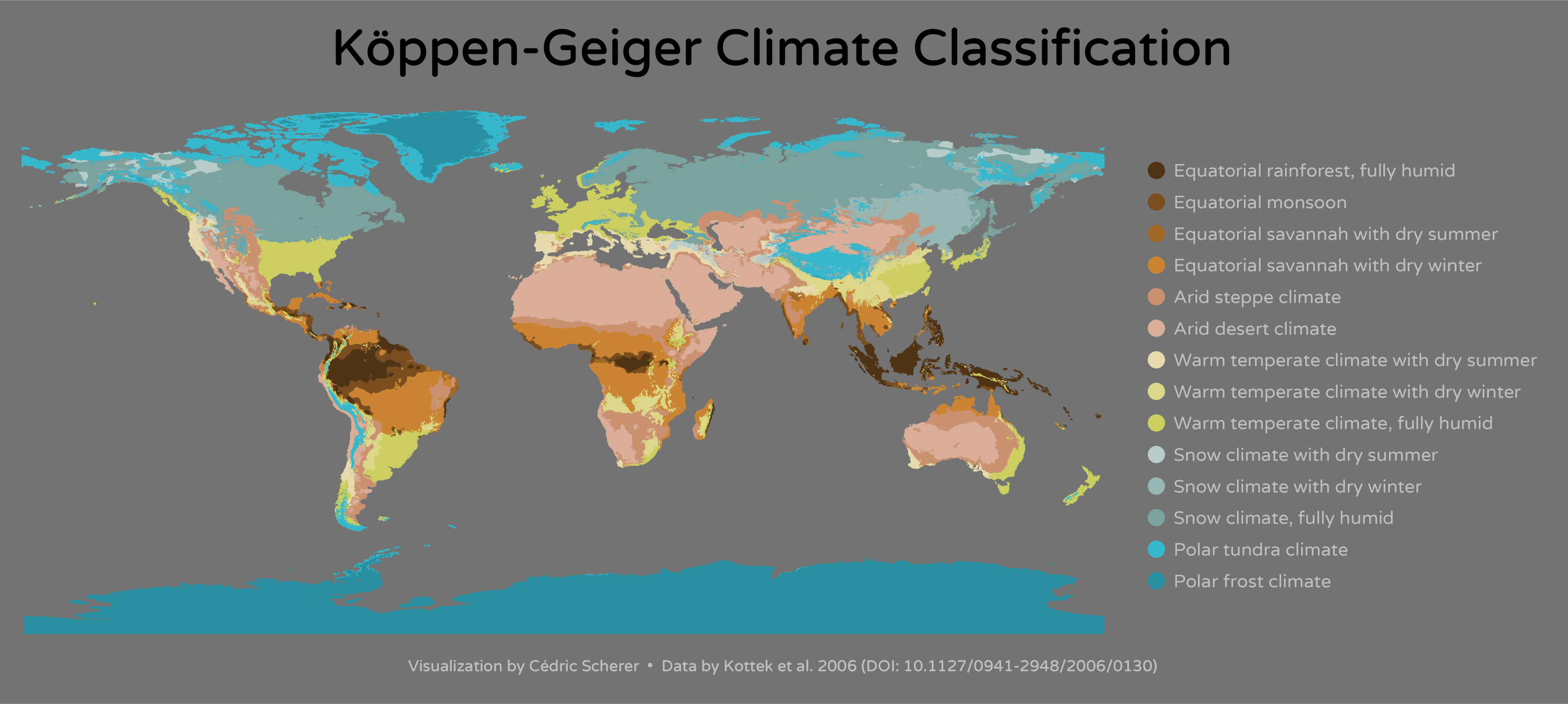
Day 25: Climate

./Day25_Climate/Climate_KoppenGeiger.png

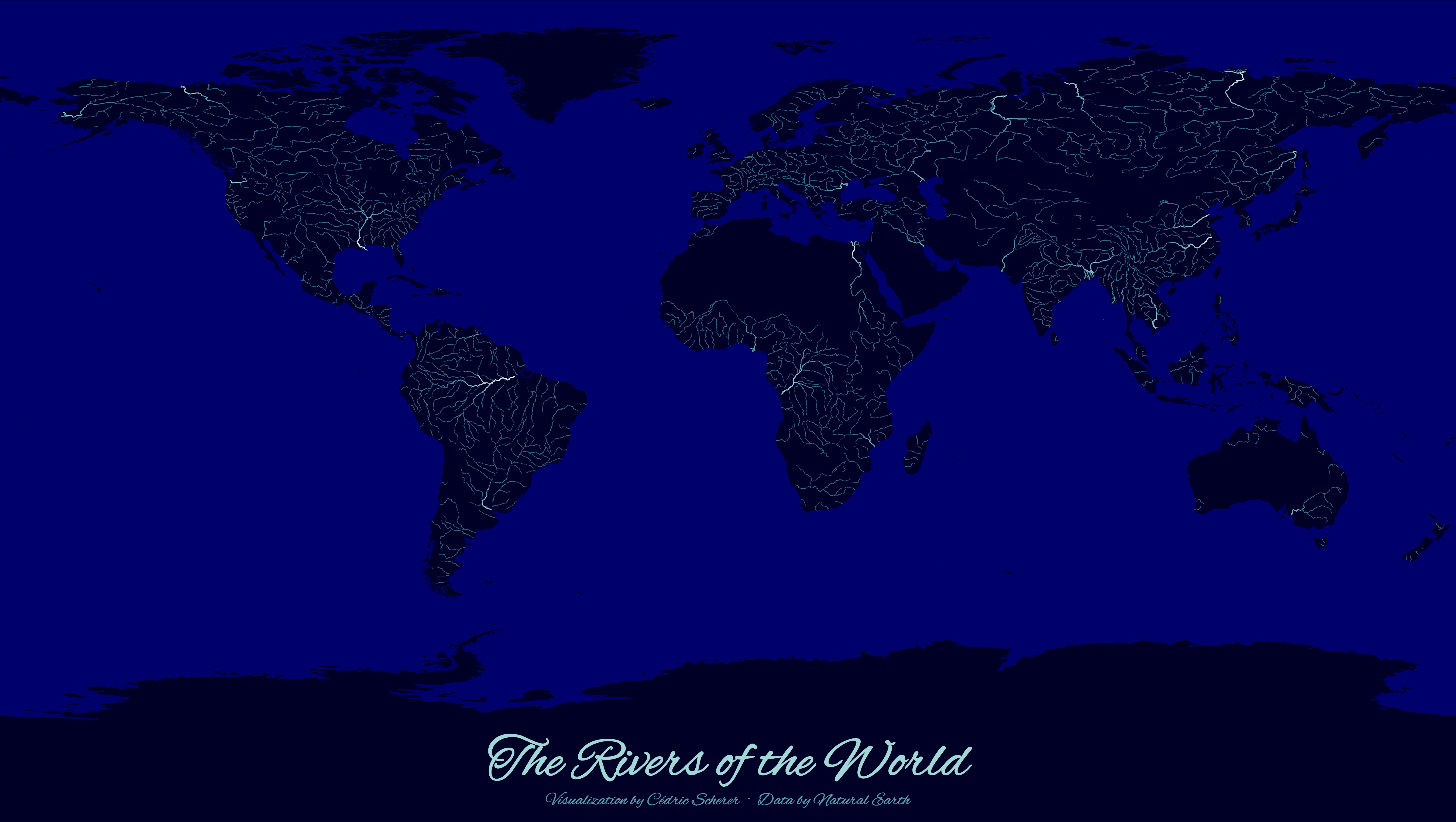
Day 26: Hydrology

./Day26_Hydrology/Hydrology_WorldRivers.png

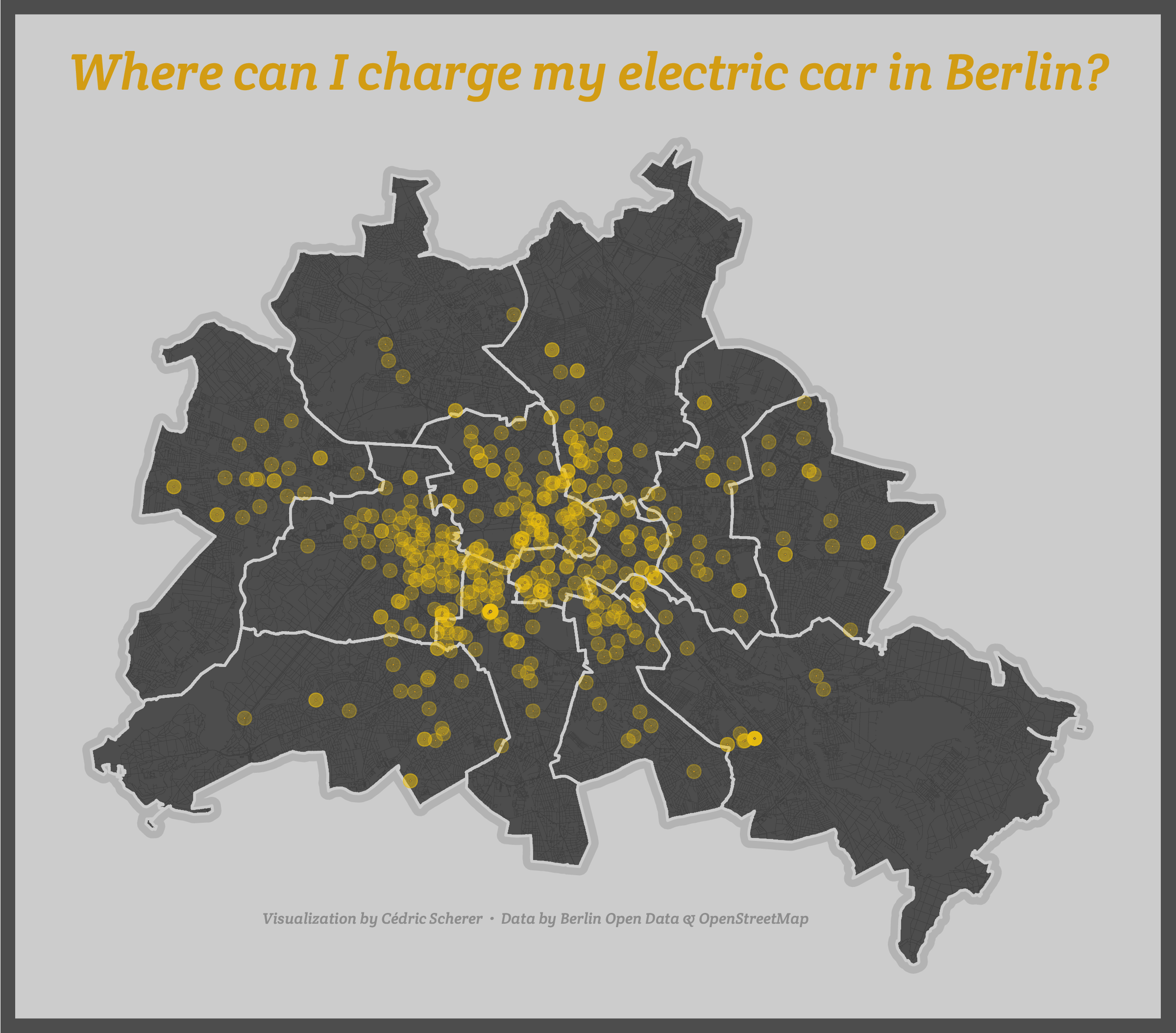
Day 27: Resources

./Day27_Resources/Resources_eMobilityBerlin.png

Day 28: Resources

coming soon? 🤷

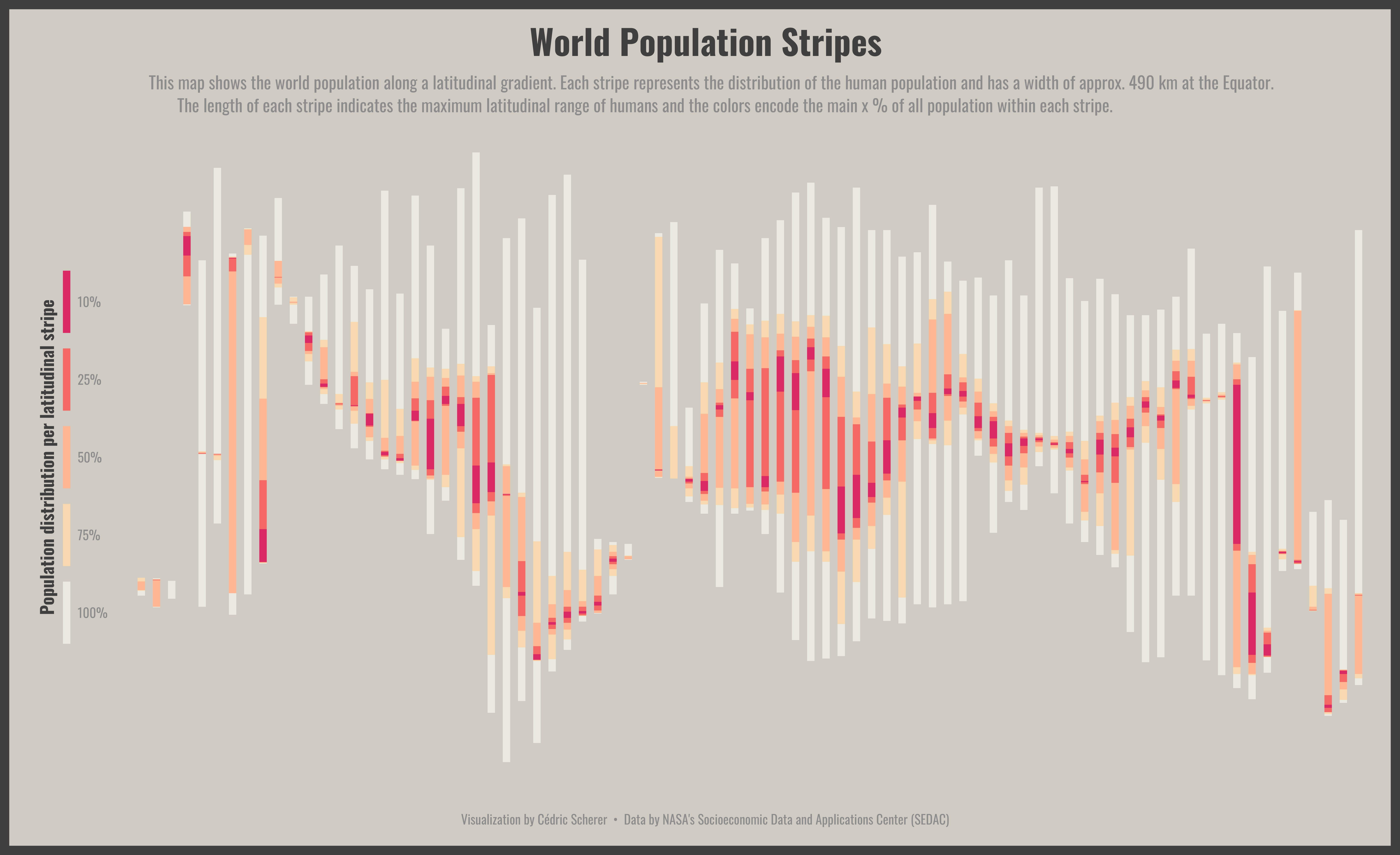
Day 29: Experimental

./Day29_Experimental/Experimental_PopIntervals.png

Day 30: Home

coming soon? 🤷

Attribution-NonCommercial-ShareAlike 4.0 International (CC BY-NC-SA 4.0)


Buy Me A Coffee

Note that the project description data, including the texts, logos, images, and/or trademarks, for each open source project belongs to its rightful owner. If you wish to add or remove any projects, please contact us at [email protected].