All Projects → tqjxlm → Atlas

tqjxlm / Atlas

Licence: GPL-3.0 license
An extensible 3D GIS application for visualization, analysis and research.

Programming Languages

C++
36643 projects - #6 most used programming language
CMake
9771 projects
c
50402 projects - #5 most used programming language
GLSL
2045 projects
C#
18002 projects
HTML
75241 projects

Projects that are alternatives of or similar to Atlas

Go Staticmaps
A go (golang) library and command line tool to render static map images using OpenStreetMap tiles.
Stars: ✭ 246 (+117.7%)
Mutual labels:  maps, gis, tilemap
R Gis Tutorial
Spatial data in R: using R as a GIS
Stars: ✭ 191 (+69.03%)
Mutual labels:  maps, gis
Azuremapscodesamples
A set of code samples for the Azure Maps web control.
Stars: ✭ 167 (+47.79%)
Mutual labels:  maps, gis
Mapstore2
Modern webmapping with OpenLayers, Leaflet and React
Stars: ✭ 251 (+122.12%)
Mutual labels:  maps, gis
Storymap
A JavaScript library for digital storytelling with web maps.
Stars: ✭ 107 (-5.31%)
Mutual labels:  maps, gis
Aerialbot
A simple yet highly configurable bot that tweets geotagged aerial imagery of a random location in the world.
Stars: ✭ 157 (+38.94%)
Mutual labels:  maps, gis
Openglobus
JavaScript 3d maps and geospatial data visualization engine library.
Stars: ✭ 199 (+76.11%)
Mutual labels:  maps, gis
Agentmaps
Make social simulations on interactive maps with Javascript! Agent-based modeling for the web.
Stars: ✭ 822 (+627.43%)
Mutual labels:  maps, gis
deck.gl-time-series-widget
A React Time Slider implementation for DECK.GL - (non)temporal data - by CPU filtering ⌛
Stars: ✭ 19 (-83.19%)
Mutual labels:  maps, gis
Samples-JS-PHP
JavaScript and PHP samples for Stimulsoft Reports.PHP reporting tool.
Stars: ✭ 17 (-84.96%)
Mutual labels:  maps, interaction
QtOSG
A proof-of-concept widget for integrating Qt and OpenSceneGraph in a thread-safe manner
Stars: ✭ 103 (-8.85%)
Mutual labels:  qt5, osg
Gwt Ol
GWT wrapper for OpenLayers 3+ using JSInterop
Stars: ✭ 57 (-49.56%)
Mutual labels:  maps, gis
Geotiff.io
Static website for viewing and analyzing GeoTIFF's in the browser
Stars: ✭ 53 (-53.1%)
Mutual labels:  maps, gis
Mapfish Print
A component of MapFish for printing templated cartographic maps. This module is the Java serverside module. For support post to the mailing list: https://groups.google.com/forum/#!forum/mapfish-print-users
Stars: ✭ 159 (+40.71%)
Mutual labels:  maps, gis
Mapboard
A framework for data-rich web mapping 🌎📊✨
Stars: ✭ 29 (-74.34%)
Mutual labels:  maps, gis
30DayMapChallenge
The official website for #30DayMapChallenge, It is a daily mapping/cartography/data visualization challenge aimed at the spatial community. Code for map submissions.
Stars: ✭ 33 (-70.8%)
Mutual labels:  maps, gis
Ui Leaflet
AngularJS directive to embed an interact with maps managed by Leaflet library
Stars: ✭ 315 (+178.76%)
Mutual labels:  maps, gis
Greatmaps
GMap.NET - Great Maps for Windows Forms & Presentation
Stars: ✭ 739 (+553.98%)
Mutual labels:  maps, gis
rlayers
React Component Library for OpenLayers
Stars: ✭ 98 (-13.27%)
Mutual labels:  maps, gis
mini-map-maker
A tool for automatically generating 3D printable STLs from freely available lidar scan data.
Stars: ✭ 51 (-54.87%)
Mutual labels:  maps, gis

Atlas

Atlas is a 3D GIS visualization project that aims to combine some basic features of QGIS and Google Earth. It utilizes osgEarth to handle 2D maps and 3D models in the same space. It depends on Qt 5 to provide an customizable UI and provides a strong plugin system.

The main purpose of the project is to provide fancier and easier visualization of geographic applications, while supporting complicated analysis tasks and more advanced research purposes.

It has been tested on Windows 10, Fedora 28 and ubuntu 16.04.

中文版说明

Features

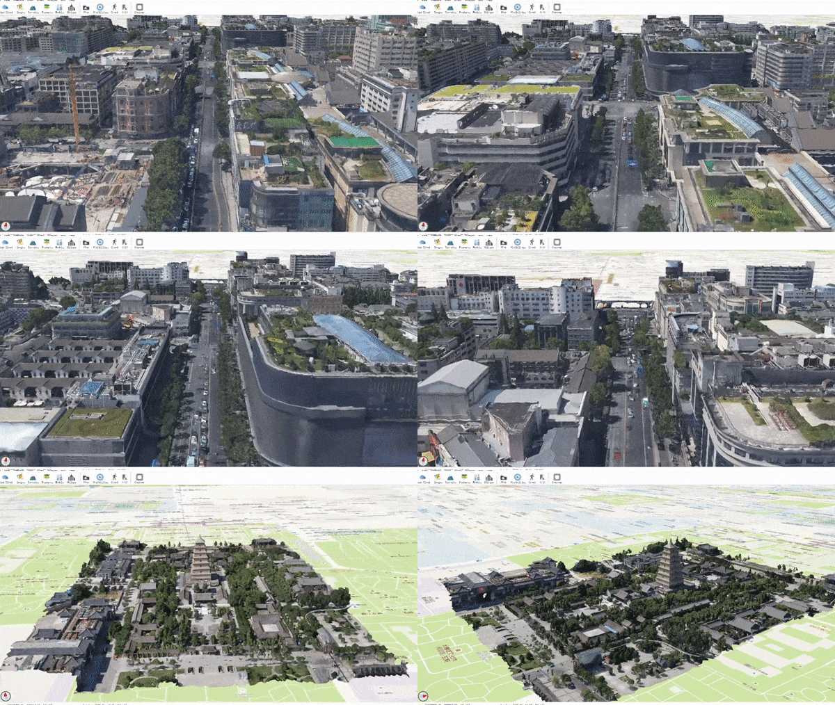
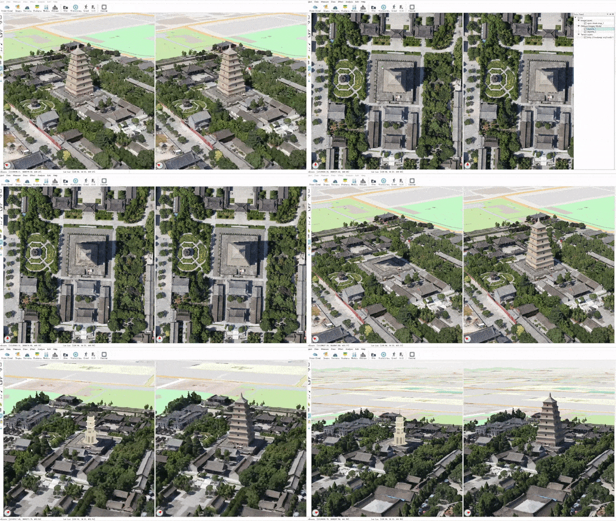
Large Scale 3D Models

Improved performance, interaction, and various analysis and measurement tools for:

Geographic Data

Common geographic data formats and services are supported and fused together in the 3D space.

  • local files: see GDAL raster and GDAL ogr
  • raster services: XYZ tiles, TMS, WMS, ArcGIS services
  • vector services: WFS, ArcGIS services

Coherent Data Api

Atlas provides a high level and uniform api for different data formats supported by OSG, osgEarth and custom plugins. For supported data formats please see:

Highly Extensible

Atlas is built upon plugins. It is easy to add new features to the main program or modify the existing behaviours with the help of plugins.

A full list of current plugins can be found at plugins.md.

Demos

The project is still under development, but a development release is provided so you can have a taste of it.

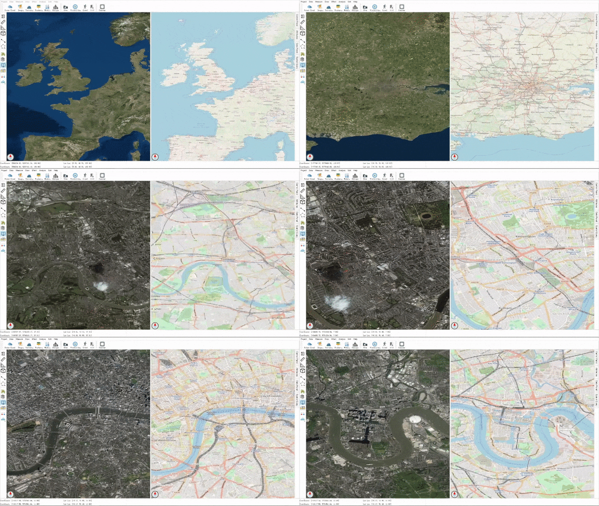
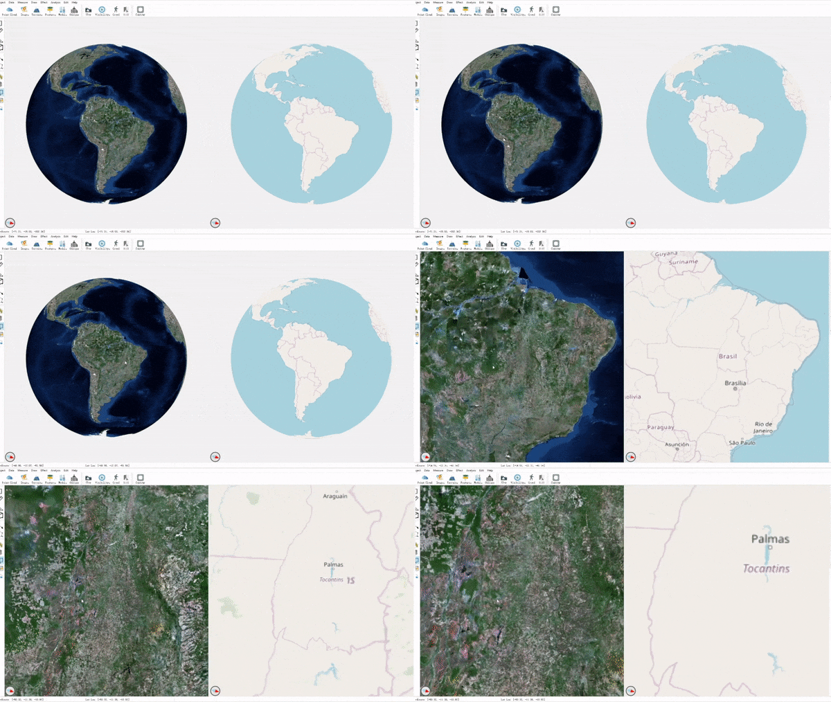
Geodetic & projected modes

image not available

image not available

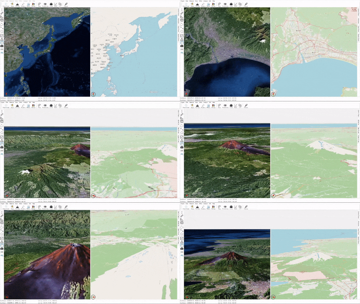
Online images & terrains

image not available

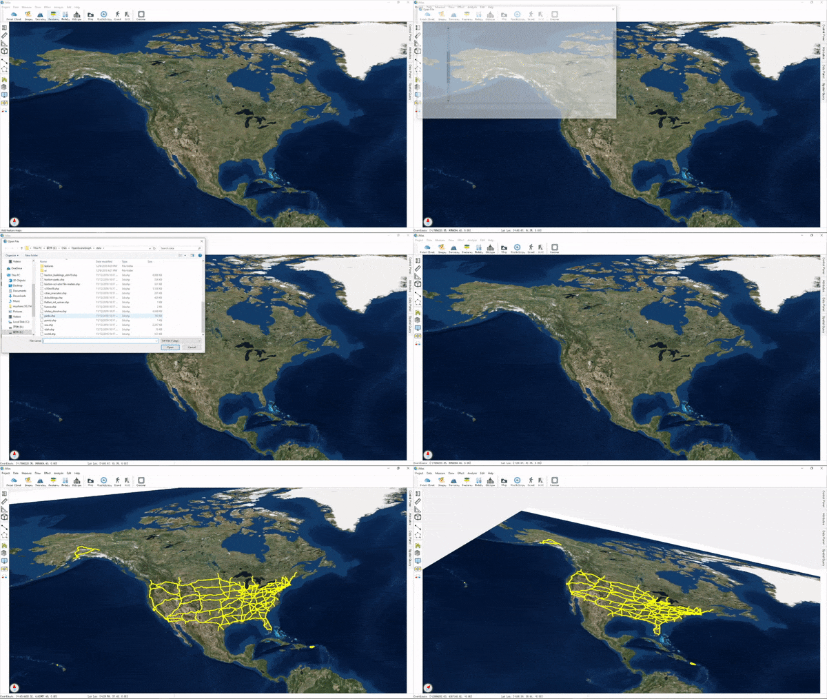
ShapeFile or Geo-features

image not available

Oblique imagery models

image not available

image not available

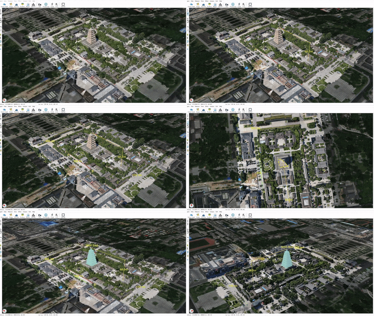
Draw & measure

image not available

Data management

image not available

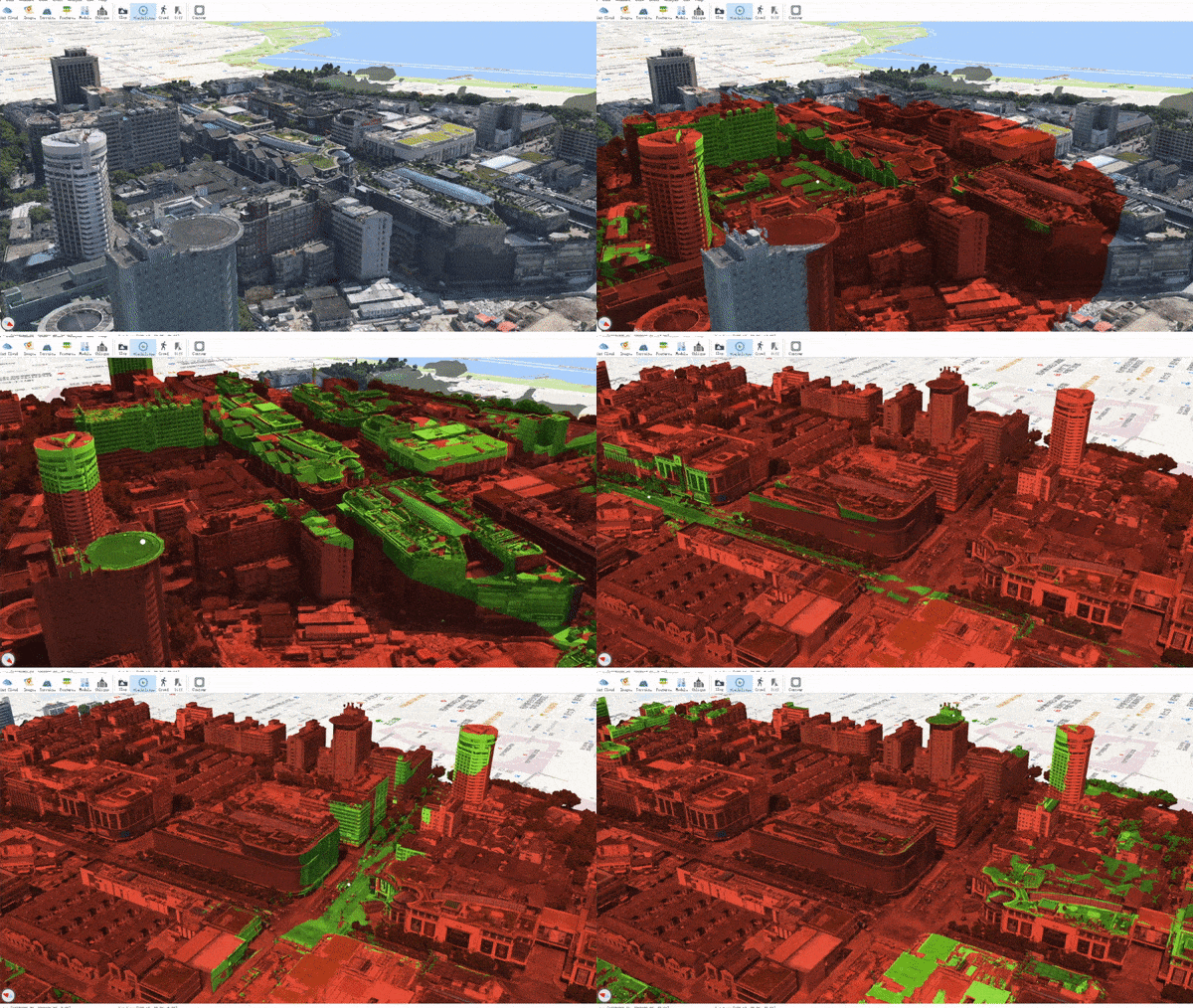
Visibility test

image not available

Slope grade visualization

image not available

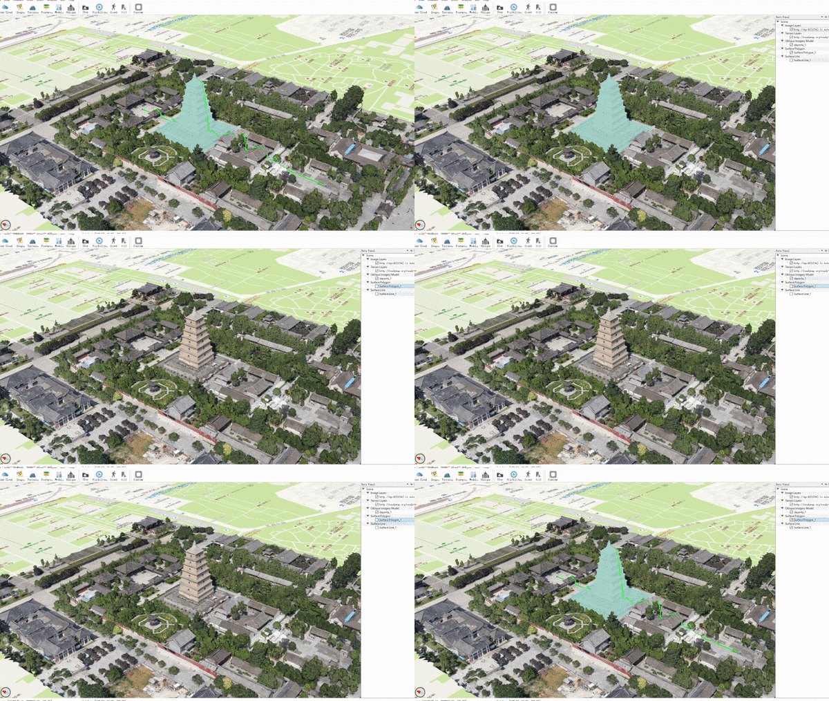
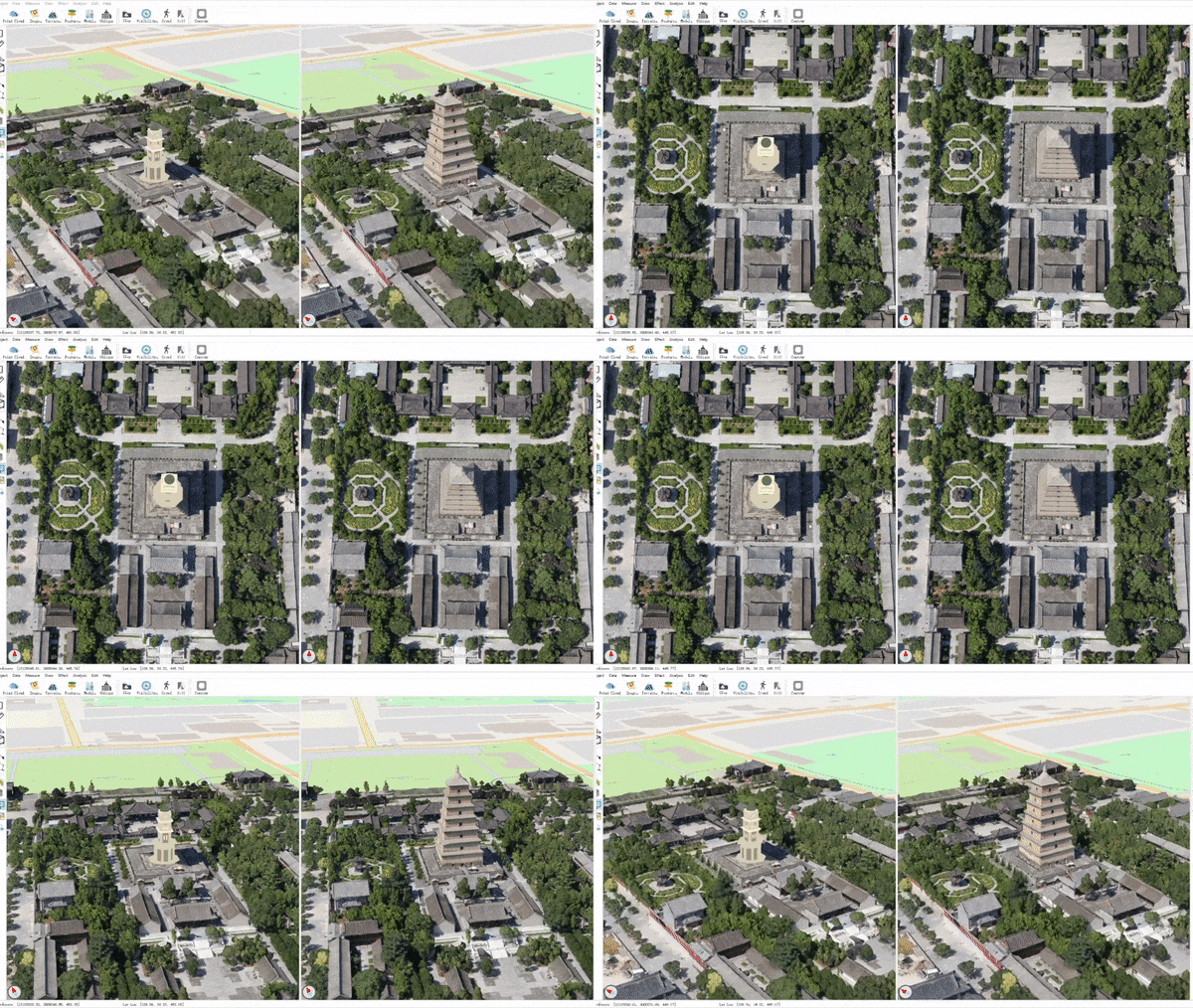
Plan comparison (by editing oblique model and insert new models)

image not available

image not available

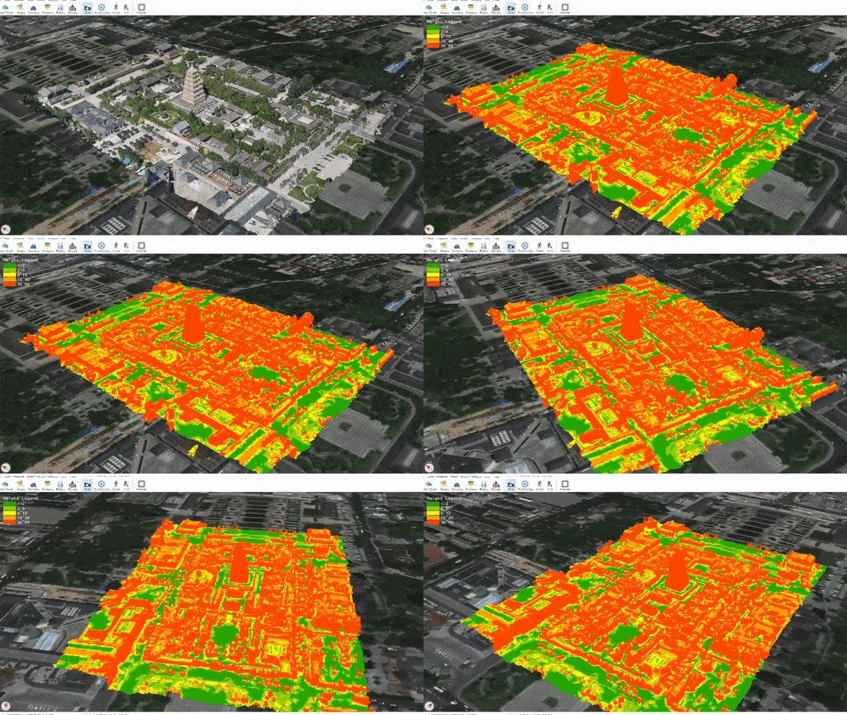
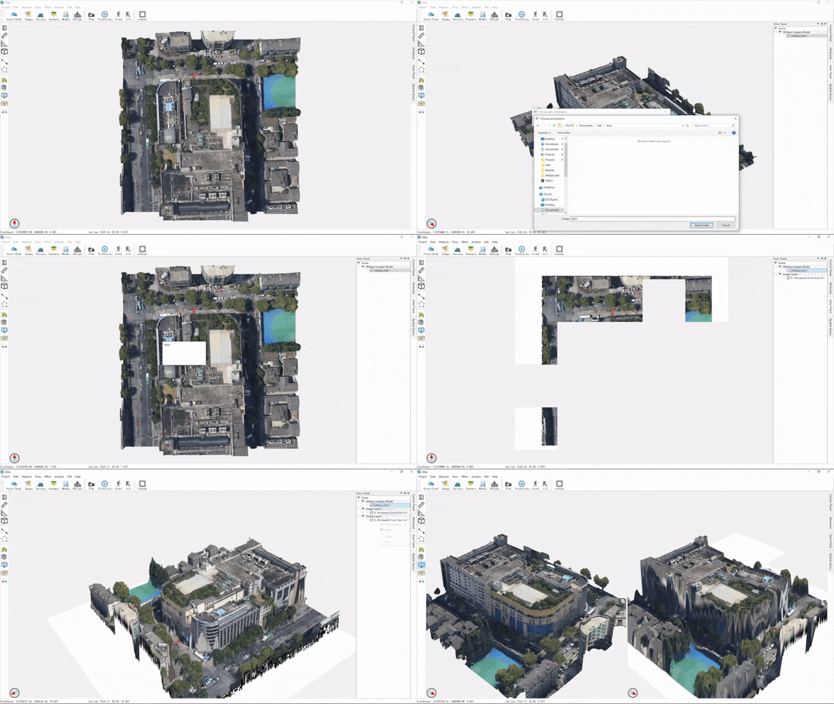
Orthographic generation (generate orthographic DOM and DSM for oblique model)

image not available

Contribute

This project is at a very early stage. The core code is far from being mature or stable, and the plugins need testing and maintenance. Also, since the project aims to mimic QGIS and Google Earth, more functionalities (plugins) are urgently and consistently needed.

If you are interested in or skilled at any of the following topics, we are most delightful if you can become a contributor:

  • skills: C++, Qt, OSG, OSGEarth, OpenGL
  • topics: desktop app, visualization, UI
  • research: GIS, CG, CV

Getting started

You can get started following these steps:

  1. try out the dev release
  2. build from source
  3. read the project structure
  4. find your interested task on trello board or put up a new idea
  5. fork the project, finish coding and commit a PR

If you want to write a new plugin, see plugin_guide.md.

Dev Resources

Contact

You are welcome to give feedbacks on issues page, or just contact us via [email protected].

We manage the project progress on trello where you can also request for features and report bugs.

Note that the project description data, including the texts, logos, images, and/or trademarks, for each open source project belongs to its rightful owner. If you wish to add or remove any projects, please contact us at [email protected].