All Projects → melowntech → vts-browser-cpp

melowntech / vts-browser-cpp

Licence: BSD-2-Clause License
VTS Browser C++ library

Programming Languages

C++
36643 projects - #6 most used programming language
C#
18002 projects
Objective-C++
1391 projects
c
50402 projects - #5 most used programming language
CMake
9771 projects
objective c
16641 projects - #2 most used programming language

Projects that are alternatives of or similar to vts-browser-cpp

Vts Browser Js
JavaScript WebGL 3D map rendering engine
Stars: ✭ 148 (+228.89%)
Mutual labels:  map, gis, 3d-engine
Openglobus
JavaScript 3d maps and geospatial data visualization engine library.
Stars: ✭ 199 (+342.22%)
Mutual labels:  map, gis
L7
🌎 Large-scale WebGL-powered Geospatial Data Visualization analysis framework which relies on Mapbox GL or AMap to render basemaps.
Stars: ✭ 2,517 (+5493.33%)
Mutual labels:  map, gis
conrex
An Elixir implementation of the CONREC algorithm for topographic or isochrone maps.
Stars: ✭ 52 (+15.56%)
Mutual labels:  map, gis
Azuremapscodesamples
A set of code samples for the Azure Maps web control.
Stars: ✭ 167 (+271.11%)
Mutual labels:  map, gis
Awesome Geospatial Companies
🌐 List of 500+ geospatial companies (GIS, Earth Observation, UAV, Satellite, Digital Farming, ..)
Stars: ✭ 184 (+308.89%)
Mutual labels:  map, gis
Go Staticmaps
A go (golang) library and command line tool to render static map images using OpenStreetMap tiles.
Stars: ✭ 246 (+446.67%)
Mutual labels:  map, gis
React Qmap
💡react腾讯地图开源组件
Stars: ✭ 60 (+33.33%)
Mutual labels:  map, gis
farmOS-map
farmOS Map is an OpenLayers wrapper library designed for agricultural mapping needs. It can be used in any project that has similar requirements.
Stars: ✭ 18 (-60%)
Mutual labels:  map, gis
ExtApp
ExtApp是一个基于三层架构,使用NHibernate、API Controller和ExtJs创建的,用于简化政府和企业应用开发的Web应用程序框架。
Stars: ✭ 14 (-68.89%)
Mutual labels:  map, gis
HMap
:earth: HMap | 基于openlayers的封装组件
Stars: ✭ 64 (+42.22%)
Mutual labels:  map, gis
Django Loci
Reusable Django app for storing geographic and indoor coordinates. Maintained by the OpenWISP Project.
Stars: ✭ 164 (+264.44%)
Mutual labels:  map, gis
UMapControl
轻量级跨平台瓦片地图库
Stars: ✭ 35 (-22.22%)
Mutual labels:  map, gis
Awesome Gis
😎Awesome GIS is a collection of geospatial related sources, including cartographic tools, geoanalysis tools, developer tools, data, conference & communities, news, massive open online course, some amazing map sites, and more.
Stars: ✭ 2,582 (+5637.78%)
Mutual labels:  map, gis
Openlayers Editor
OpenLayers Editor
Stars: ✭ 138 (+206.67%)
Mutual labels:  map, gis
Ol3echarts
🌏 📊 ol3Echarts | a openlayers extension to echarts
Stars: ✭ 229 (+408.89%)
Mutual labels:  map, gis
Tiledmapview
Tiled map loader for Android , based on the pyramid model, supports a variety of projections, including Web Mercator projection, latitude and longitude projection and custom projection; supports locating, adding layers and overlays. Android瓦片地图加载控件,基于金字塔模型,支持多种投影,包括Web墨卡托投影,经纬度直投及自定义投影等;支持定位,添加图层和覆盖物。
Stars: ✭ 45 (+0%)
Mutual labels:  map, gis
Geotiff.io
Static website for viewing and analyzing GeoTIFF's in the browser
Stars: ✭ 53 (+17.78%)
Mutual labels:  map, gis
font-gis
Icon font and SVG for use with GIS and spatial analysis tools
Stars: ✭ 121 (+168.89%)
Mutual labels:  map, gis
awesome-maps-ukraine
A curated list of maps of Ukraine, ukrainian mappers and tools that they use or develop for creating and publish maps
Stars: ✭ 35 (-22.22%)
Mutual labels:  map, gis

VTS Browser JS

VTS Browser CPP is a collection of libraries that bring VTS frontend capabilities to your native applications.

Examples

Unity 3D integration example

Youtube Preview

(Click to play the video)

iOS app example

Youtube Preview

(Click to play the video)

Features

  • Highly flexible -> almost all aspects can be changed through configuration.
  • Rendering API independent -> the browser library, on its own, does not render anything. Instead, it just tells the application what to render.
    • Optional OpenGL (ES) rendering library is also provided.
  • Clean C++ API.
    • C and C# bindings are available too.
  • Works on Windows, UWP (experimental), Linux, Web Assembly (experimental), macOS and iOS.
  • Simple -> minimal application using these libraries has about 300 LOC. See vts-browser-minimal.

WIP

Be warned, this library is still in development. We make no attempt on maintaining ABI nor API compatibility yet.

Documentation

Browser documentation is available at the wiki.

Documentation for the whole VTS is at VTS Geospatial.

Installing from Melown repository (Linux desktop only)

We provide pre-compiled packages for some popular linux distributions. See Melown OSS package repository for more information.

The packages are named libvts-browser0 (the library itself), libvts-browser-dbg (debug symbols for the library), libvts-browser-dev (developer files for the library) and vts-browser-desktop (example application).

Building and using the browser

See BUILDING.md for instructions to build the libraries from source.

See USING.md for instructions to write a simple app with VTS browser.

Running example application

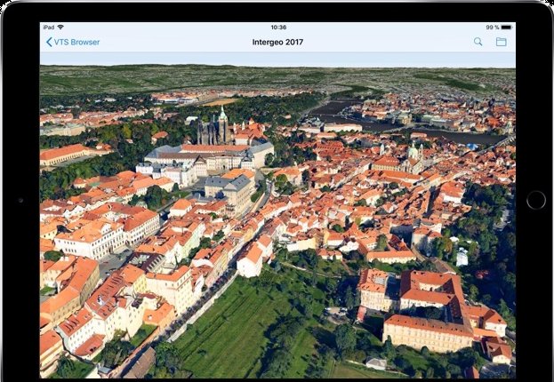
Run the desktop example application with default mapconfig (our Intergeo presentation):

vts-browser-desktop

Run the desktop example application with specific mapconfig:

vts-browser-desktop https://cdn.melown.com/mario/store/melown2015/map-config/melown/Melown-Earth-Intergeo-2017/mapConfig.json

Bug reports

For bug reports or enhancement suggestions use the Issue tracker.

How to contribute

Check the CONTRIBUTING.md file.

License

See the LICENSE file.

Note that the project description data, including the texts, logos, images, and/or trademarks, for each open source project belongs to its rightful owner. If you wish to add or remove any projects, please contact us at [email protected].