melowntech / Vts Browser Js
Programming Languages
Projects that are alternatives of or similar to Vts Browser Js

VTS Browser JS is a powerful JavaScript 3D map rendering engine with a very small footprint (about 163 kB of gziped JS code). It provides almost all features for web-based 3D mapping you will ever want.
VTS Browser JS is independently usable part of VTS 3D Geospatial Software Stack: a state-of-the-art, full-stack open source platform for 3D geospatial application development.
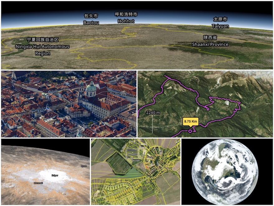
With VTS Browser JS you may combine and render diverse geospatial data in a single online map, style and display various types of geodata, render textured polygonal meshes or OBJ models, or even render topographic labels in almost any international writing system.
- Features
- Live Demos
- Getting Started with VTS Browser JS
- Get the library
- Documentation
- Roadmap
- Map Configuration
- Licence
- How to Contribute
Features
- [x] part of a comprehensive open-source 3D geospatial software Stack
- [x] supports all modern web browsers
- [x] photorealistic rendering
- [x] geocoding API support
- [x] tiled, hierarchical data model
- [x] optimized for web-based rendering
- [x] supports any coordinate system
- [x] multiple surfaces
- [x] multiple bound layers on each surface
- [x] vector layers (geodata)
- [x] geodata styling and geodata interaction
- [x] dynamic surfaces and layer switching
- [x] international writing systems (e.g. Arabic, Devangaric, Chinese, Japanese, ...)
- [x] extensive, yet simple API (including UI extensions)
- [x] custom meshes, lines, polygons, icons, OBJ models, etc
- [x] rendering and styling of GeoJSON files
- [x] very small footprint (163KB minified and gzipped)
- [x] large set of ready-to-use data
- [x] open-source under BSD-2 license
Comparison to CesiumJS library
The open-source CesiumJS is an excellent JavaScript 3D mapping library which is widely used and frequently compared to VTS Browser JS. The following table might help you to identify the application scenarios where VTS Browser JS may be an alternative, or simply a straightforward software platform of choice for your project.
| Feature | VTS Browser JS | CesiumJS |
|---|---|---|
| Different coordinate systems support | yes | limited |
| Dynamic tiled surfaces mixing (including glues) | yes | no |
| Multiple surfaces and multiple bound layers support (including transparent layers) | yes | no |
| Bound layers with optimized masks | yes | no |
| Out-of-the-box OSM data support with custom styling | yes | limited |
| Open-source backend components | yes | no |
| Backend data-fusion capabilities | yes | no |
| Support for international writing systems | yes | limited |
| Compact-size library (gzipped and minified) | 221 KB | 577 KB + Workers |
Live Demos
These are some of the applications built with VTS browser JS:
Examples
First steps
- Include The VTS browser JS library
<link rel="stylesheet"
  type="text/css" href="https://cdn.melown.com/libs/vtsjs/browser/v2/vts-browser.min.css" />
<script type="text/javascript"
  src="https://cdn.melown.com/libs/vtsjs/browser/v2/vts-browser.min.js"></script>
- Declare map containing element (with id
map-div)
<div id="map-div" style="width:100%; height:100%;"></div>
- Initiate vts browser (with example map configuration)
<script>
  var browser = vts.browser('map-div', {
    map: 'https://cdn.melown.com/mario/store/melown2015/map-config/melown/VTS-Tutorial-map/mapConfig.json'
  });
</script>
Wonder where to find mapConfig.json file? See Map Configuration section.
Next steps
You can run many examples in JSFiddle.
Get the library
There is several ways how to bundle The VTS Browser JS Library into your project.
Our CDN
The easiest way to link The VTS Browser JS Library is to use the latest build (or specific version) from Melown Technologies CDN.
<link rel="stylesheet"
  href="https://cdn.melown.com/libs/vtsjs/browser/v2/vts-browser.min.css" />
<script type="text/javascript"
  src="https://cdn.melown.com/libs/vtsjs/browser/v2/vts-browser.min.js"></script>
Prebuilt
In case you do not want to build libray yourself or use our CDN, there is a link where you can find latest compiled libraries with demo examples.
NPM repository
Vts-browser-js library is in npm js repository. To add it as dependecy to your project just add it as any npm package
npm install -S vts-browser-js
Build from code
If you prefer, you may build The VTS Browser JS Library from source code.
Build system
The build system uses webpack module bundler.
Typical development cycle starts with npm install for installation of
dependenices. Then you usually run webpack-dev-server and build with webpack.
Install
Download and install all dependencies to local node_modules directory.
NOTE: For some dependencies, you need git available in your system.
npm install
or more advanced (if you are using new versions of NodeJS and Yarn)
yarn install
Run dev server
The development server is serving local files at http://localhost:8080.
node_modules/.bin/webpack-dev-server
And go to http://localhost:8080/demos/
Build
node_modules/.bin/webpack
The unzipped file (along with source map and CSS) is stored in build/
directory. You may now start the dev server (see lower) and open browser at
http://localhost:8080 to see some demos in the demos/
directory.
Build compressed version
The compressed version - it's intended to be used in in production env. You can
include in the <script ...></script> tags (along with CSS) there.
Compressed version is build in the dist/ directory.
NODE_ENV=production node_modules/.bin/webpack
Makefile
There is also Makefile available in the project directory. Referer make help
to specific make targets. The Makefile is just wrapper around npm run commands
(which are wrappers around webpack configuration).
Map Configuration
Map configuration contains a all information The VTS Browser JS library needs to display given map/model. Library is usually initialize with URL to mapConfig.json file which is JSON representation of Map configuration data.
The question is, where you can get your own Map Configuration. Basically you have two options:
Melown Cloud
Melown Cloud is point-and-click interface to a subset of VTS technology, operated by Melown Tecchnologies. Conveniently, Melown Cloud may be also used as a source of custom map configurations for VTS browser JS application development.
VTS 3D Geospatial Software stack
VTS Browser JS forms part of the VTS 3D Geospatial Software Stack. Running the full stack gives you complete control over your map resources, provides you with powerful data fusion capabilities and allows for closed networks or other types of off-grid deployment.
Documentation
VTS Browser JavaScript API documentation is available in our wiki:
License
See the LICENSE file for VTS Browser JS license, run webpack and check the
build/3rdpartylicenses.txt file for 3rd party licenses.
How to contribute
Check out the CONTRIBUTING.md file.