laboshinl / Loam_velodyne
Licence: other
Laser Odometry and Mapping (Loam) is a realtime method for state estimation and mapping using a 3D lidar.
Stars: ✭ 1,135
Projects that are alternatives of or similar to Loam velodyne
Loam noted
loam code noted in Chinese(loam中文注解版)
Stars: ✭ 455 (-59.91%)
Mutual labels: slam, pointcloud, lidar, mapping, pcl
Sc Lego Loam
LiDAR SLAM: Scan Context + LeGO-LOAM
Stars: ✭ 332 (-70.75%)
Mutual labels: slam, pointcloud, lidar, mapping
direct lidar odometry
Direct LiDAR Odometry: Fast Localization with Dense Point Clouds
Stars: ✭ 202 (-82.2%)
Mutual labels: mapping, ros, lidar, slam
lt-mapper
A Modular Framework for LiDAR-based Lifelong Mapping
Stars: ✭ 301 (-73.48%)
Mutual labels: mapping, lidar, slam, pointcloud
Awesome Robotic Tooling
Tooling for professional robotic development in C++ and Python with a touch of ROS, autonomous driving and aerospace.
Stars: ✭ 1,876 (+65.29%)
Mutual labels: ros, slam, lidar, mapping
Lego Loam
LeGO-LOAM: Lightweight and Ground-Optimized Lidar Odometry and Mapping on Variable Terrain
Stars: ✭ 1,138 (+0.26%)
Mutual labels: ros, slam, lidar, mapping
Lidar camera calibration
Light-weight camera LiDAR calibration package for ROS using OpenCV and PCL (PnP + LM optimization)
Stars: ✭ 133 (-88.28%)
Mutual labels: ros, lidar, pcl
Visual Gps Slam
This is a repo for my master thesis research about the Fusion of Visual SLAM and GPS. It contains the research paper, code and other interesting data.
Stars: ✭ 175 (-84.58%)
Mutual labels: ros, slam, 3d
annotate
Create 3D labelled bounding boxes in RViz
Stars: ✭ 104 (-90.84%)
Mutual labels: lidar, pcl, pointcloud
Grid map
Universal grid map library for mobile robotic mapping
Stars: ✭ 1,135 (+0%)
Mutual labels: ros, mapping, pcl
puma
Poisson Surface Reconstruction for LiDAR Odometry and Mapping
Stars: ✭ 302 (-73.39%)
Mutual labels: mapping, lidar, slam
GA SLAM
🚀 SLAM for autonomous planetary rovers with global localization
Stars: ✭ 40 (-96.48%)
Mutual labels: mapping, pcl, slam
Evo
Python package for the evaluation of odometry and SLAM
Stars: ✭ 1,373 (+20.97%)
Mutual labels: ros, slam, mapping
Depth clustering
🚕 Fast and robust clustering of point clouds generated with a Velodyne sensor.
Stars: ✭ 657 (-42.11%)
Mutual labels: ros, lidar, pcl
Mrpt slam
ROS wrappers for SLAM algorithms in MRPT
Stars: ✭ 84 (-92.6%)
Mutual labels: ros, slam, mapping
UrbanLoco
UrbanLoco: A Full Sensor Suite Dataset for Mapping and Localization in Urban Scenes
Stars: ✭ 147 (-87.05%)
Mutual labels: mapping, lidar, slam
Pyicp Slam
Full-python LiDAR SLAM using ICP and Scan Context
Stars: ✭ 155 (-86.34%)
Mutual labels: slam, pointcloud, lidar
awesome-lidar
😎 Awesome LIDAR list. The list includes LIDAR manufacturers, datasets, point cloud-processing algorithms, point cloud frameworks and simulators.
Stars: ✭ 217 (-80.88%)
Mutual labels: lidar, slam, pointcloud
Dynamic robot localization
Point cloud registration pipeline for robot localization and 3D perception
Stars: ✭ 339 (-70.13%)
Mutual labels: lidar, mapping, pcl
loam_velodyne
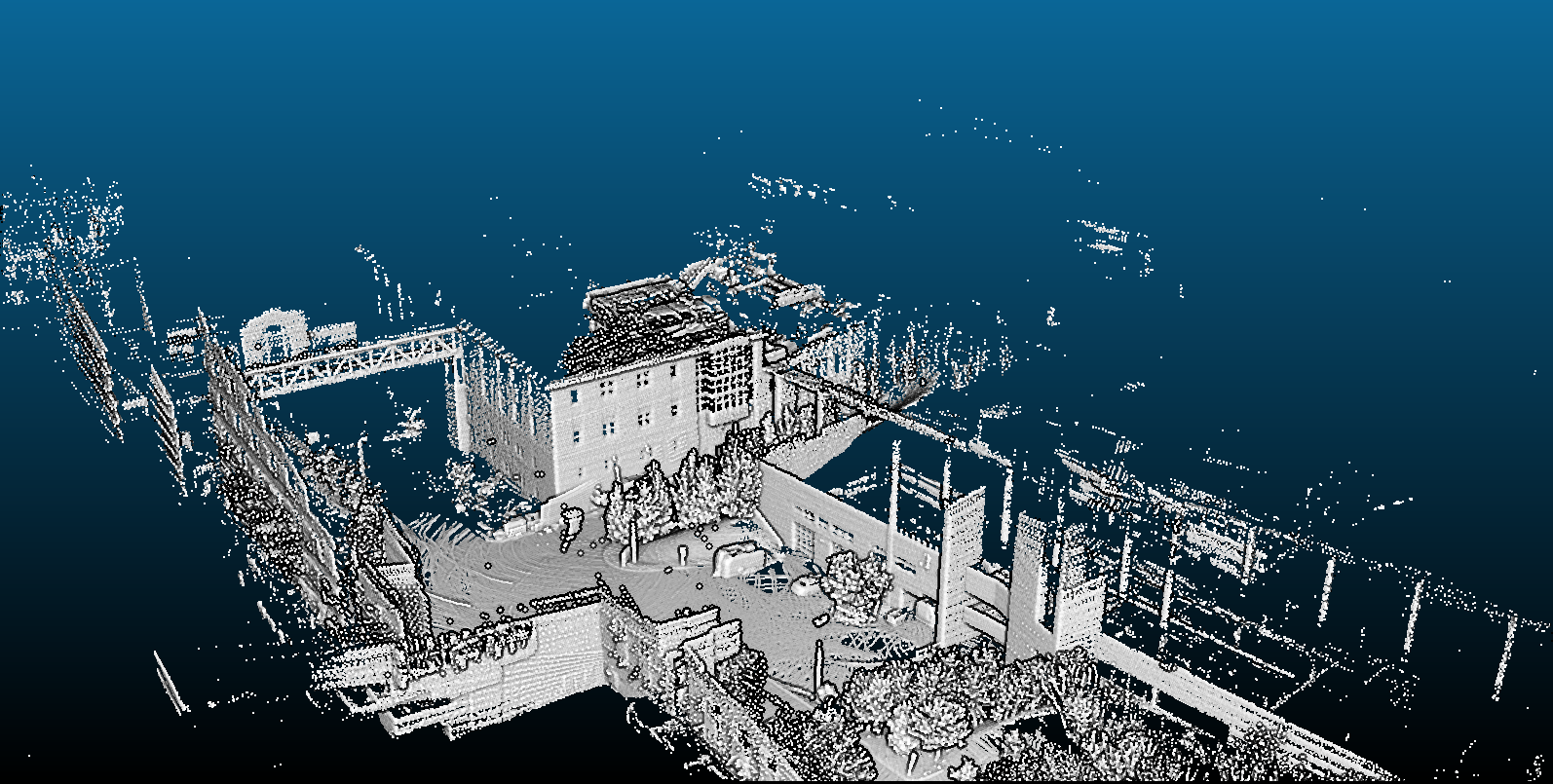
 Sample map built from nsh_indoor_outdoor.bag (opened with ccViewer)
✅ Tested with ROS Indigo and Velodyne VLP16. (Screencast)
All sources were taken from ROS documentation
Ask questions here.
How to build with catkin
$ cd ~/catkin_ws/src/
$ git clone https://github.com/laboshinl/loam_velodyne.git
$ cd ~/catkin_ws
$ catkin_make -DCMAKE_BUILD_TYPE=Release
$ source ~/catkin_ws/devel/setup.bash
Running
roslaunch loam_velodyne loam_velodyne.launch
In second terminal play sample velodyne data from VLP16 rosbag:
rosbag play ~/Downloads/velodyne.bag
Or read from velodyne VLP16 sample pcap:
roslaunch velodyne_pointcloud VLP16_points.launch pcap:="$HOME/Downloads/velodyne.pcap"
Troubleshooting
multiScanRegistration crashes right after playing bag file
Issues #71 and
#7 address this
problem. The current known solution is to build the same version of PCL that
you have on your system from source, and set the CMAKE_PREFIX_PATH
accordingly so that catkin can find it. See this
issue
for more details.
Quantifying Aerial LiDAR Accuracy of LOAM for Civil Engineering Applications. Derek Anthony Wolfe
Note that the project description data, including the texts, logos, images, and/or trademarks,
for each open source project belongs to its rightful owner.
If you wish to add or remove any projects, please contact us at [email protected].
